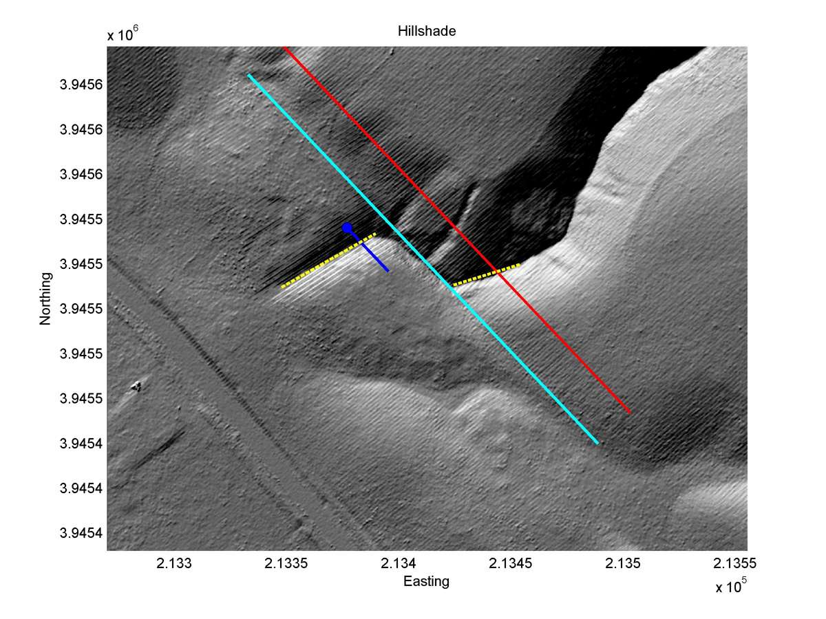
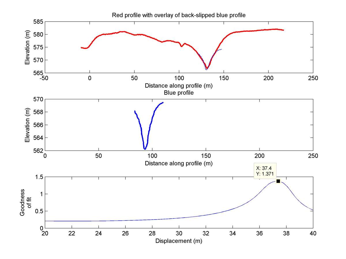
| Latitude | Longitude | Distance to reference | Best Offset (m) | Offset Range (m) | Quality Rating | Comment |
|---|---|---|---|---|---|---|
| 35.61199 | -120.16388 | 17.60 km | 37.4 | 36.0 - 39.0 | High | Large offset gully. |
| Hillshade with profiles | Topographic profiles and GOF |
|
|
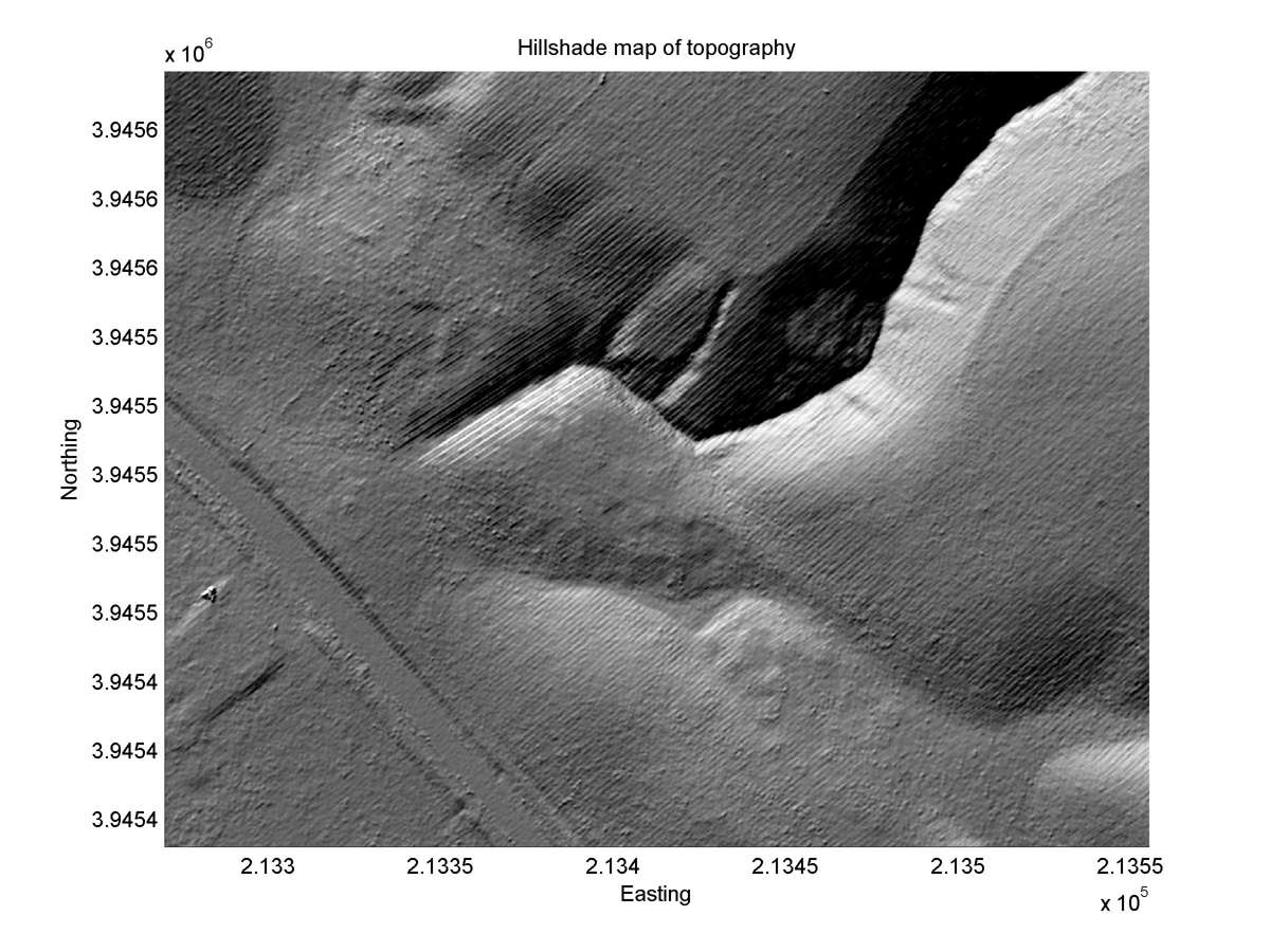
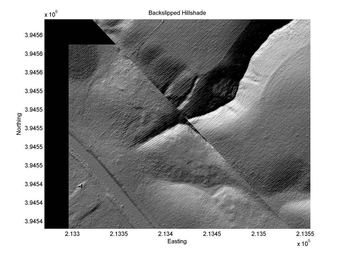
| Hillshade plot | Hillshade plot, Optimal back-slip |
|
|
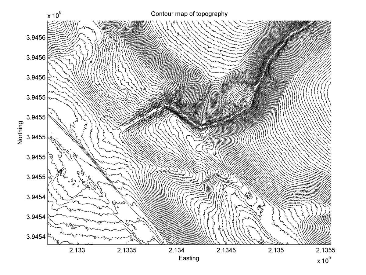
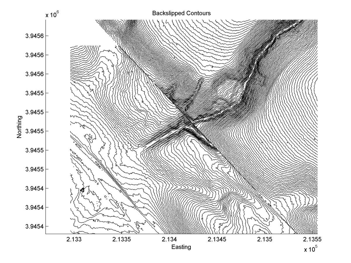
| Contour plot | Contour plot, Optimal back-slip |
|
|
| Dist. from Bitterwater road | Offset (m) | Error (m) | Quality Rating | Comments |
|---|---|---|---|---|
| 7.99km | 45 | 3 | high | Head and tail of large unusually straight, narrow, and parallel to each other. Single, narrow, distinct fault trace. |