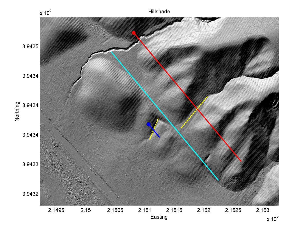
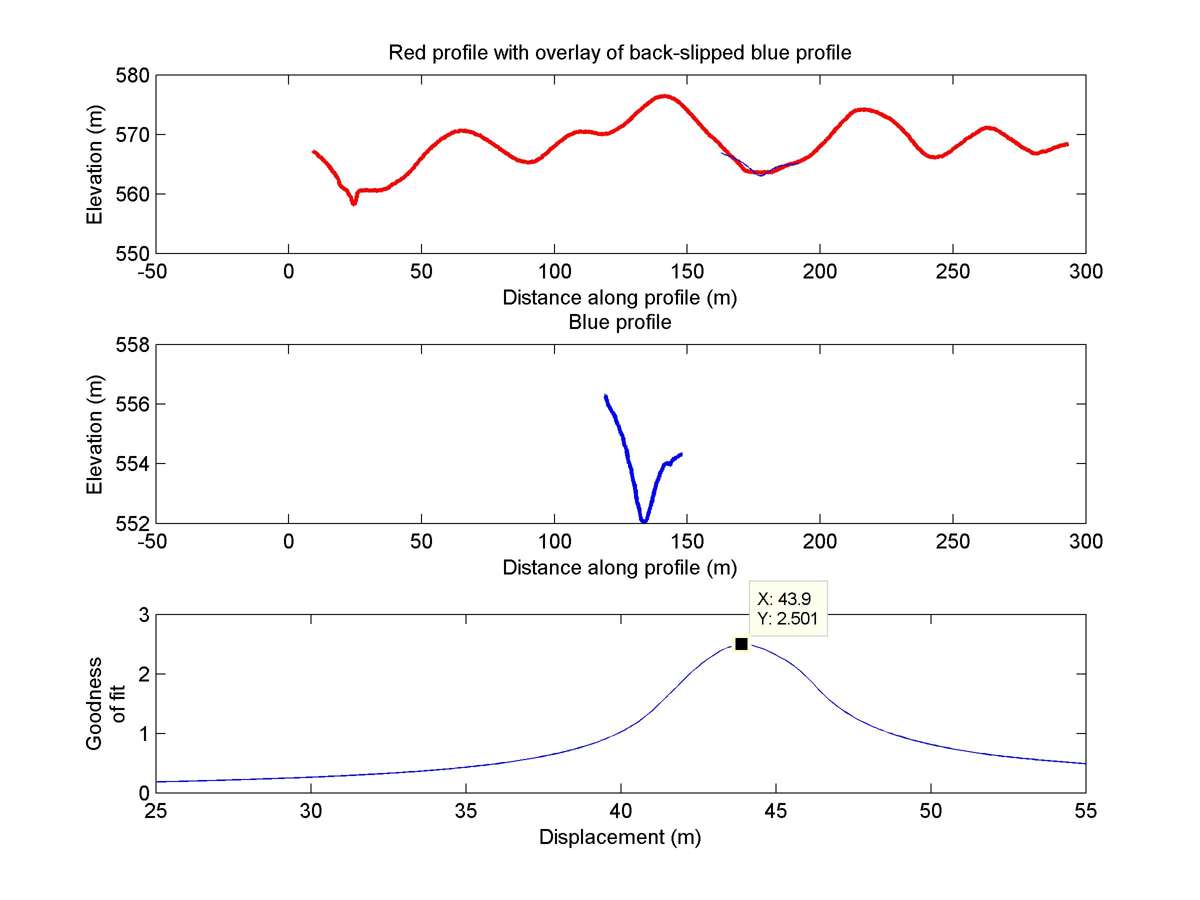
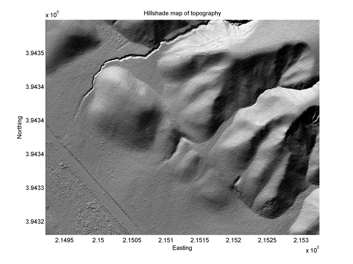

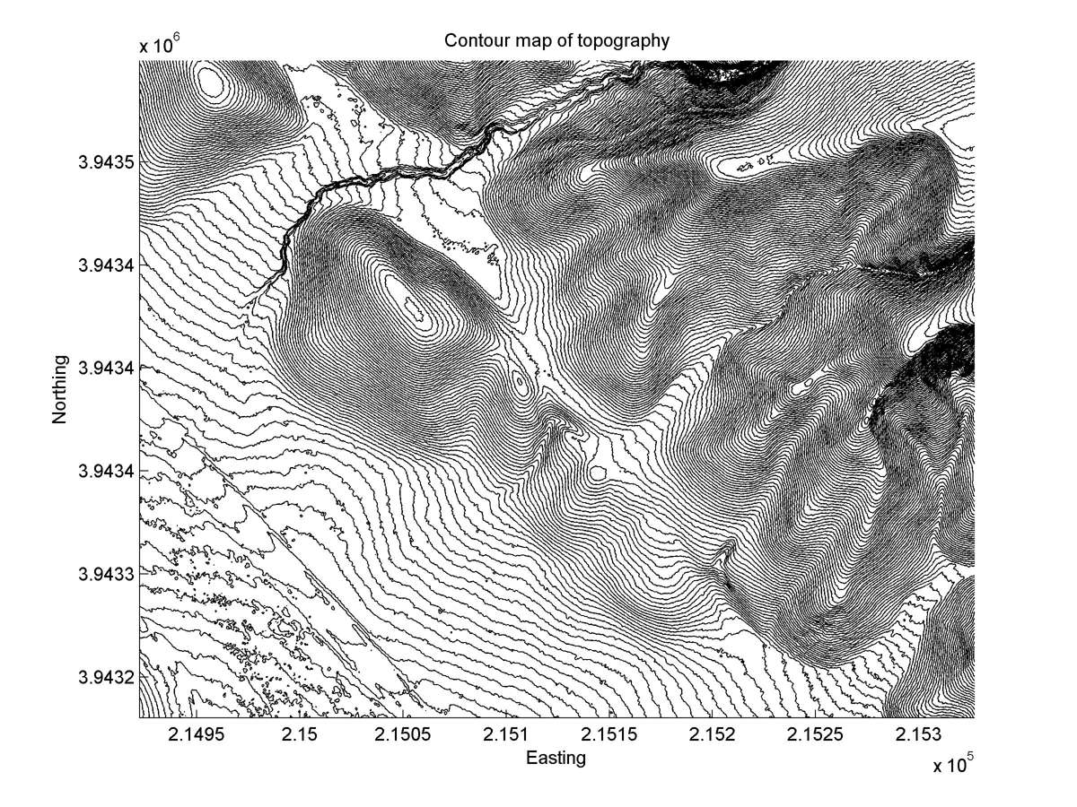
| Latitude | Longitude | Distance to reference | Best Offset (m) | Offset Range (m) | Quality Rating | Comment |
|---|---|---|---|---|---|---|
| 35.59312 | -120.14402 | 20.20 km | 43.9 | 40.0 - 48.0 | Moderate | Offset channel. Fault zone very narrow, justifying rahter high rating for this channel. |
| Hillshade with profiles | Topographic profiles and GOF |
|
|
| Hillshade plot | Hillshade plot, Optimal back-slip |
|
|
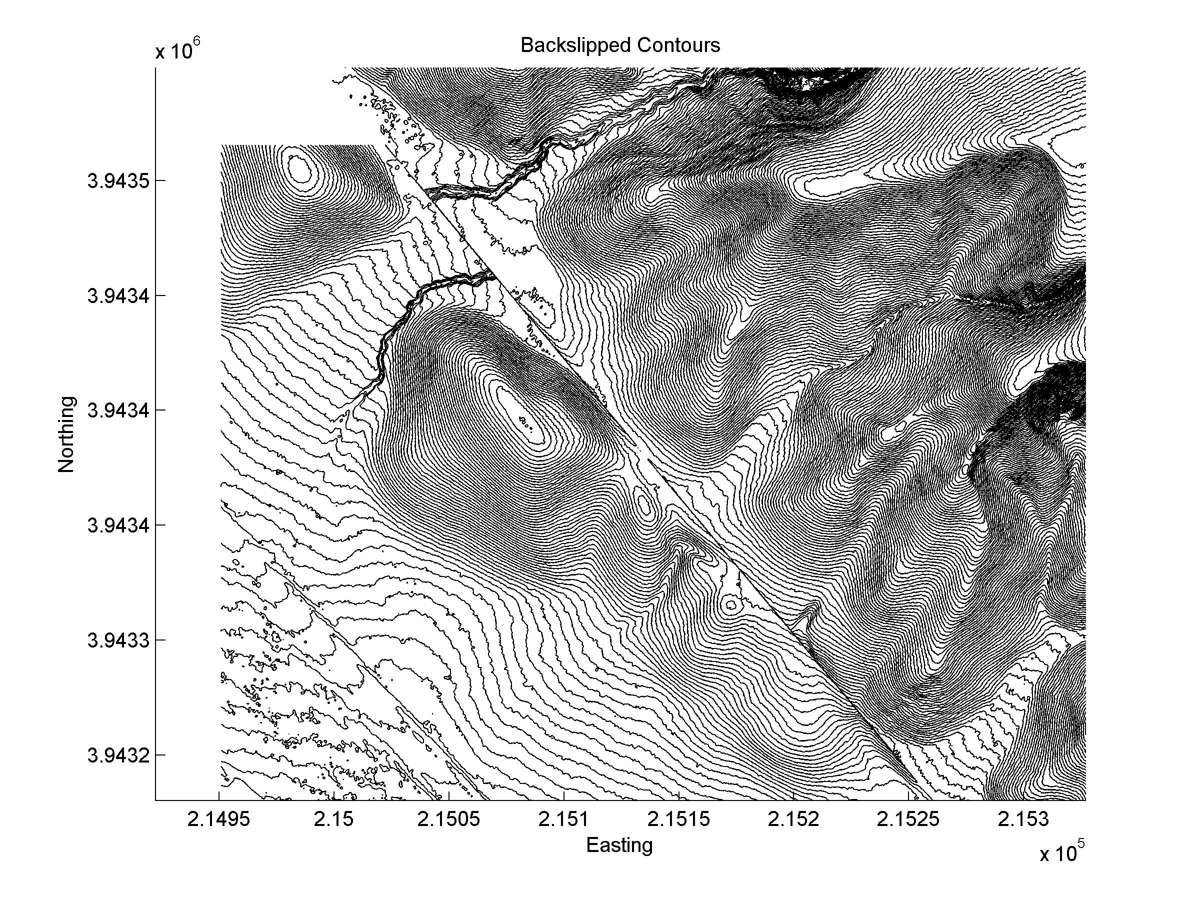
| Contour plot | Contour plot, Optimal back-slip |
|
|
| Dist. from Bitterwater road | Offset (m) | Error (m) | Quality Rating | Comments |
|---|---|---|---|---|
| 5.25km | 40 | 20 | low | Active tail. Both a1 and a2 might have been captured tail of other channels to the southeast, thus invalid for slip. |