
| Latitude | Longitude | Distance to reference | Best Offset (m) | Offset Range (m) | Quality Rating | Comment |
|---|---|---|---|---|---|---|
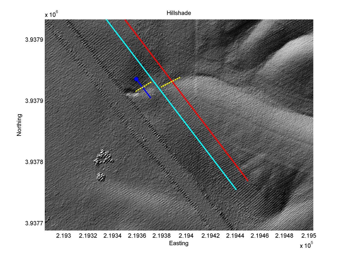
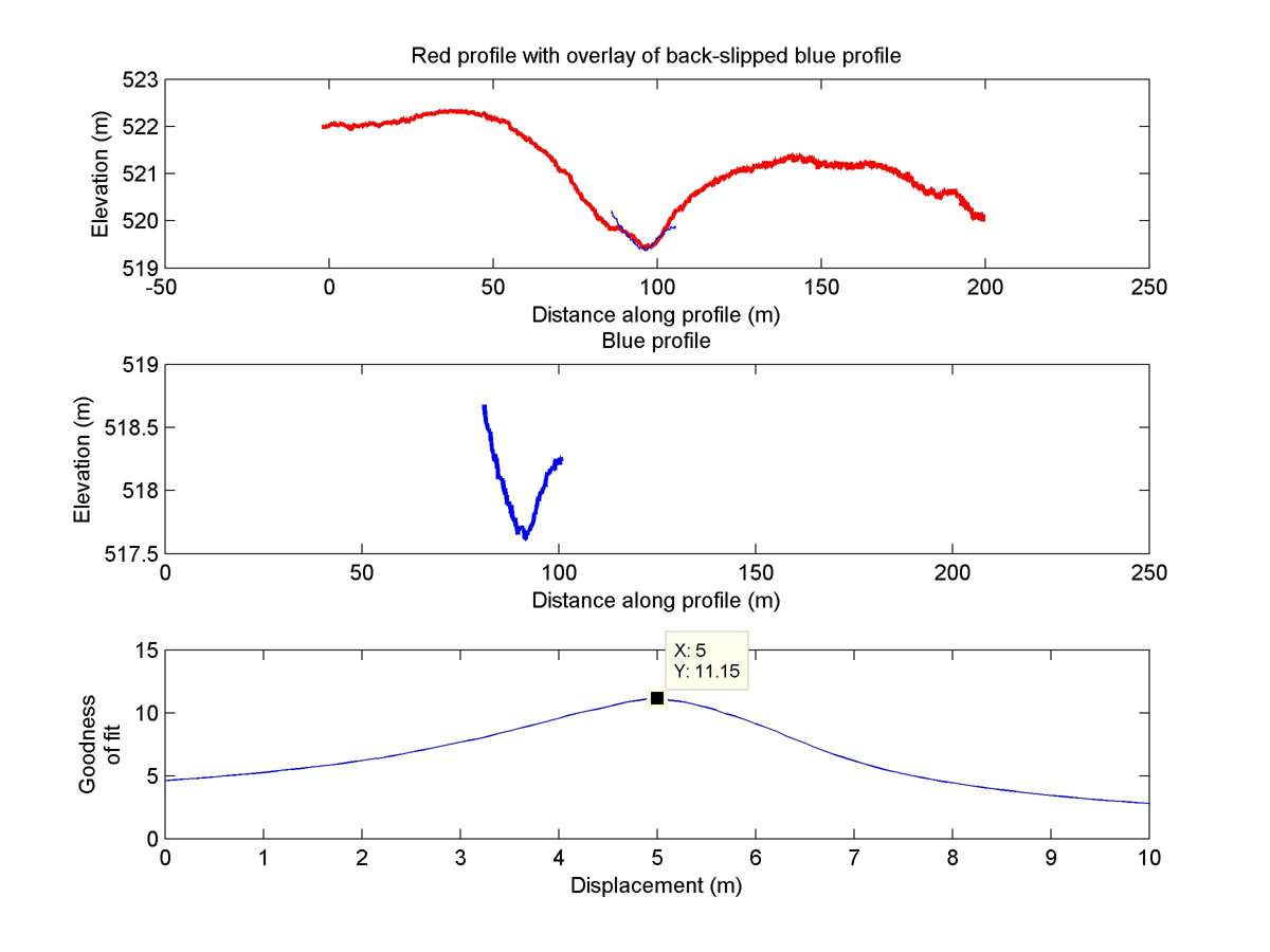
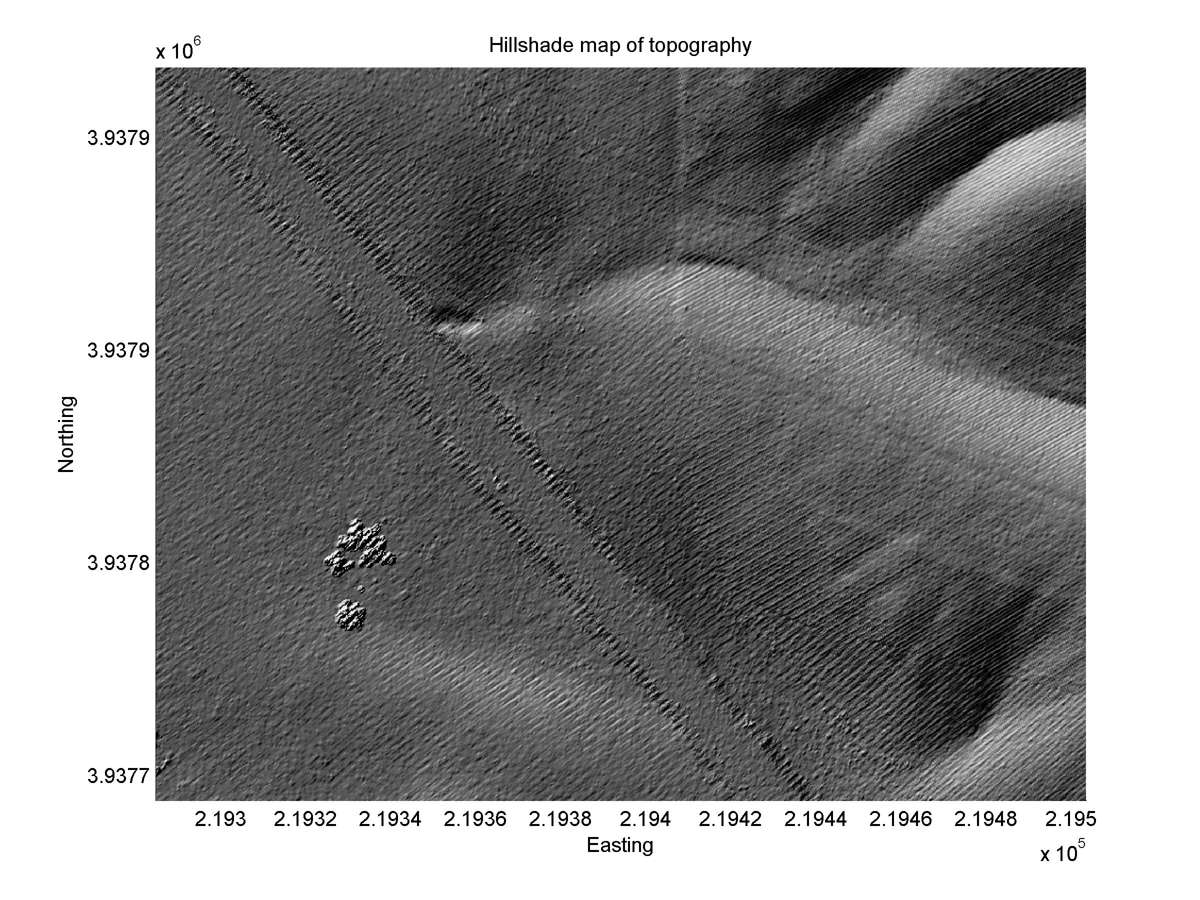
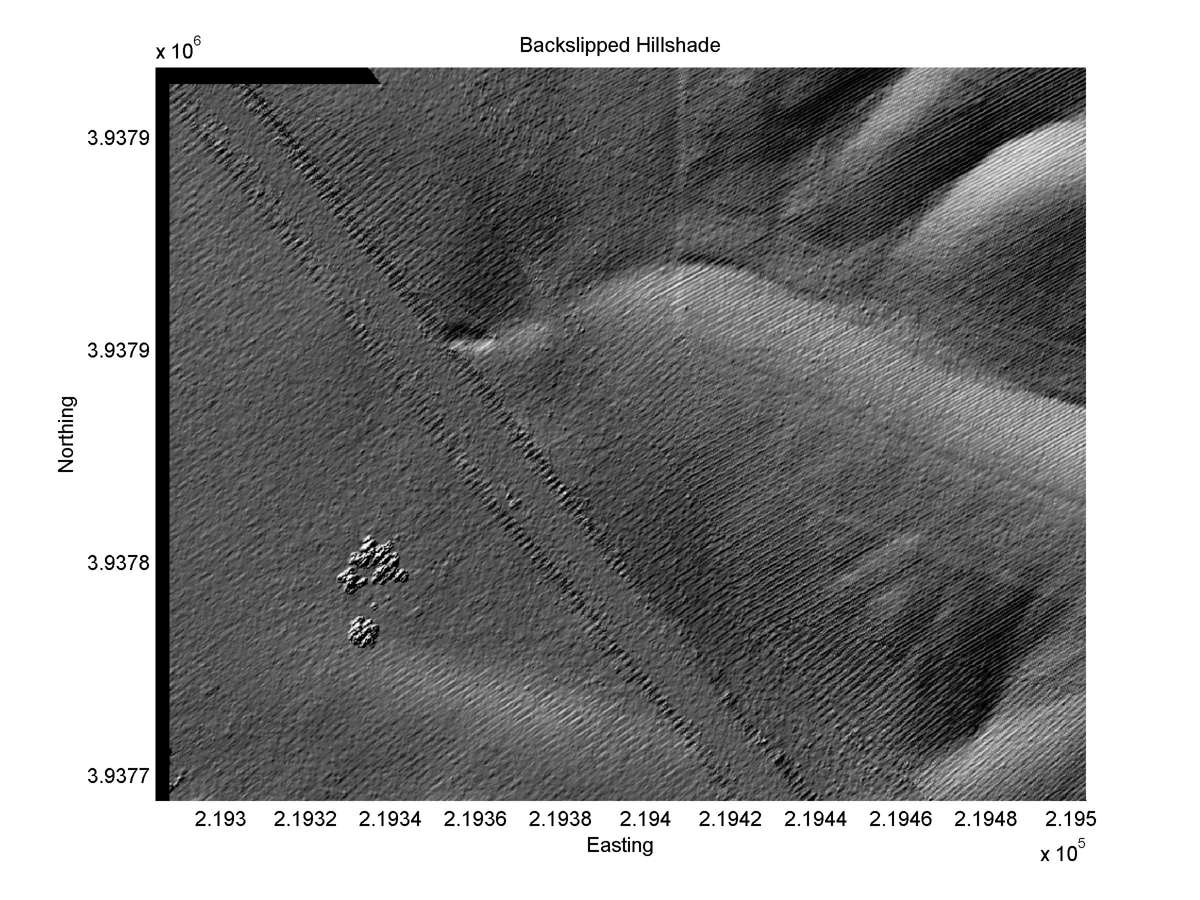
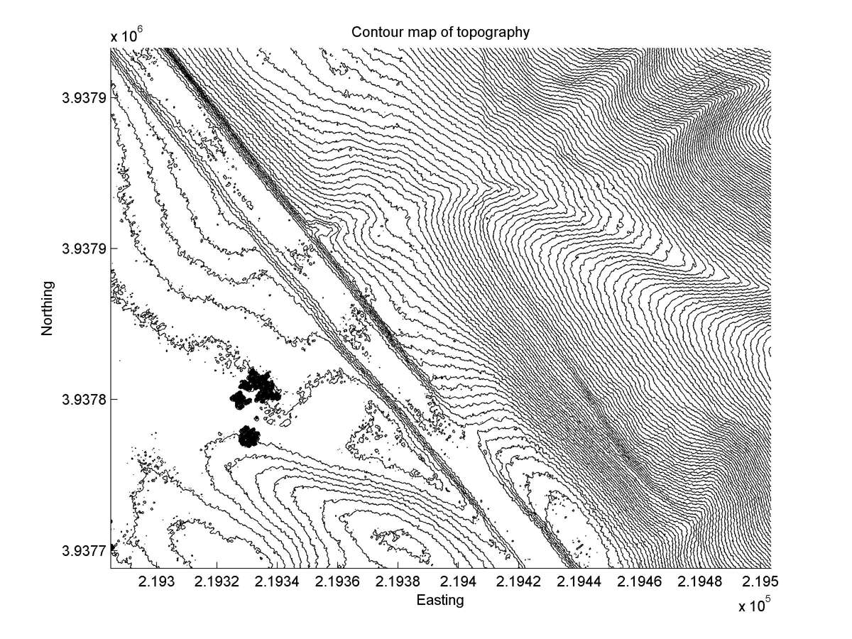
| 35.54473 | -120.09545 | 27.32 km | 5.0 | 4.3 - 5.7 | High | Small offset gully. Correlation with Liekaempers measurement not certain. Offset very well expressed in contour plot |
| Hillshade with profiles | Topographic profiles and GOF |
|
|
| Hillshade plot | Hillshade plot, Optimal back-slip |
|
|
| Contour plot | Contour plot, Optimal back-slip |
|
|
| Dist. from Bitterwater road | Offset (m) | Error (m) | Quality Rating | Comments |
|---|---|---|---|---|
| -1.69km | 6.7 | 0.5 | high | In 1966 aerial photos offset unusually distinct. Channel straight and parallel near fault. Offset since destroyed by disking. |