| Latitude | Longitude | Distance to reference | Best Offset (m) | Offset Range (m) | Quality Rating | Comment |
|---|---|---|---|---|---|---|
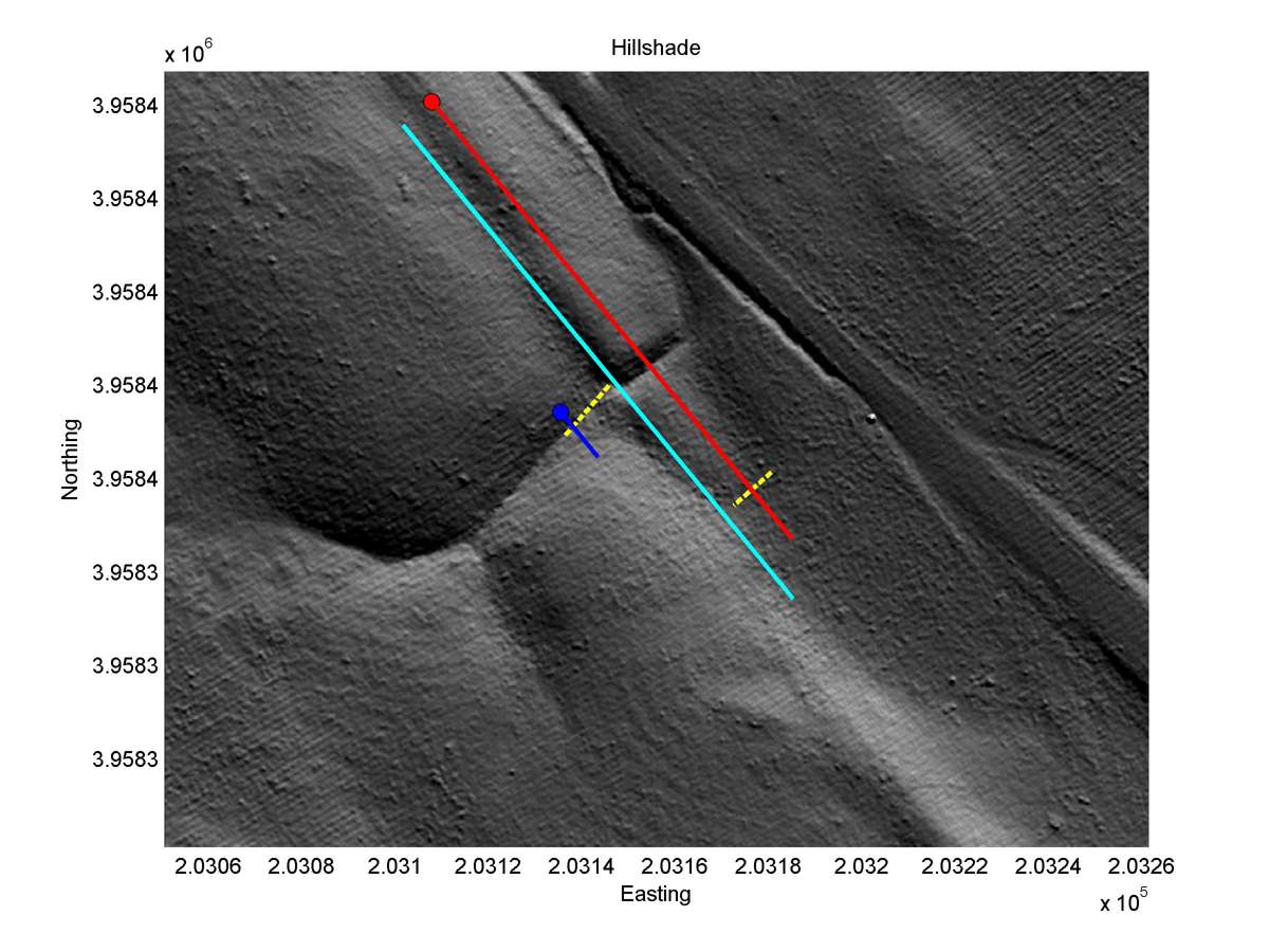
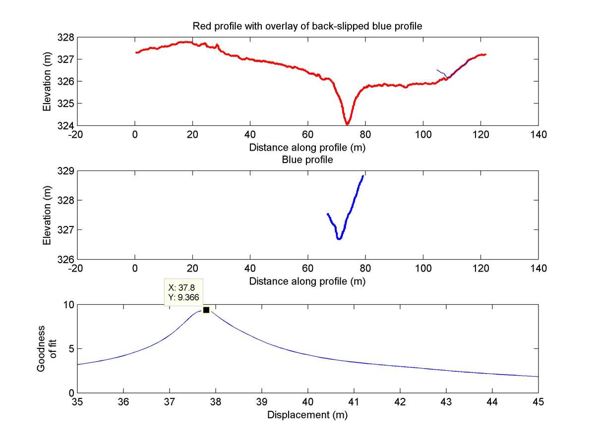
| 35.72457 | -120.28162 | 1.17 km | 37.8 | 35.0 - 42.0 | Low | None |
| Hillshade with profiles | Topographic profiles and GOF |
|
|
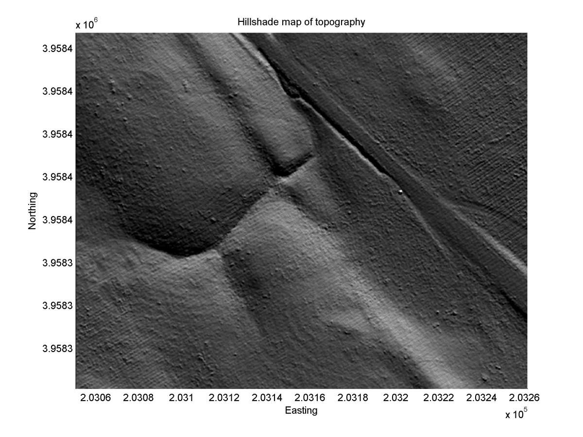
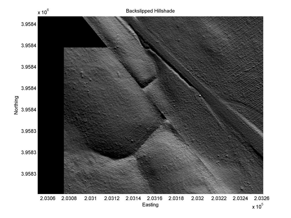
| Hillshade plot | Hillshade plot, Optimal back-slip |
|
|
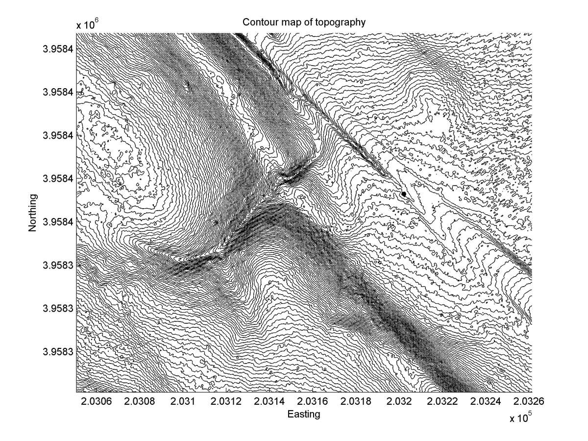
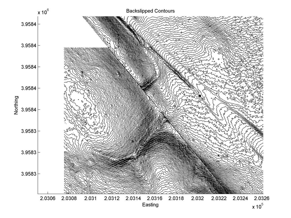
| Contour plot | Contour plot, Optimal back-slip |
|
|
| Dist. from Bitterwater road | Offset (m) | Error (m) | Quality Rating | Comments |
|---|---|---|---|---|
| 24.35km | 33 | 3 | high | Abandoned tail of Sieh (1978) site 1. Straight and narrow head. All error in offset estimate from breadth of tail. Fault trace and well defined. |