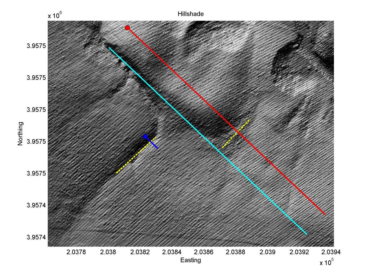
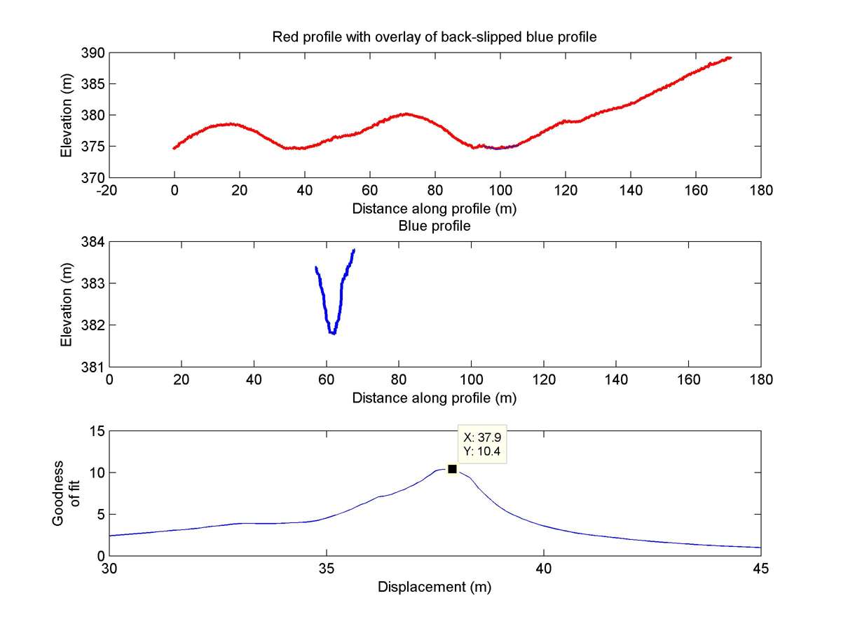
| Latitude | Longitude | Distance to reference | Best Offset (m) | Offset Range (m) | Quality Rating | Comment |
|---|---|---|---|---|---|---|
| 35.71685 | -120.27358 | 2.28 km | 37.9 | 33.0 - 42.0 | Moderate-Low | None |
| Hillshade with profiles | Topographic profiles and GOF |
|
|
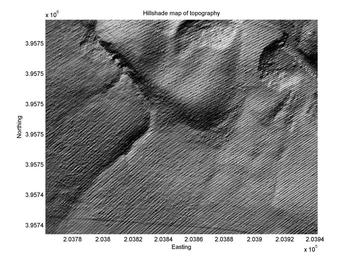
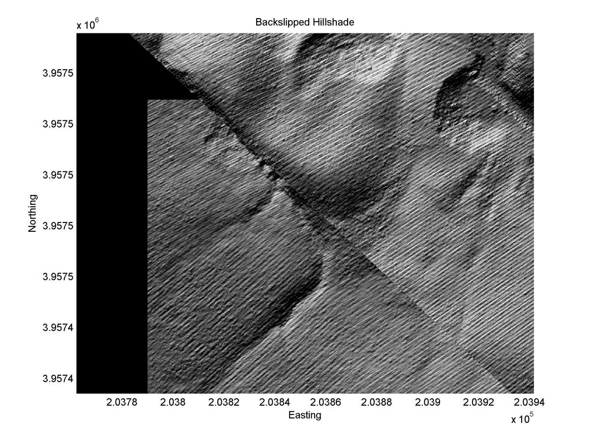
| Hillshade plot | Hillshade plot, Optimal back-slip |
|
|
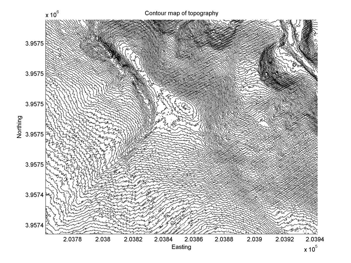
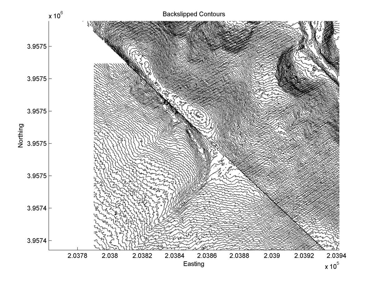
| Contour plot | Contour plot, Optimal back-slip |
|
|
| Dist. from Bitterwater road | Offset (m) | Error (m) | Quality Rating | Comments |
|---|---|---|---|---|
| 23.23km | 30 | 6 | medium | Good matches of straight, parallel head and tail. Head captured by other outlet. Southeast wall abandoned tail carried away by landslide. Reconstruction assumes tail was shaped like head. |