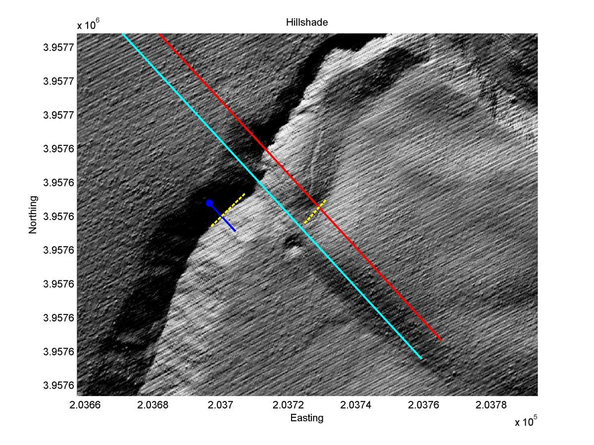
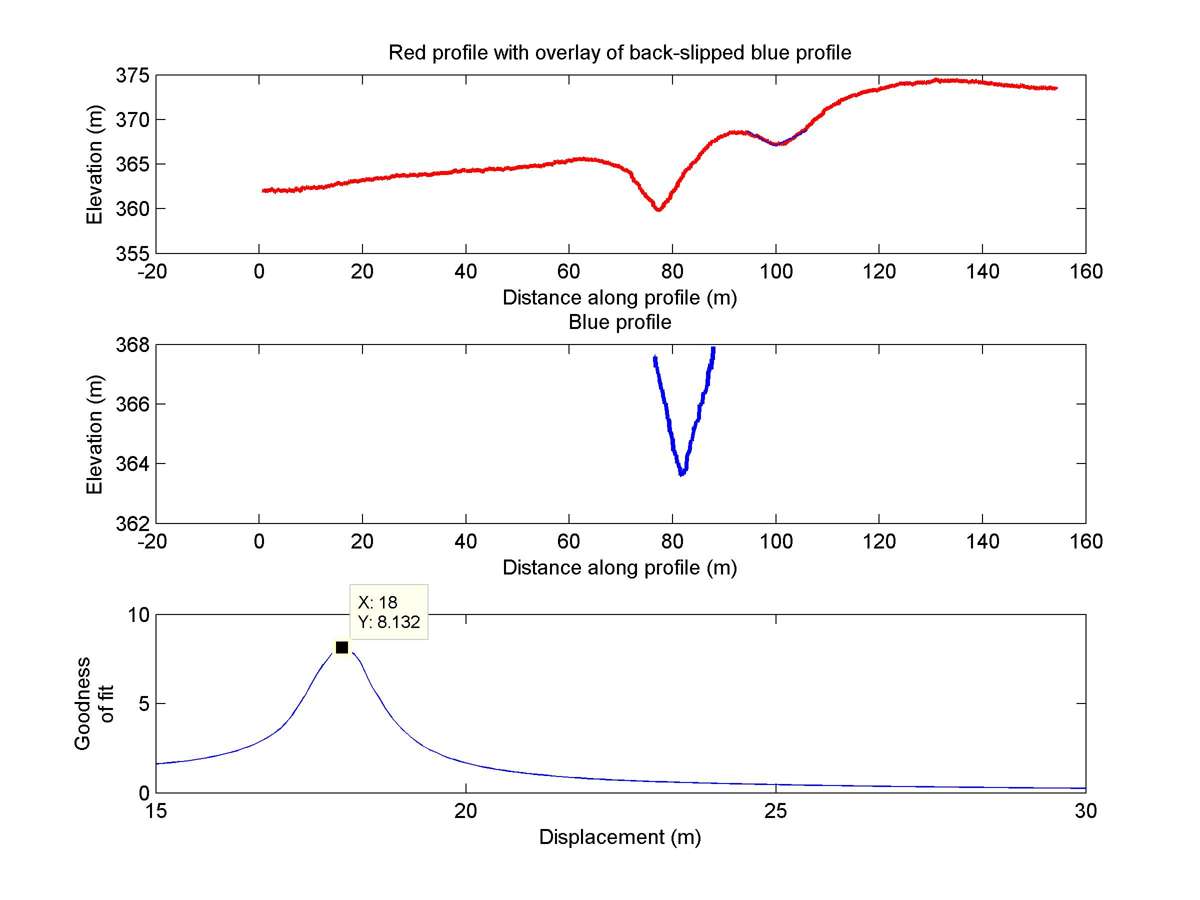
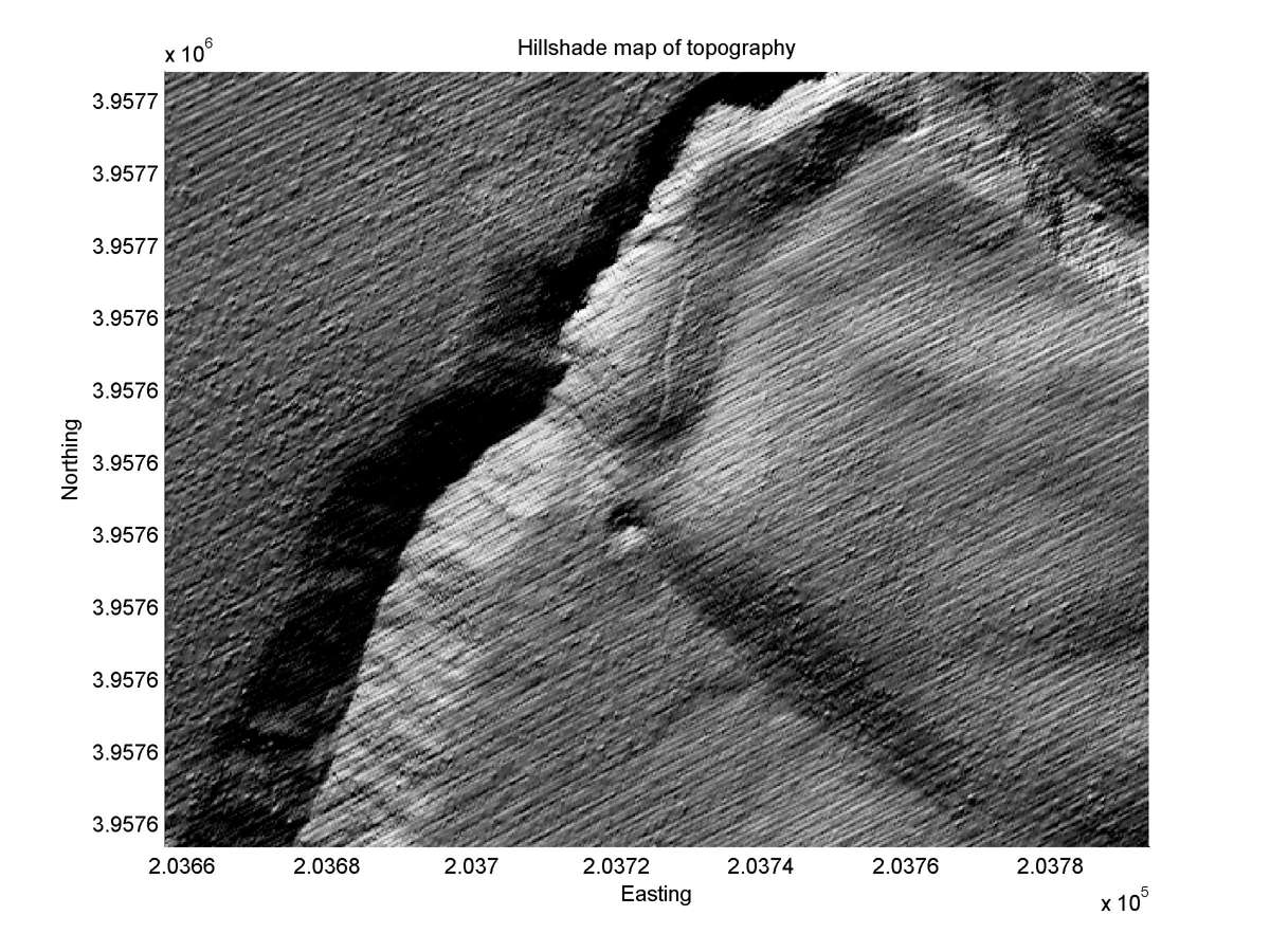
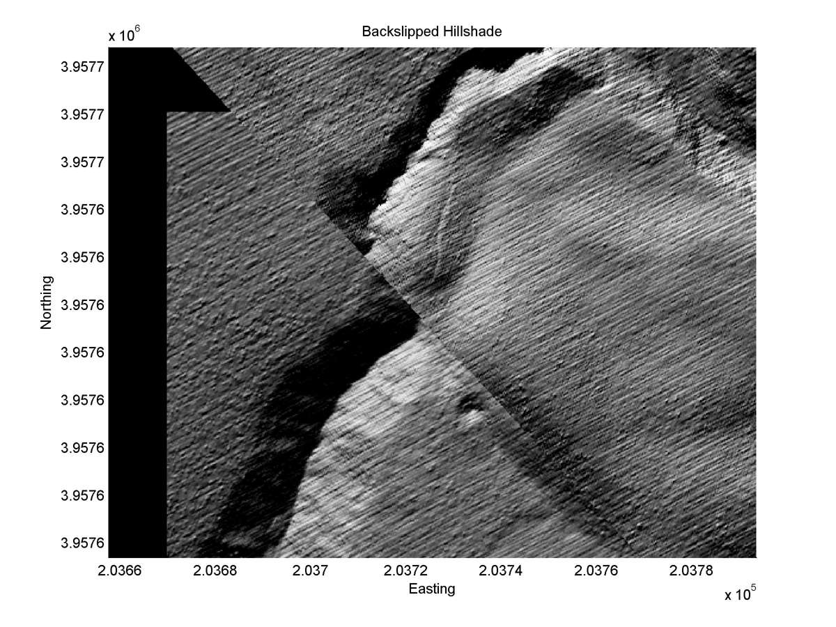
| Latitude | Longitude | Distance to reference | Best Offset (m) | Offset Range (m) | Quality Rating | Comment |
|---|---|---|---|---|---|---|
| 35.71805 | -120.27518 | 2.10 km | 18.0 | 16.5 - 21.0 | Moderate | None |
| Hillshade with profiles | Topographic profiles and GOF |
|
|
| Hillshade plot | Hillshade plot, Optimal back-slip |
|
|
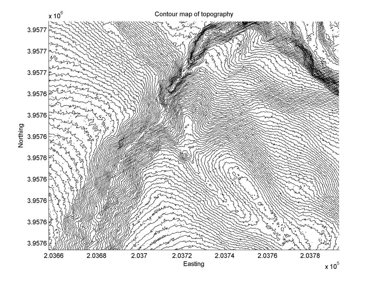
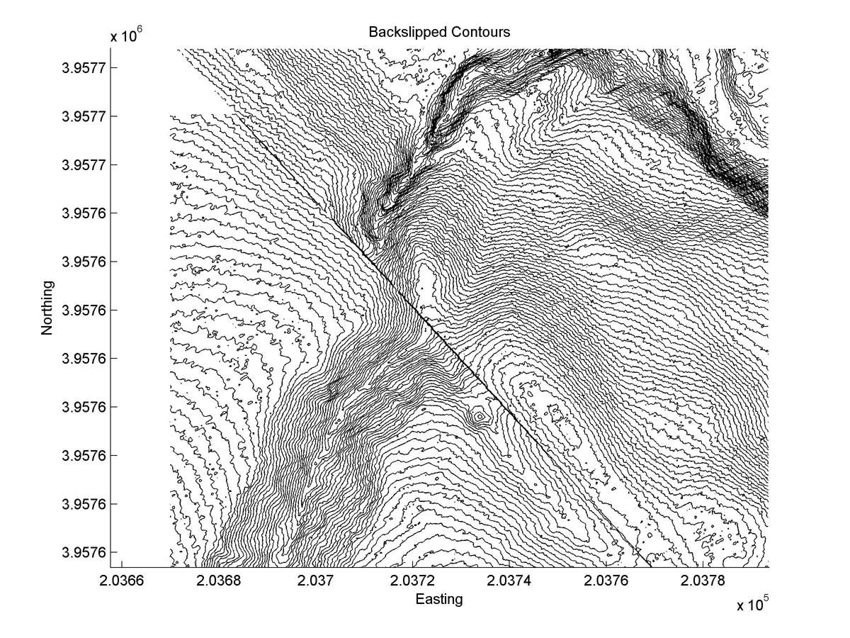
| Contour plot | Contour plot, Optimal back-slip |
|
|
| Dist. from Bitterwater road | Offset (m) | Error (m) | Quality Rating | Comments |
|---|---|---|---|---|
| 23.43km | 30 | 5 | medium | Intermediate tail b2 offset 90m ignored because too poorly expressed. Tail b3, straight and well preserved because completely abandoned; escaped deep incision experience by head by artificial base-level change. |