| Latitude | Longitude | Distance to reference | Best Offset (m) | Offset Range (m) | Quality Rating | Comment |
|---|---|---|---|---|---|---|
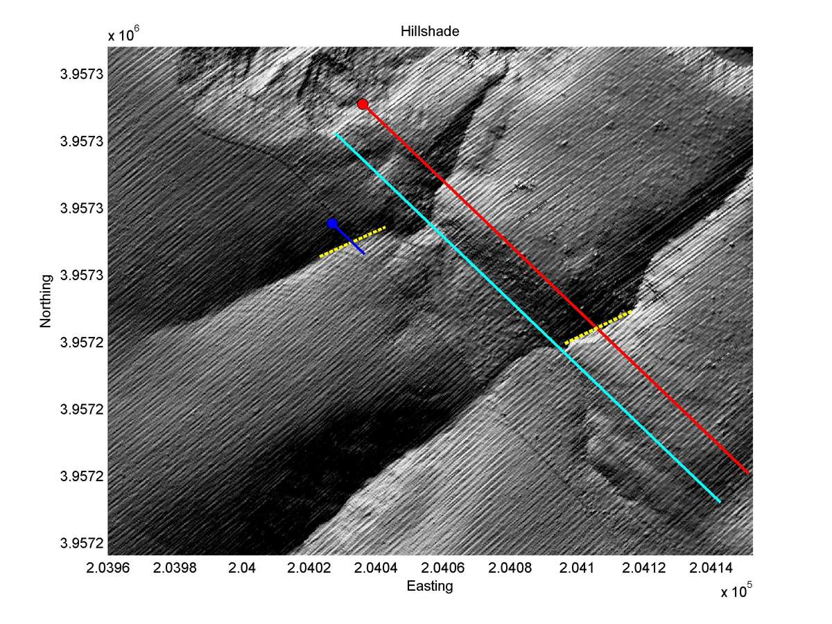
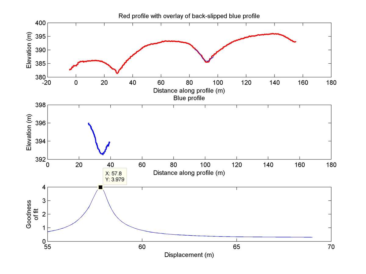
| 35.71487 | -120.27111 | 2.61 km | 57.8 | 55.0 - 60.0 | High-Moderate | Beheaded channel. |
| Hillshade with profiles | Topographic profiles and GOF |
|
|
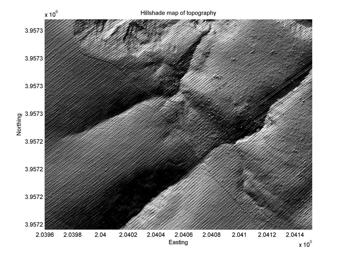
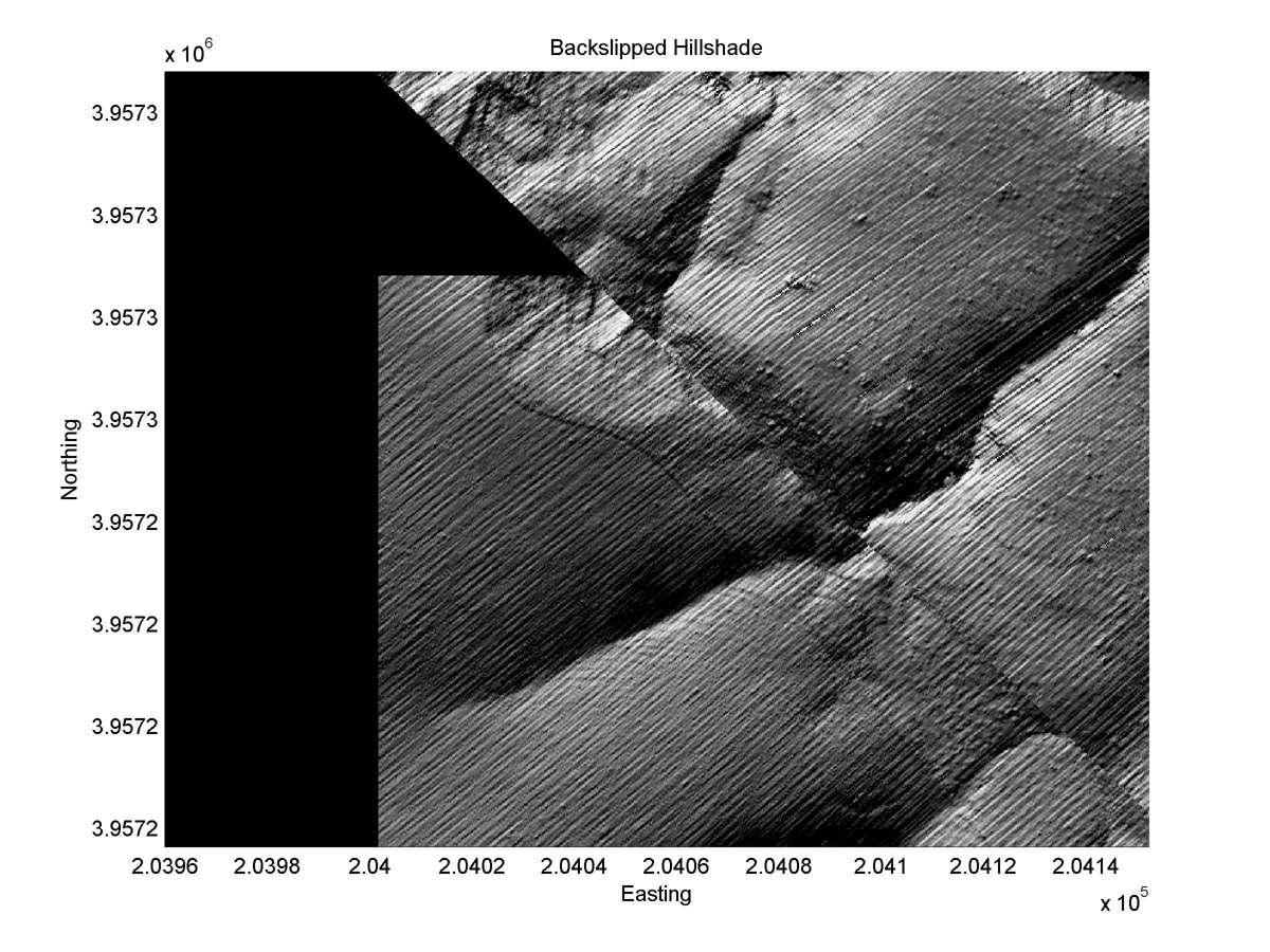
| Hillshade plot | Hillshade plot, Optimal back-slip |
|
|
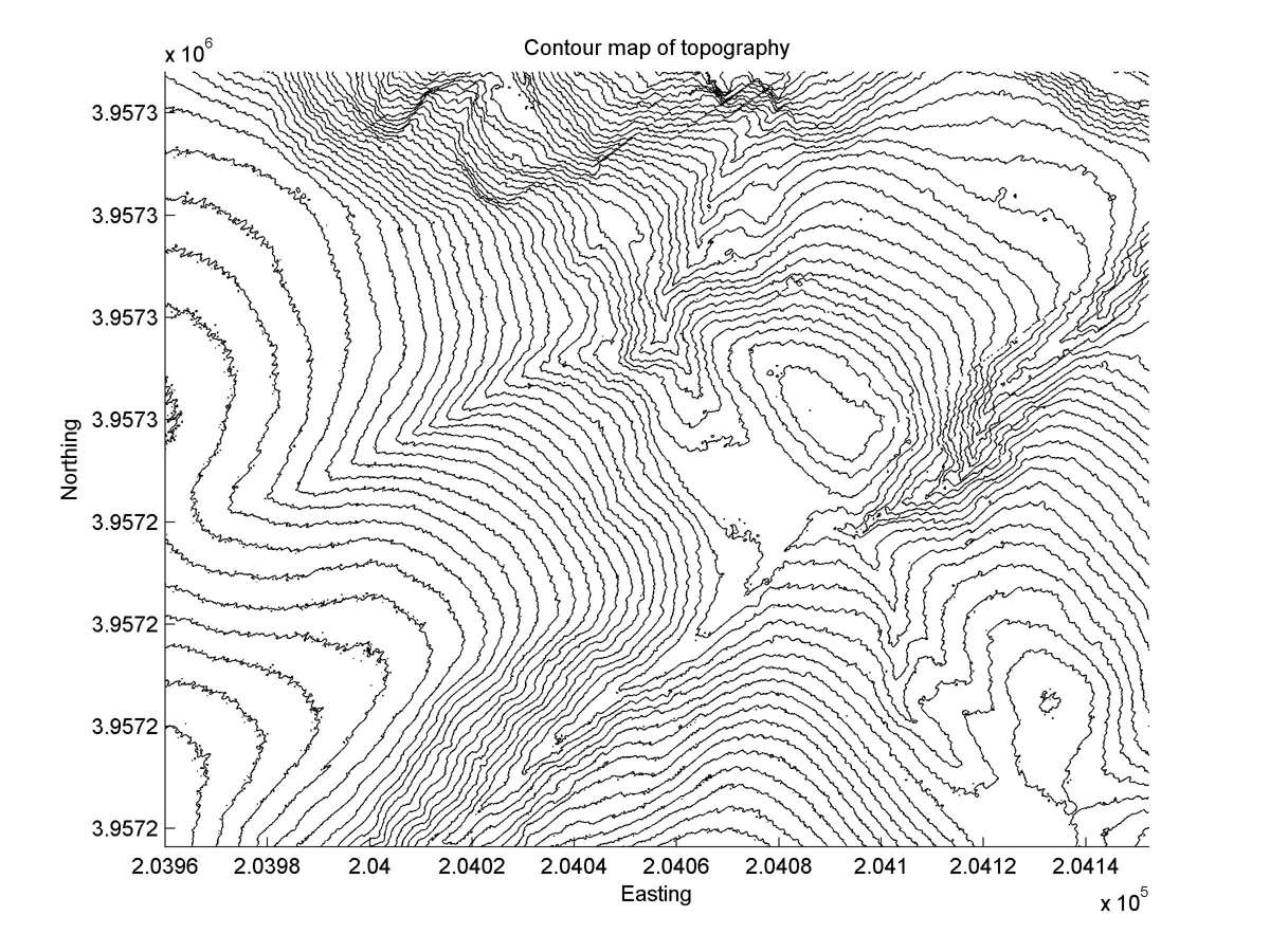
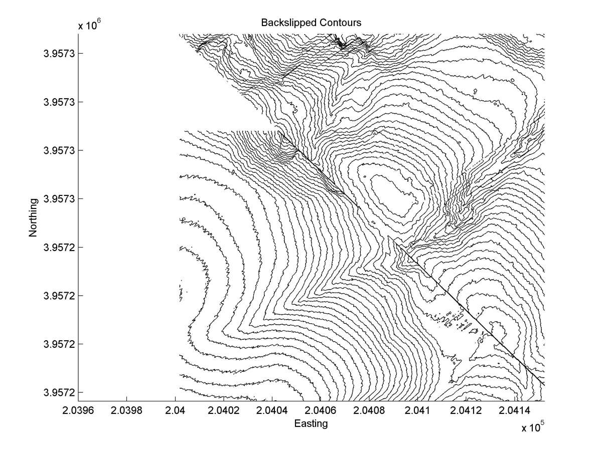
| Contour plot | Contour plot, Optimal back-slip |
|
|
| Dist. from Bitterwater road | Offset (m) | Error (m) | Quality Rating | Comments |
|---|---|---|---|---|
| 22.92km | 54 | 5 | medium | Match of head and tail most probably correct, but interaction with much larger head 35a obscures some details of the offset. |