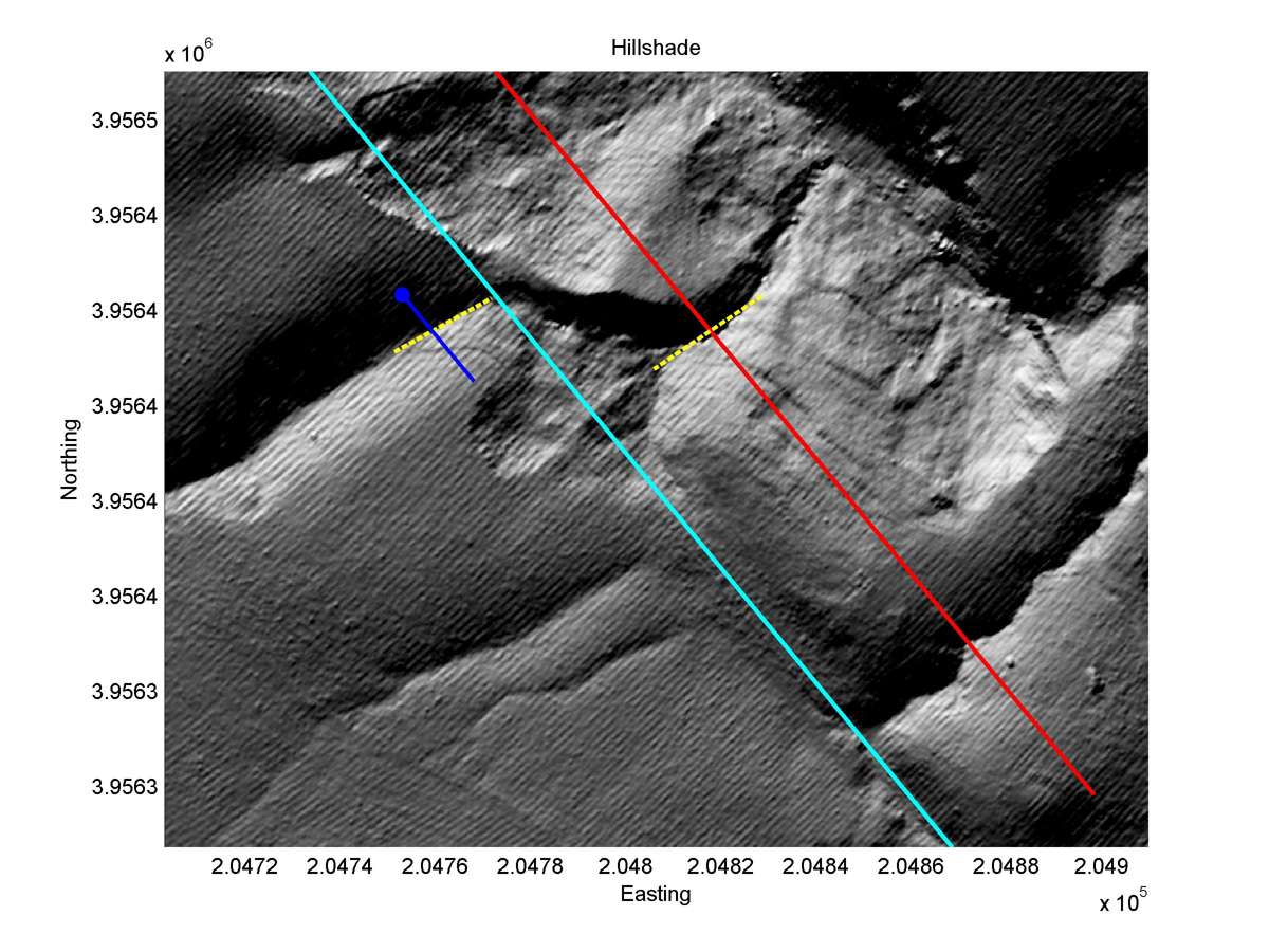
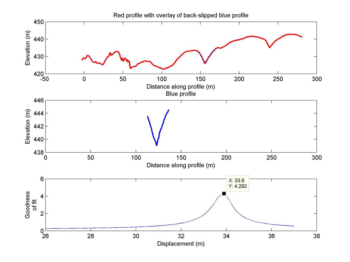
| Latitude | Longitude | Distance to reference | Best Offset (m) | Offset Range (m) | Quality Rating | Comment |
|---|---|---|---|---|---|---|
| 35.70745 | -120.26297 | 3.72 km | 33.9 | 30.0 - 38.0 | Moderate-Low | Offset channel. |
| Hillshade with profiles | Topographic profiles and GOF |
|
|
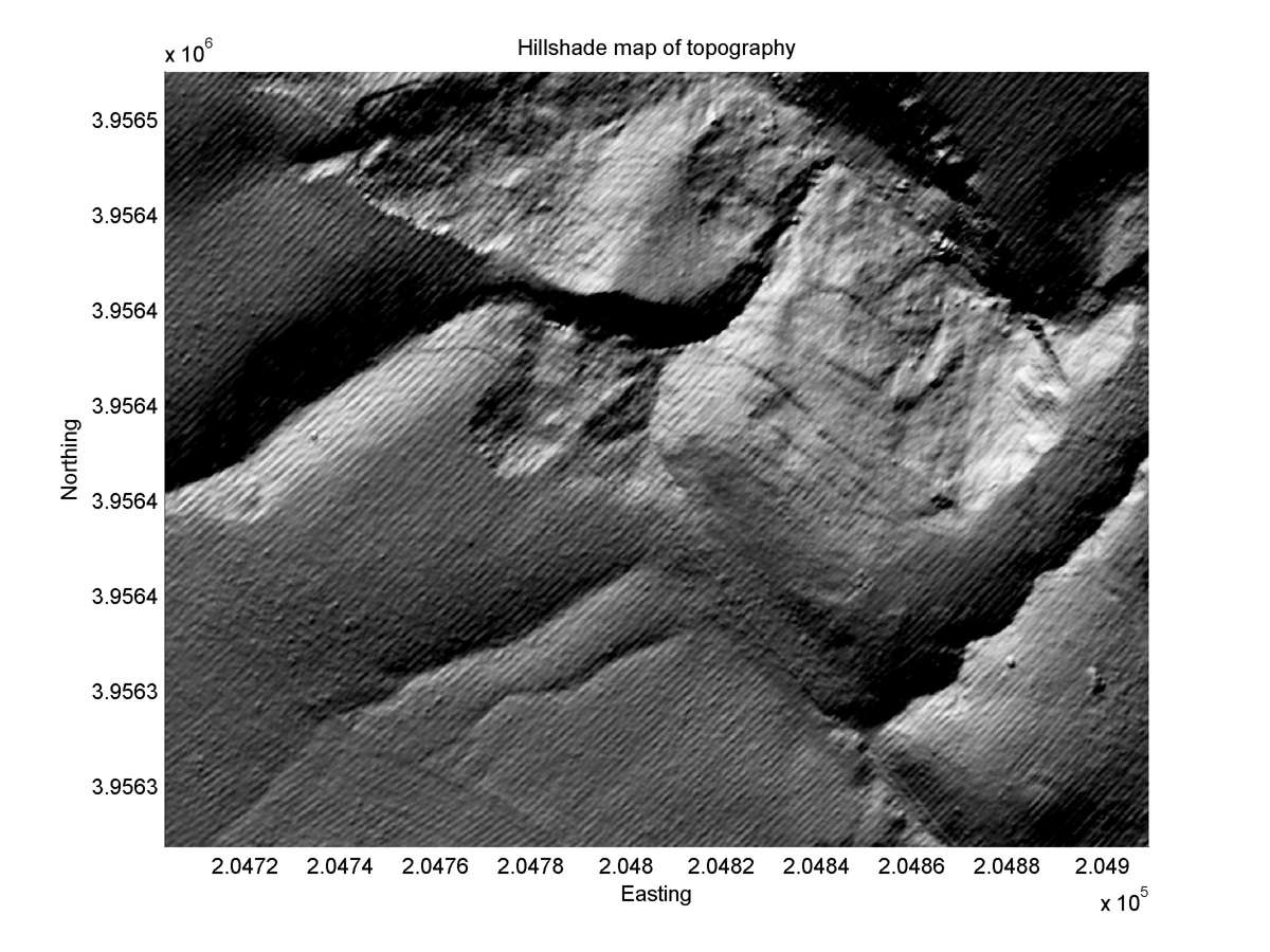
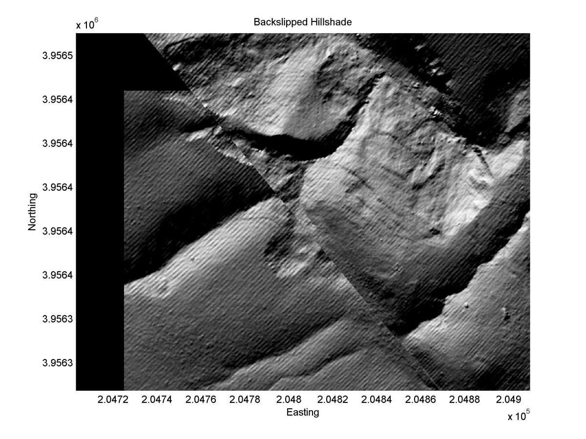
| Hillshade plot | Hillshade plot, Optimal back-slip |
|
|
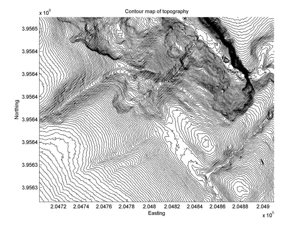
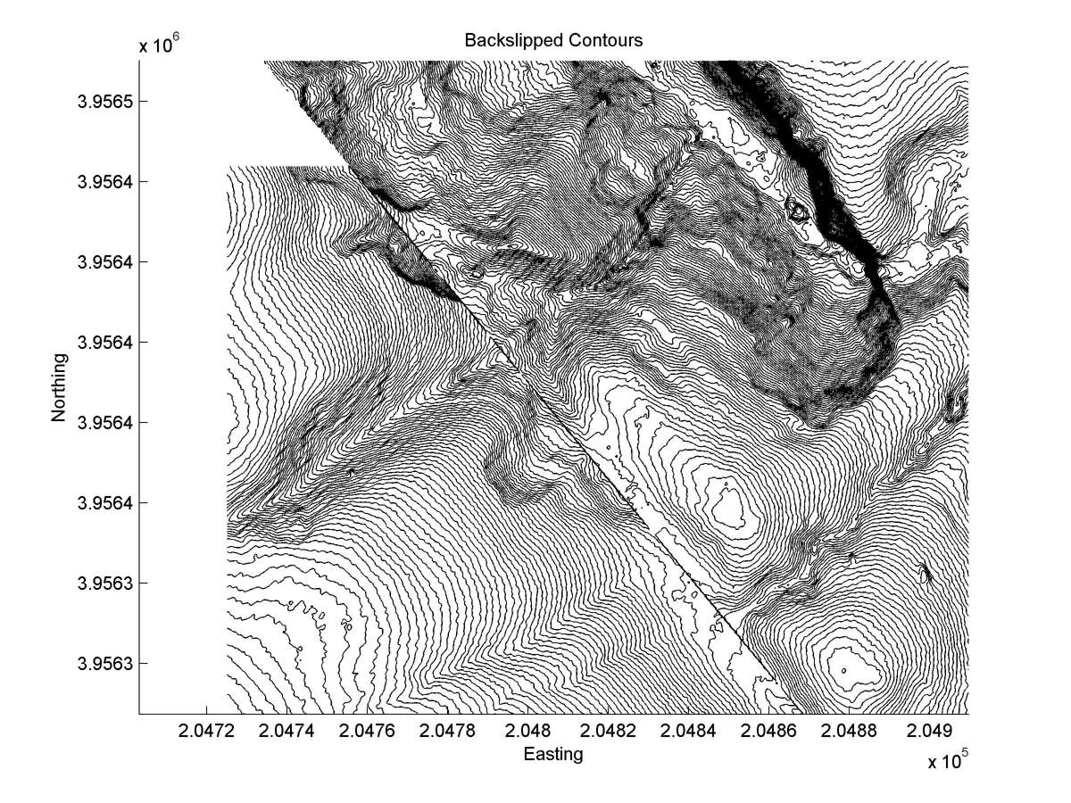
| Contour plot | Contour plot, Optimal back-slip |
|
|
| Dist. from Bitterwater road | Offset (m) | Error (m) | Quality Rating | Comments |
|---|---|---|---|---|
| 21.72km | 30 | 10 | medium | A classic succession of three abandoned tails: 41a1, a2 and a3. Next major earthquake will behead present active tail, a3. Straight, narrow, and unusually parallel head and tails make reconstructions certain, except a3 requires long projection of channel center through landslide debris at fault. |