| Latitude | Longitude | Distance to reference | Best Offset (m) | Offset Range (m) | Quality Rating | Comment |
|---|---|---|---|---|---|---|
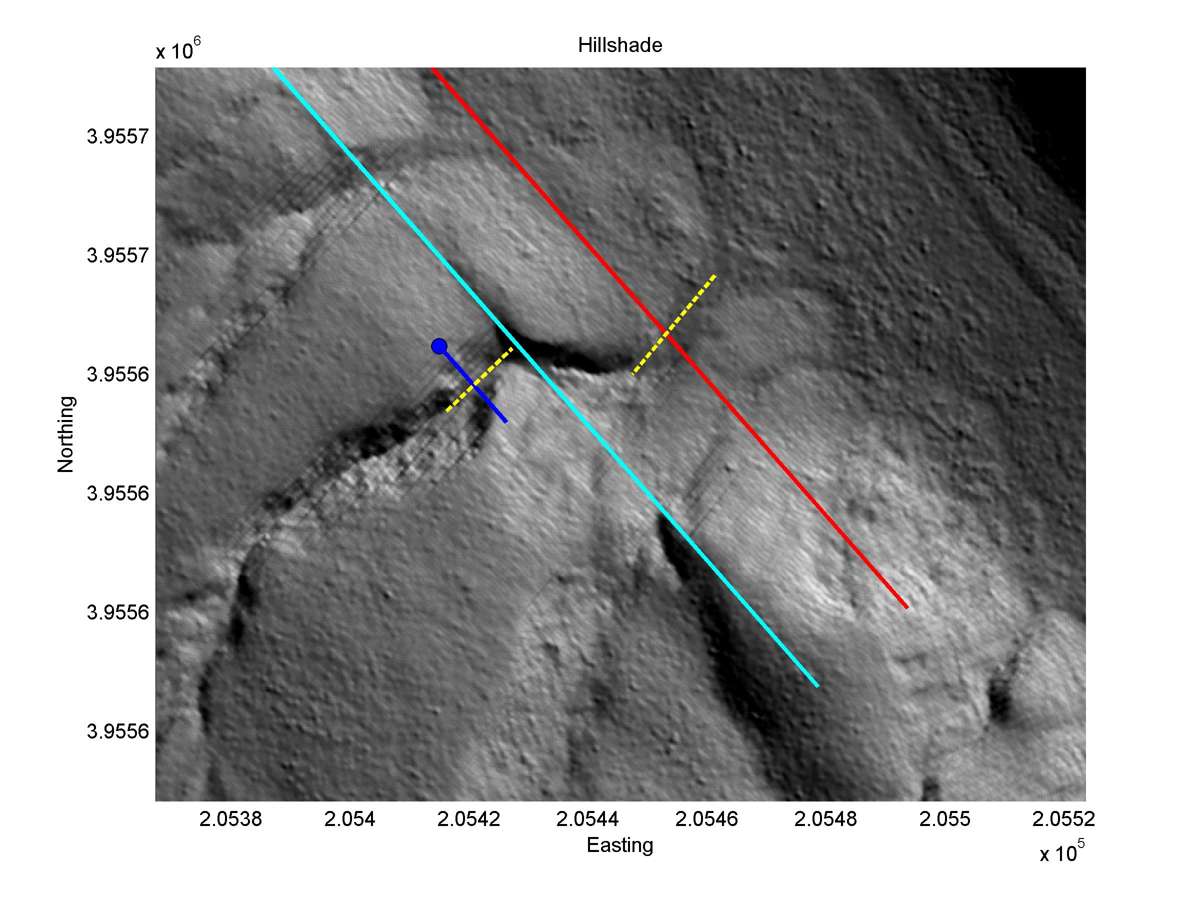
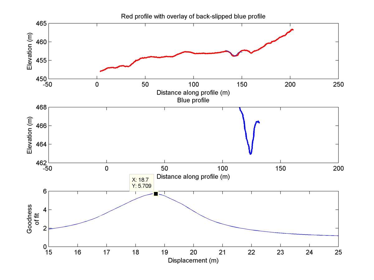
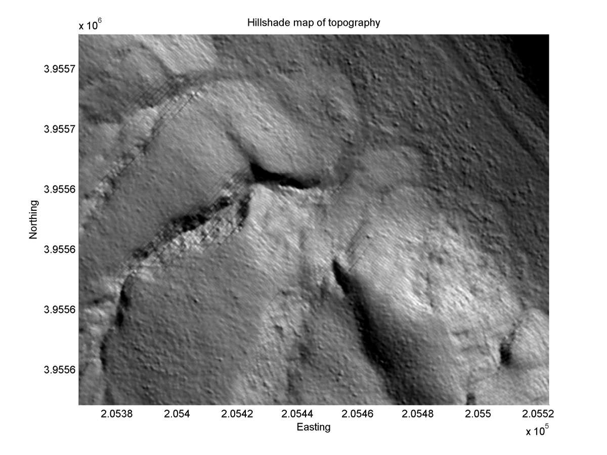
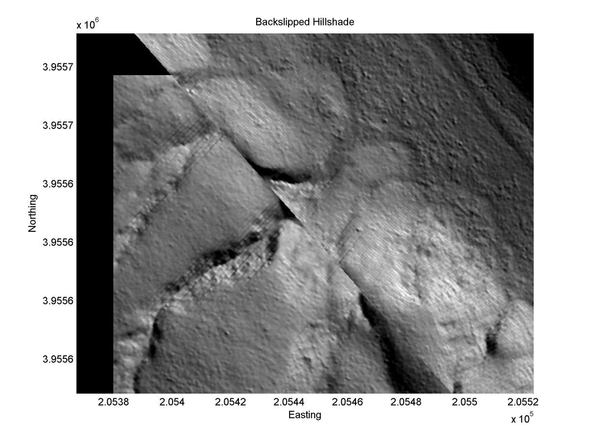
| 35.70069 | -120.25550 | 4.72 km | 18.7 | 17.0 - 21.0 | Moderate-Low | Offset channel. Obliquity lowers rating. |
| Hillshade with profiles | Topographic profiles and GOF |
|
|
| Hillshade plot | Hillshade plot, Optimal back-slip |
|
|
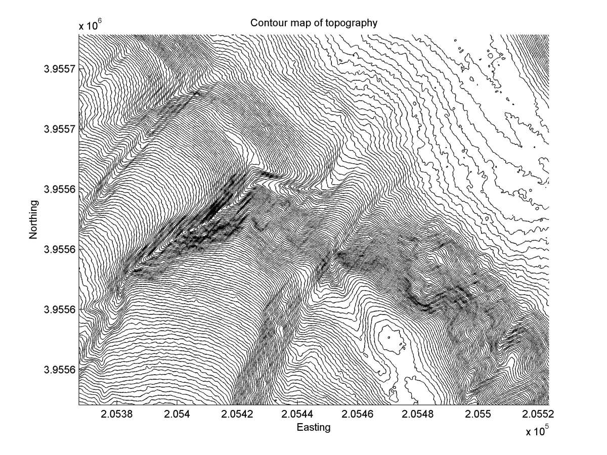
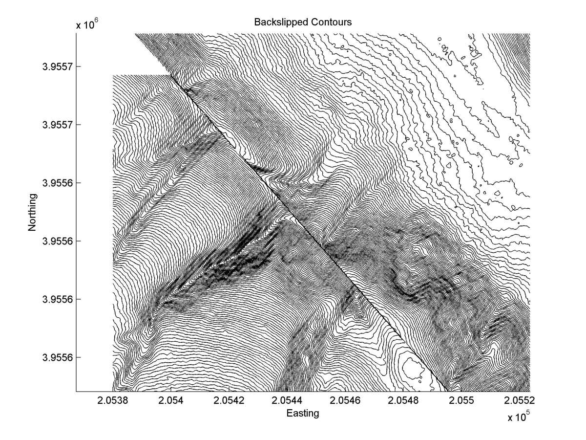
| Contour plot | Contour plot, Optimal back-slip |
|
|
| Dist. from Bitterwater road | Offset (m) | Error (m) | Quality Rating | Comments |
|---|---|---|---|---|
| 20.82km | 12 | 3 | medium | Distinct offset of straight head, but exact shape of tail obscured by landsliding and erosion. |