| Latitude | Longitude | Distance to reference | Best Offset (m) | Offset Range (m) | Quality Rating | Comment |
|---|---|---|---|---|---|---|
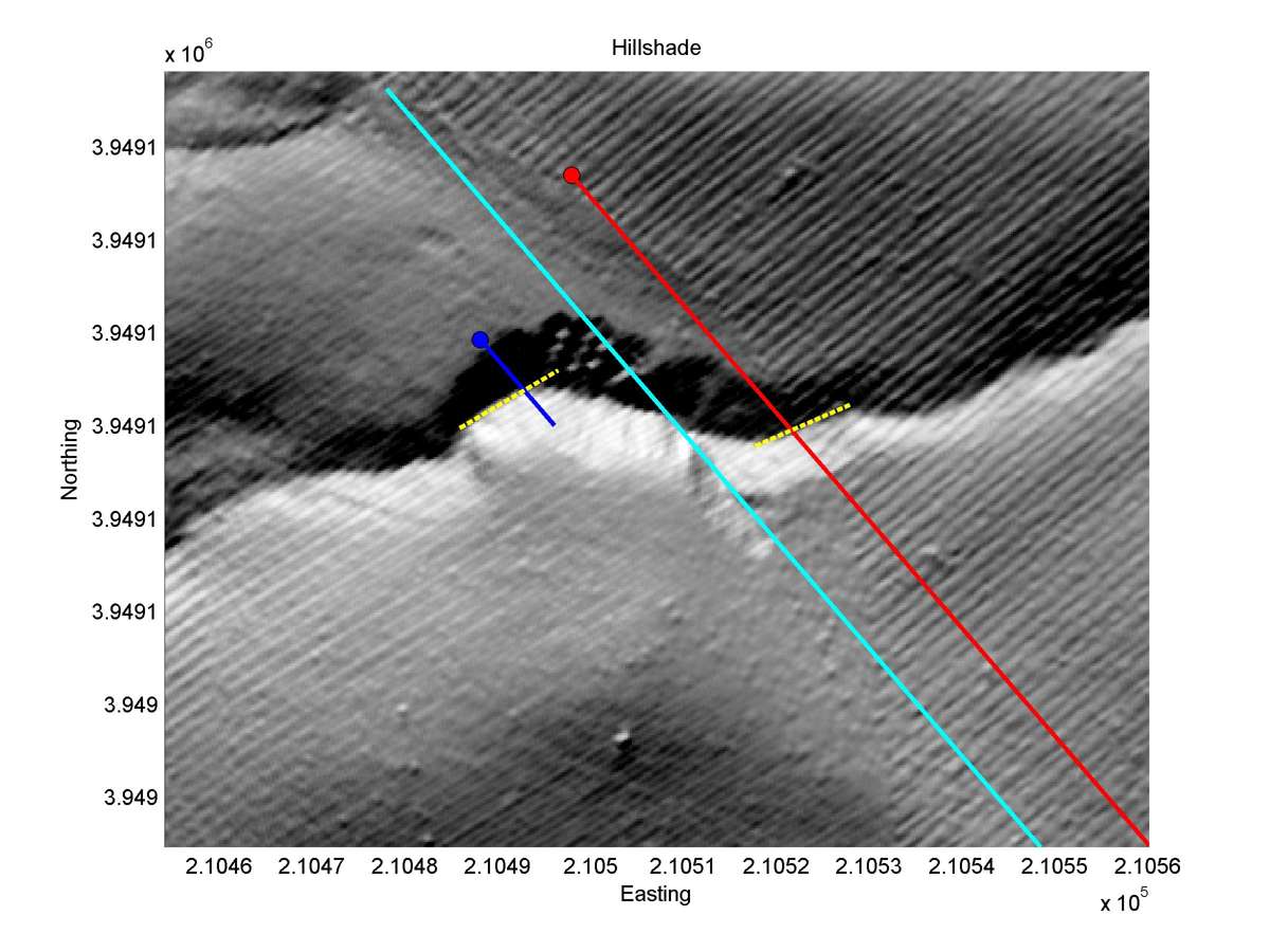
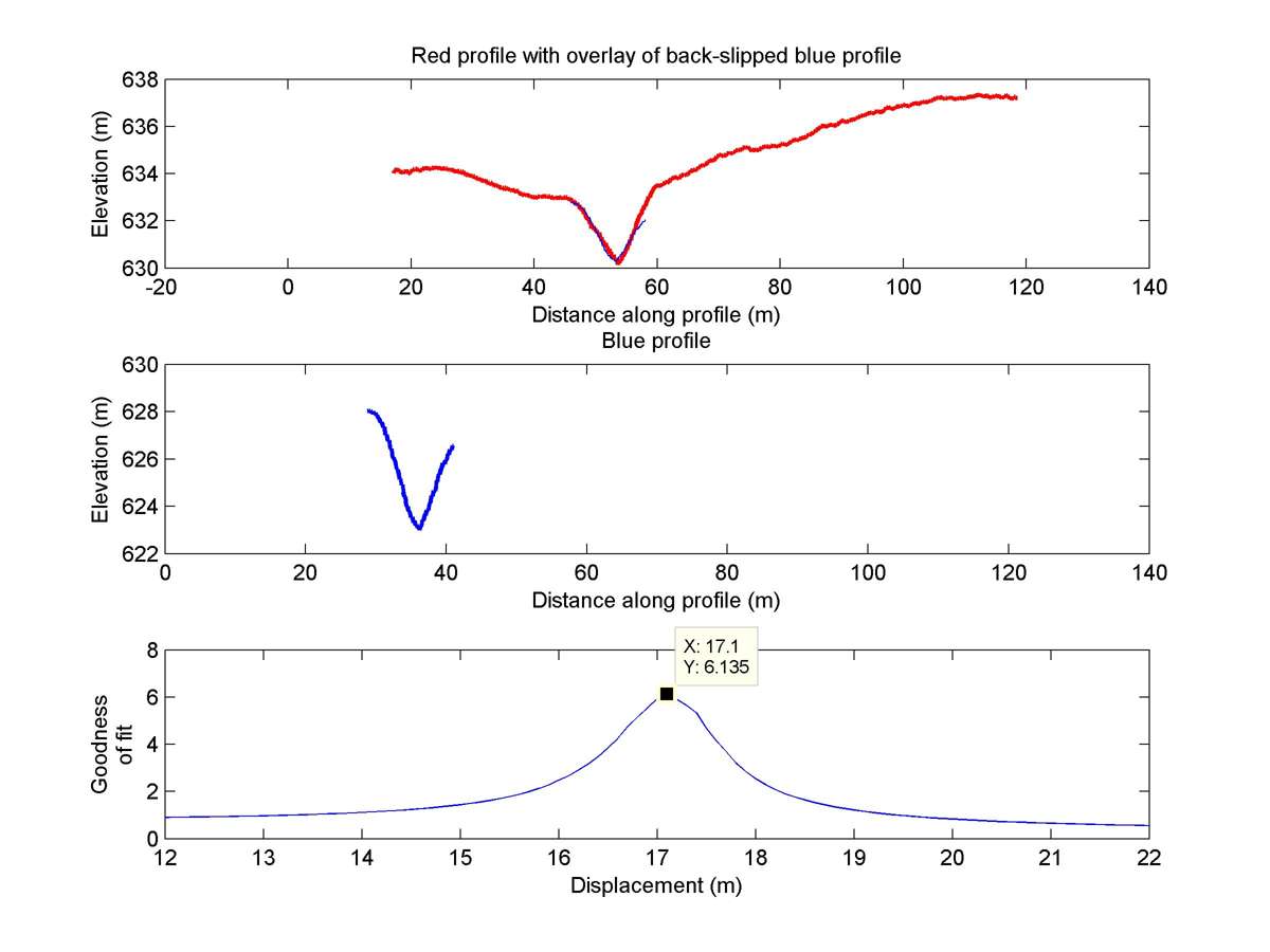
| 35.64309 | -120.19715 | 13.06 km | 17.1 | 16.0 - 18.0 | Moderate-Low | Offset channel. Apparently high erosion around fault zone makes measurement less reliable. |
| Hillshade with profiles | Topographic profiles and GOF |
|
|
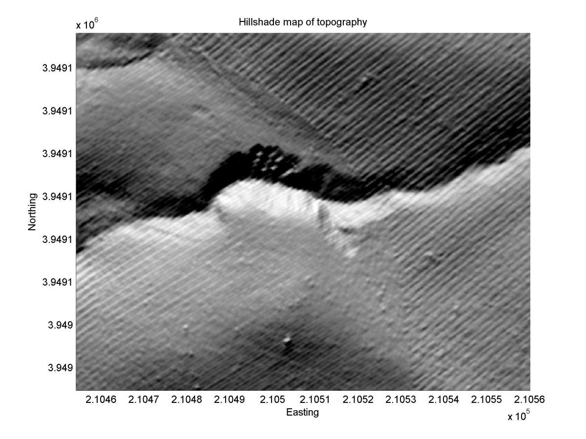
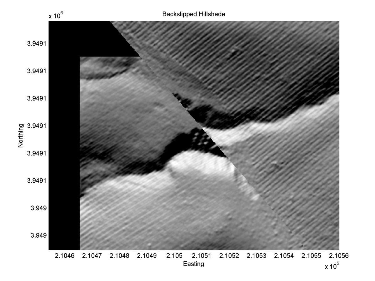
| Hillshade plot | Hillshade plot, Optimal back-slip |
|
|
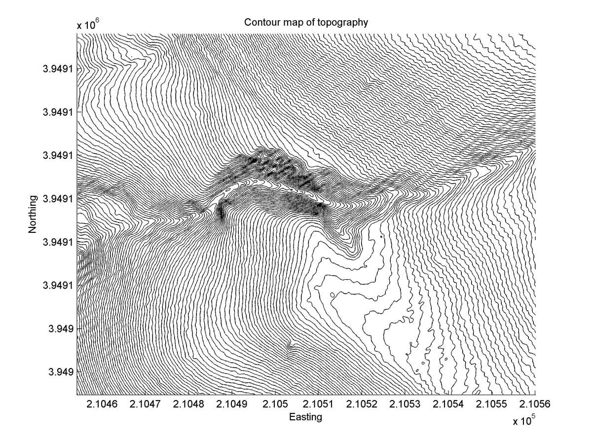
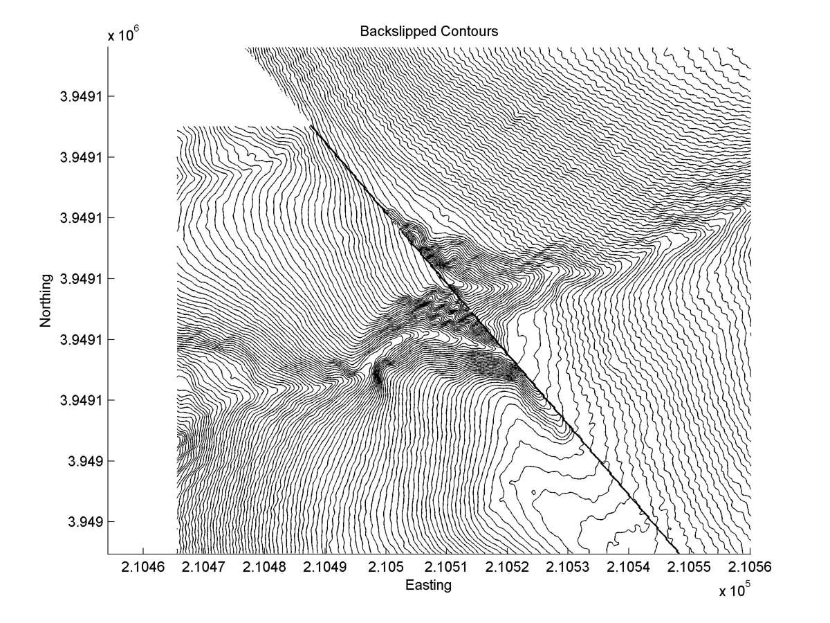
| Contour plot | Contour plot, Optimal back-slip |
|
|
| Dist. from Bitterwater road | Offset (m) | Error (m) | Quality Rating | Comments |
|---|---|---|---|---|
| 12.53km | 15 | 5 | low | Slightly clearer than smaller offset here, but intense erosion prevents certain reconstruction. |