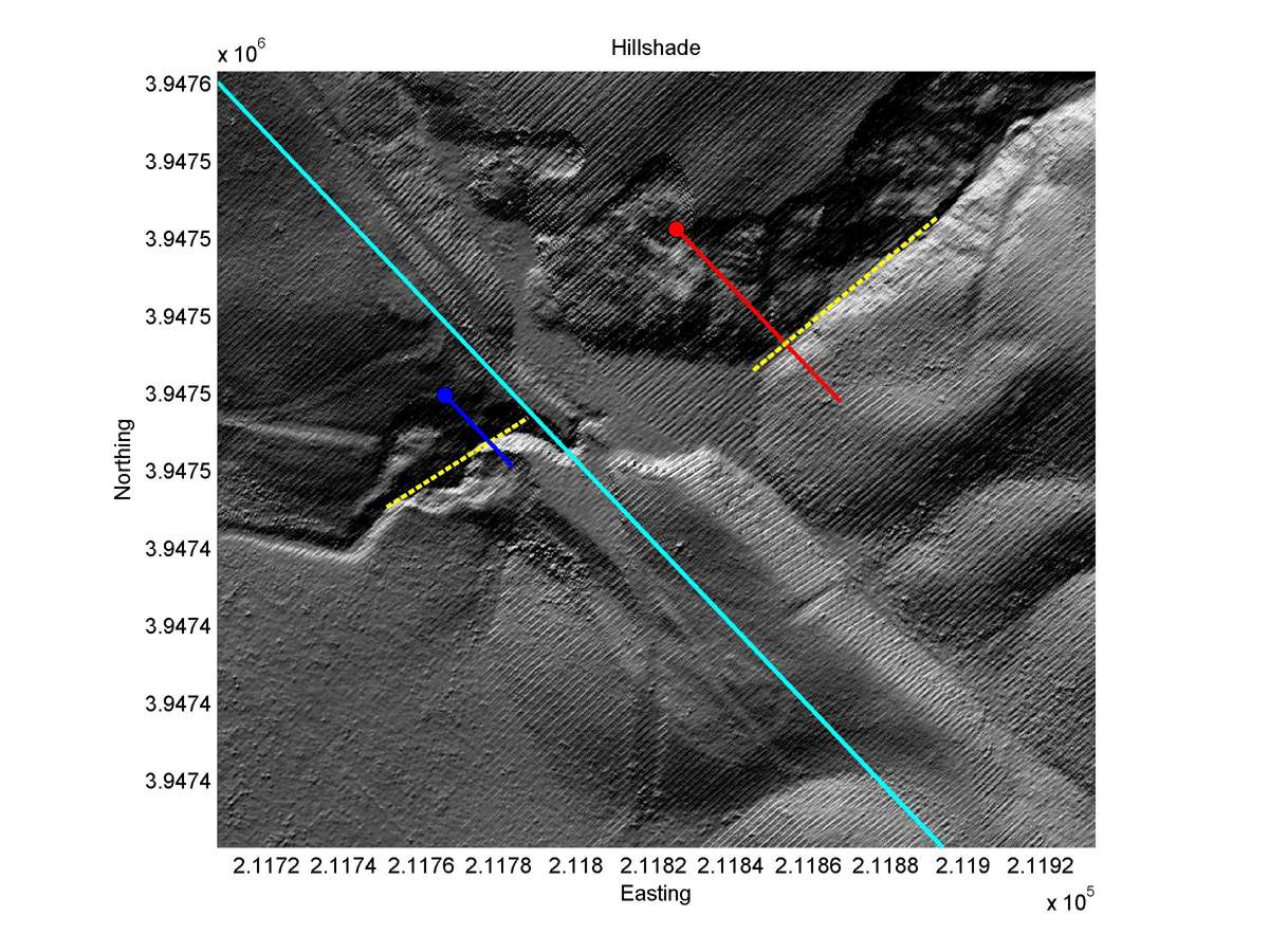
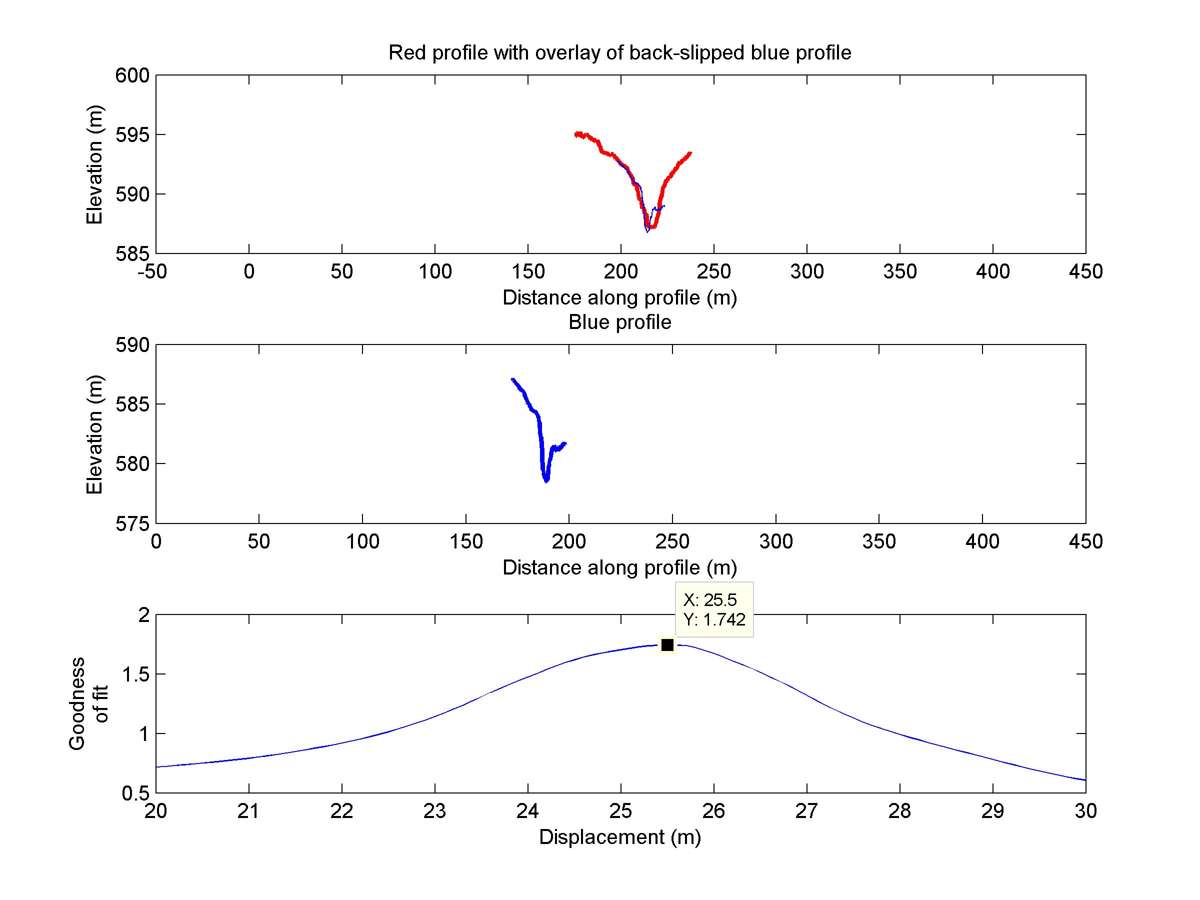
| Latitude | Longitude | Distance to reference | Best Offset (m) | Offset Range (m) | Quality Rating | Comment |
|---|---|---|---|---|---|---|
| 35.62899 | -120.18234 | 15.07 km | 25.5 | 21.0 - 30.0 | Moderate-Low | None |
| Hillshade with profiles | Topographic profiles and GOF |
|
|
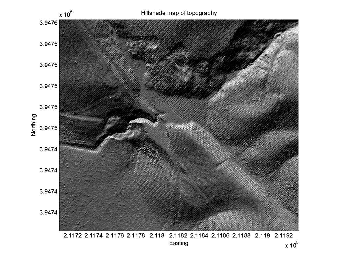
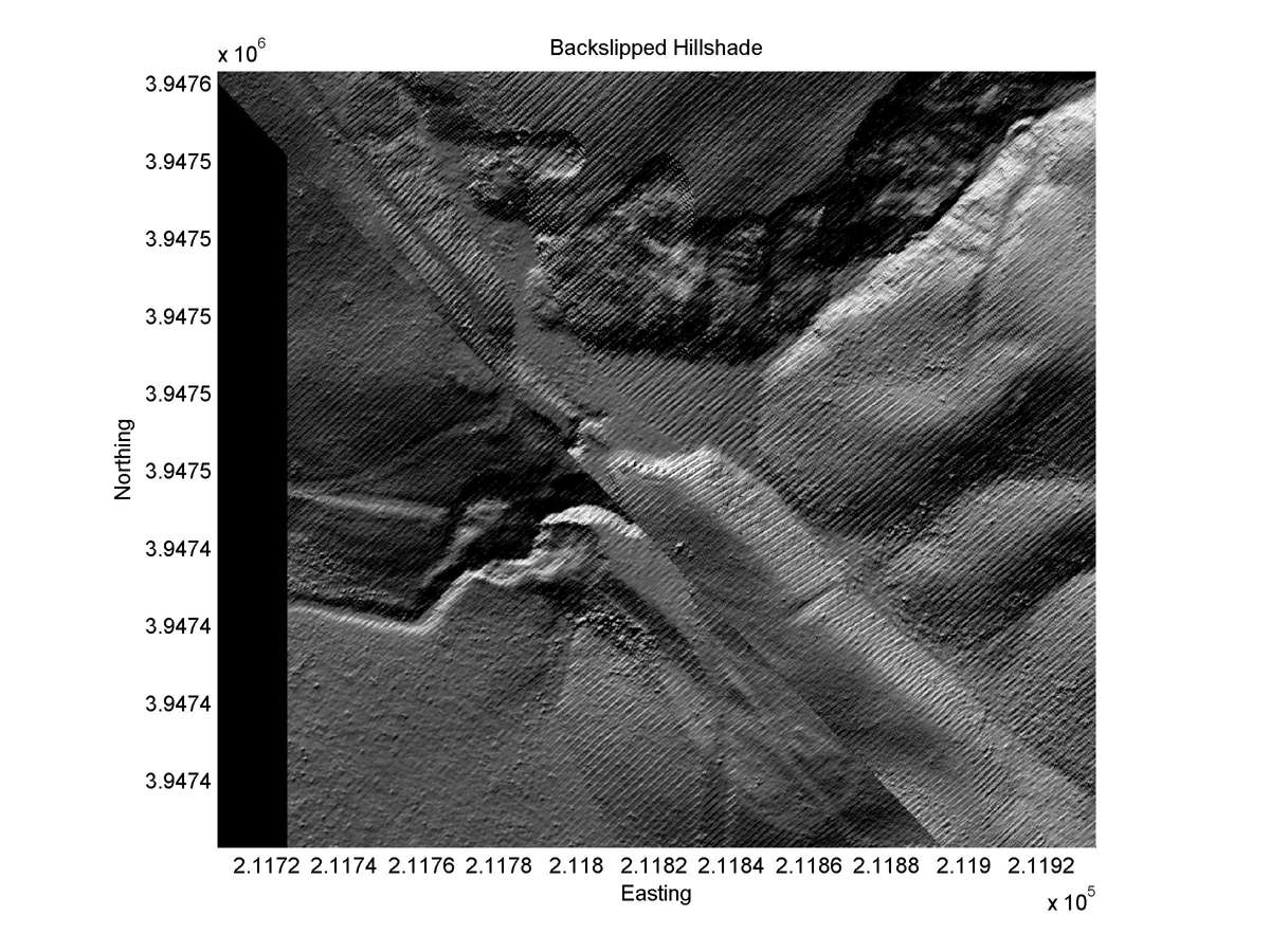
| Hillshade plot | Hillshade plot, Optimal back-slip |
|
|
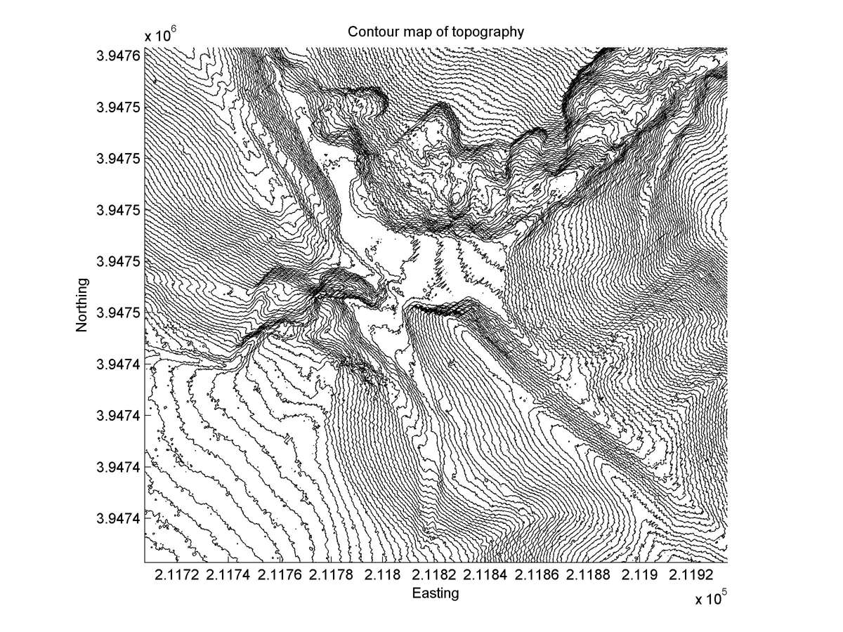
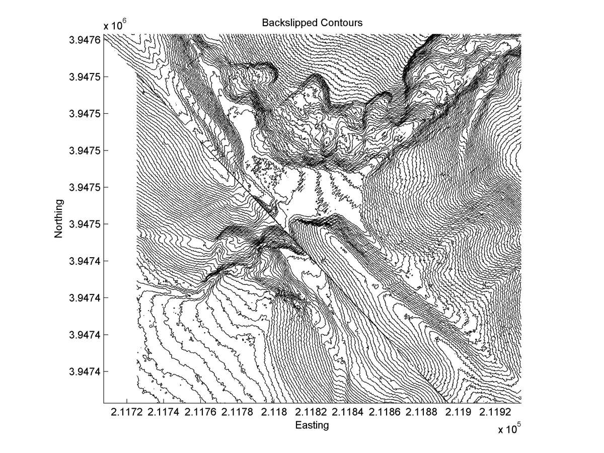
| Contour plot | Contour plot, Optimal back-slip |
|
|
| Dist. from Bitterwater road | Offset (m) | Error (m) | Quality Rating | Comments |
|---|---|---|---|---|
| 10.49km | 25 | 10 | median | Straight head, but deeply eroded broad tail causes low accuracy in measurement. Use 1930 and 1966 aerial photos to measure. Site has since been altered by major landsliding and construction of stock pond. |