
| Latitude | Longitude | Distance to reference | Best Offset (m) | Offset Range (m) | Quality Rating | Comment |
|---|---|---|---|---|---|---|
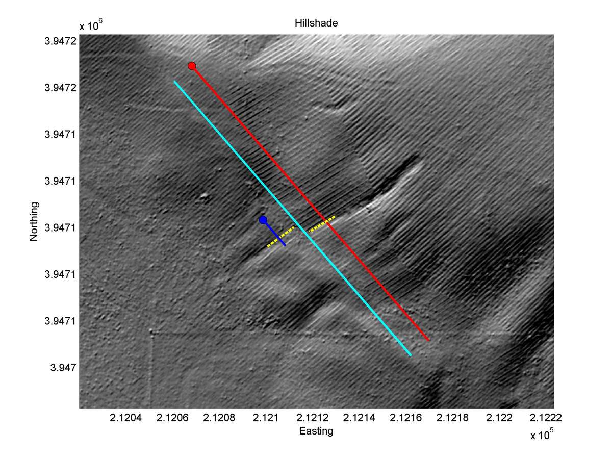
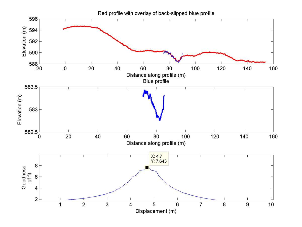
| 35.62579 | -120.17871 | 15.58 km | 4.7 | 4.0 - 5.5 | High | Offset channel. Both segments straight and sub-parallel to distinct fault trace. Good indicator for slip. Rating only lowered due to not well expressed bend in channel. |
| Hillshade with profiles | Topographic profiles and GOF |
|
|
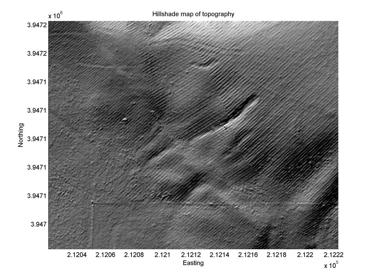
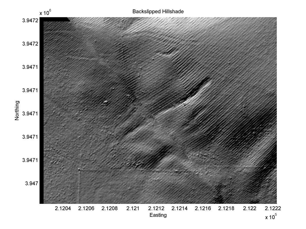
| Hillshade plot | Hillshade plot, Optimal back-slip |
|
|
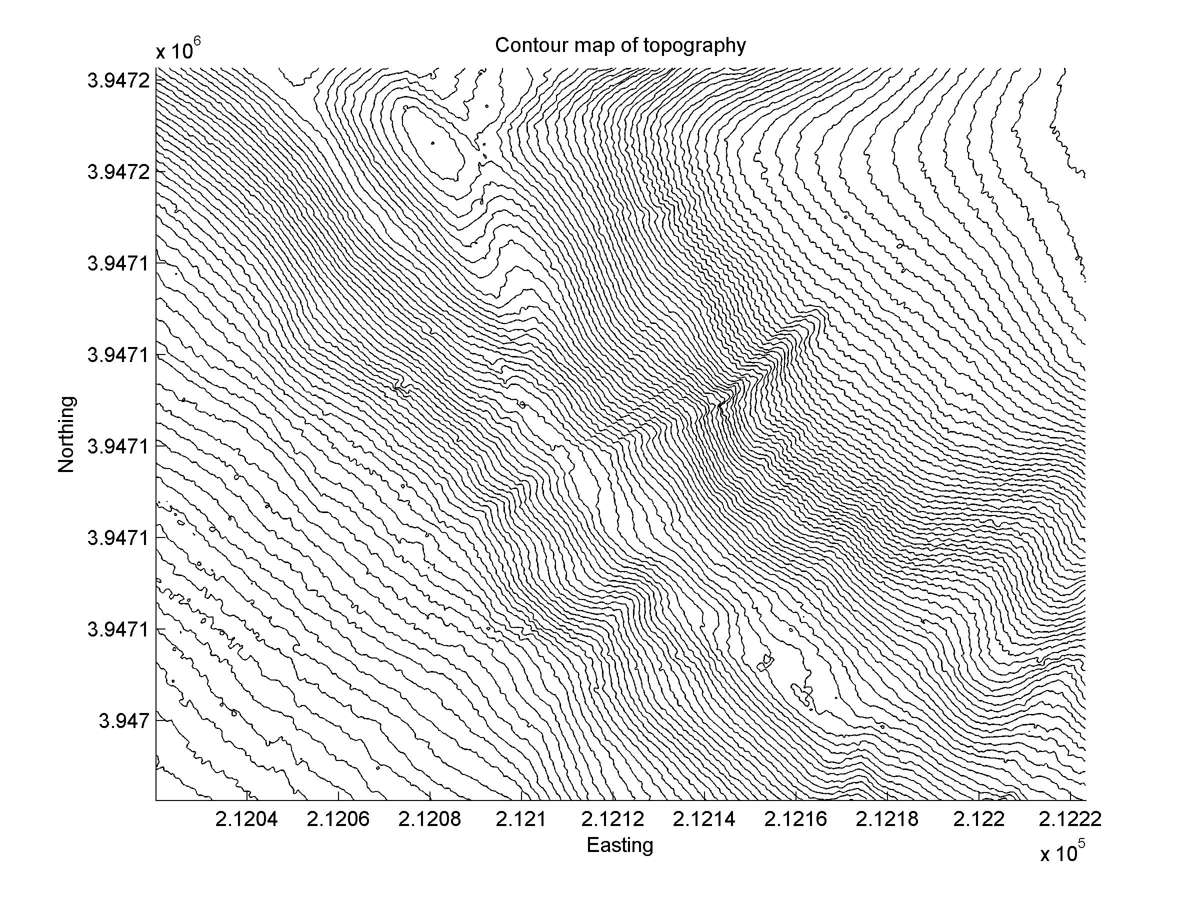
| Contour plot | Contour plot, Optimal back-slip |
|
|
| Dist. from Bitterwater road | Offset (m) | Error (m) | Quality Rating | Comments |
|---|---|---|---|---|
| 9.97km | 4.9 | 1.7 | median | Straight channel, but its width causes large range in slip estimated from 1966 aerial photos. Considerable erosion since 1966 prevents remeasurement. |