| Latitude | Longitude | Distance to reference | Best Offset (m) | Offset Range (m) | Quality Rating | Comment |
|---|---|---|---|---|---|---|
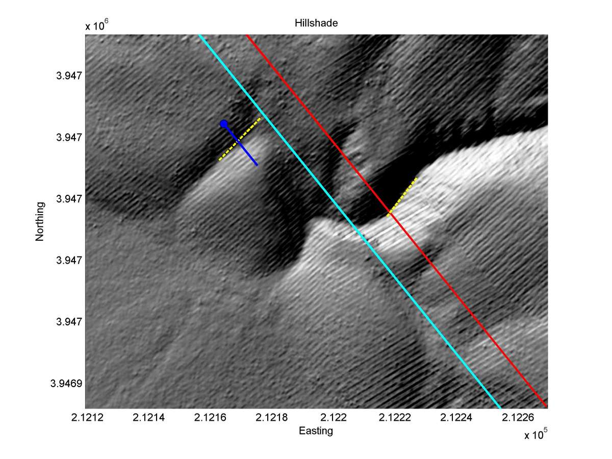
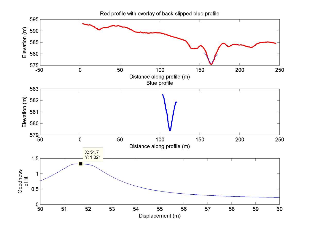
| 35.62498 | -120.17781 | 15.69 km | 51.7 | 50.0 - 54.0 | Moderate | Beheaded channel. |
| Hillshade with profiles | Topographic profiles and GOF |
|
|
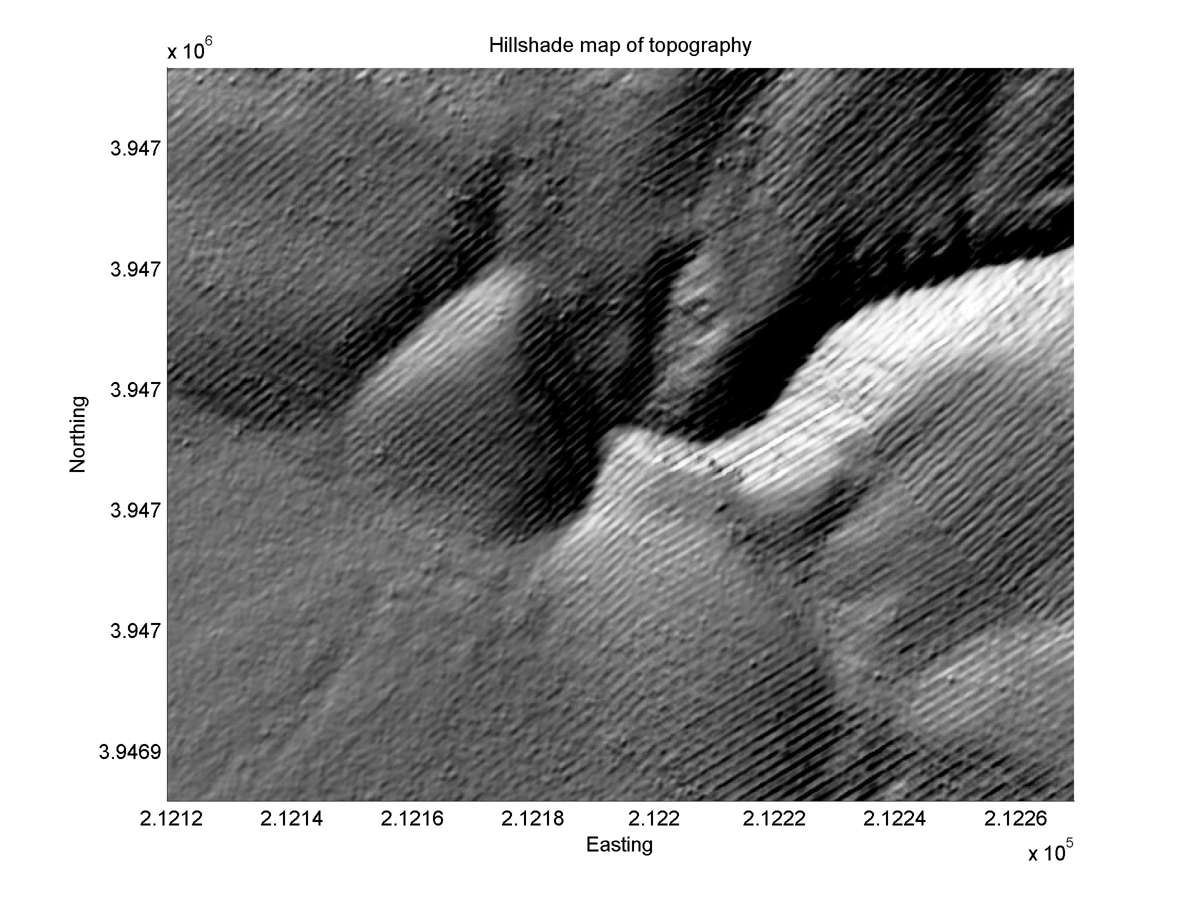
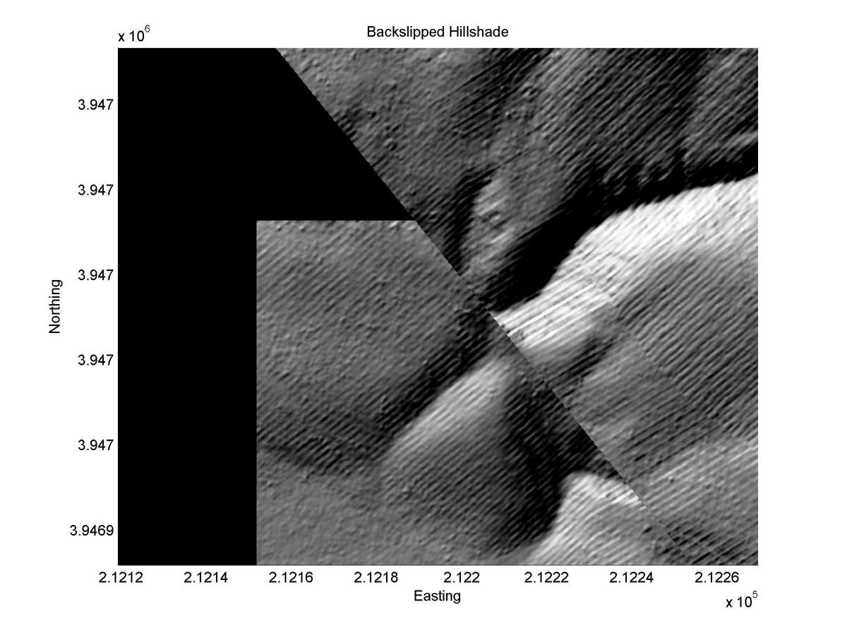
| Hillshade plot | Hillshade plot, Optimal back-slip |
|
|
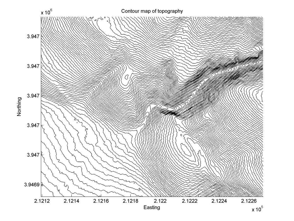
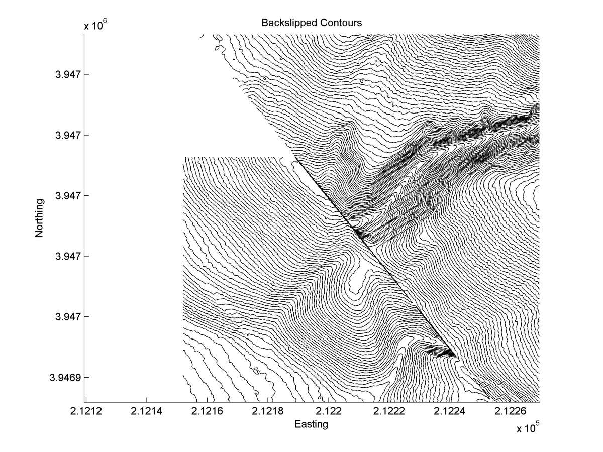
| Contour plot | Contour plot, Optimal back-slip |
|
|
| Dist. from Bitterwater road | Offset (m) | Error (m) | Quality Rating | Comments |
|---|---|---|---|---|
| 9.89km | 60 | 5 | high | Tail straight, narrow and parallel to head. Unusually exact reconstruction of long beheaded tail. Alluvial cone of d1 nearly all buried by that of d2 |