| Latitude | Longitude | Distance to reference | Best Offset (m) | Offset Range (m) | Quality Rating | Comment |
|---|---|---|---|---|---|---|
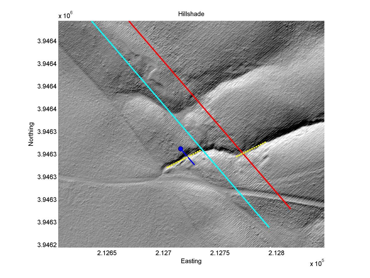
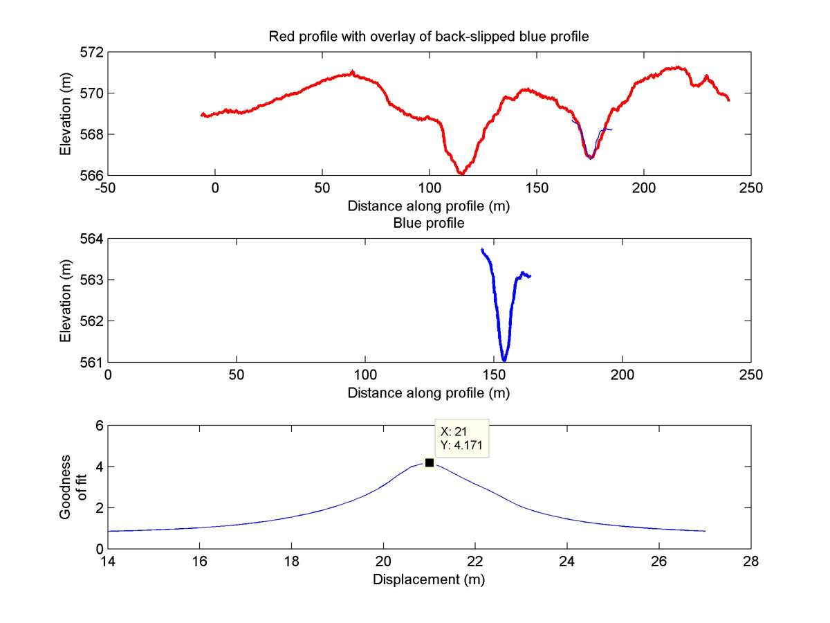
| 35.61893 | -120.17154 | 16.50 km | 21.0 | 19.5 - 23.0 | High-Moderate | Offset channel. Wide fault zone lowers rating. |
| Hillshade with profiles | Topographic profiles and GOF |
|
|
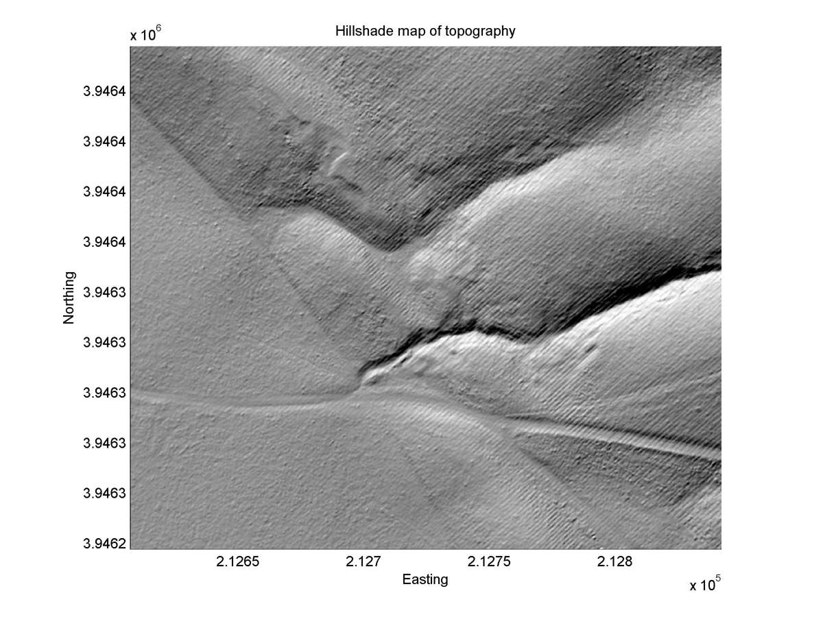
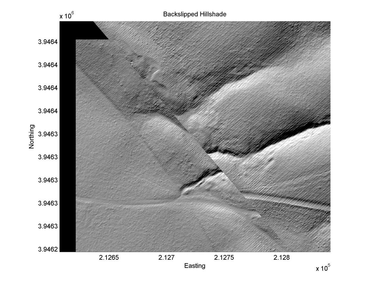
| Hillshade plot | Hillshade plot, Optimal back-slip |
|
|
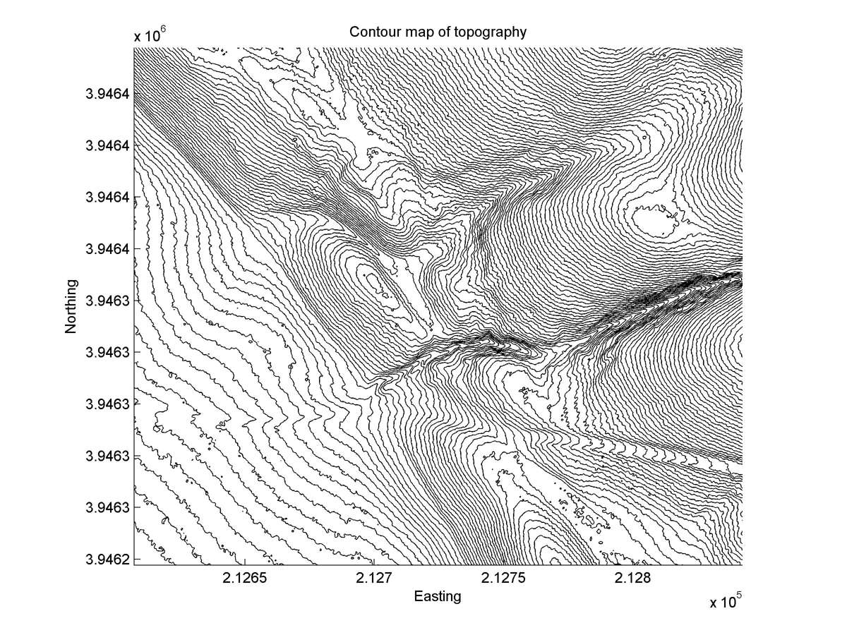
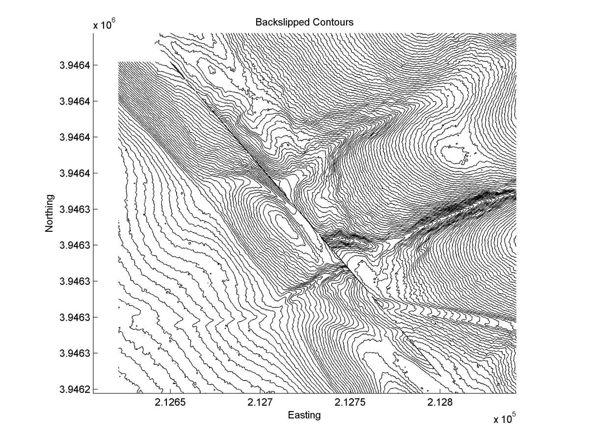
| Contour plot | Contour plot, Optimal back-slip |
|
|
| Dist. from Bitterwater road | Offset (m) | Error (m) | Quality Rating | Comments |
|---|---|---|---|---|
| 9.01km | 17 | 6 | high | Head and tail straight and parallel at scale of offset wide, lobate soil slump. |