
| Latitude | Longitude | Distance to reference | Best Offset (m) | Offset Range (m) | Quality Rating | Comment |
|---|---|---|---|---|---|---|
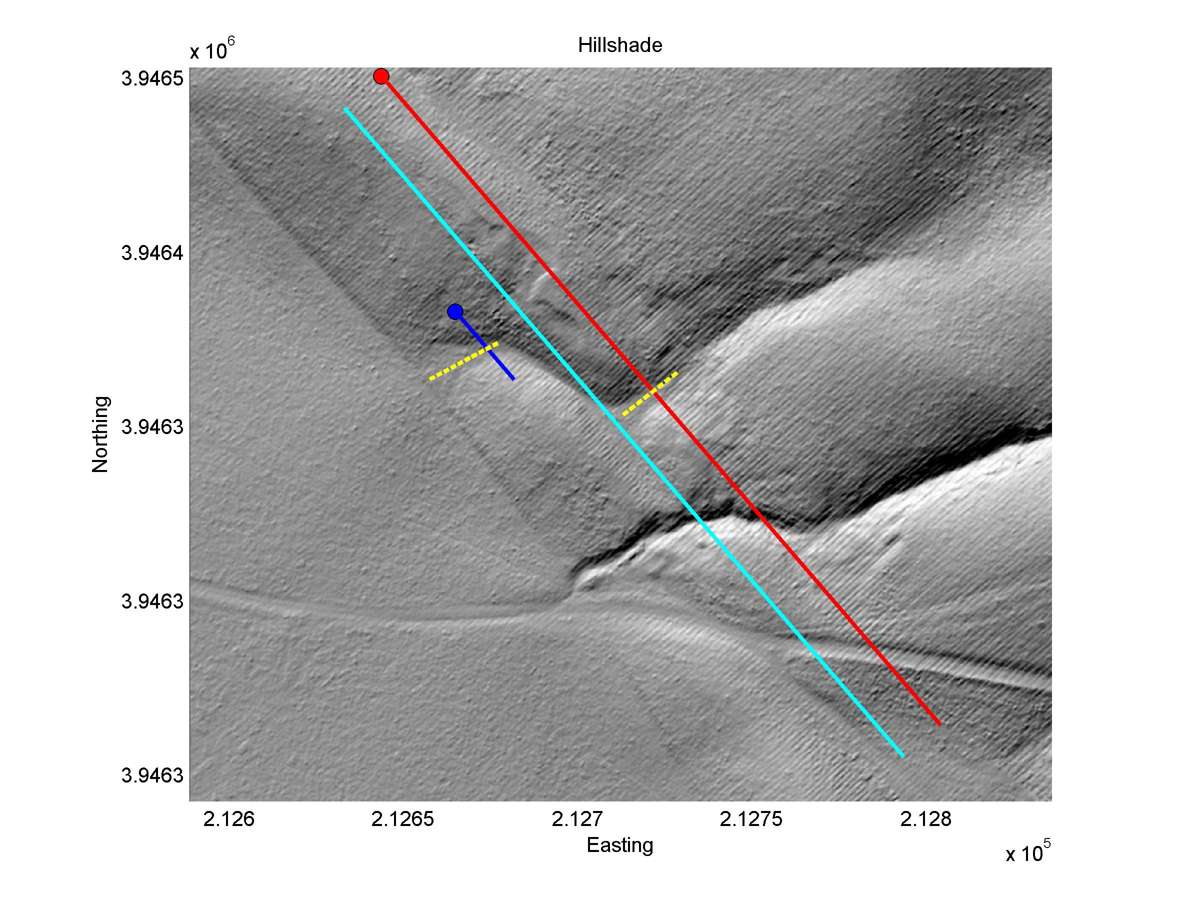
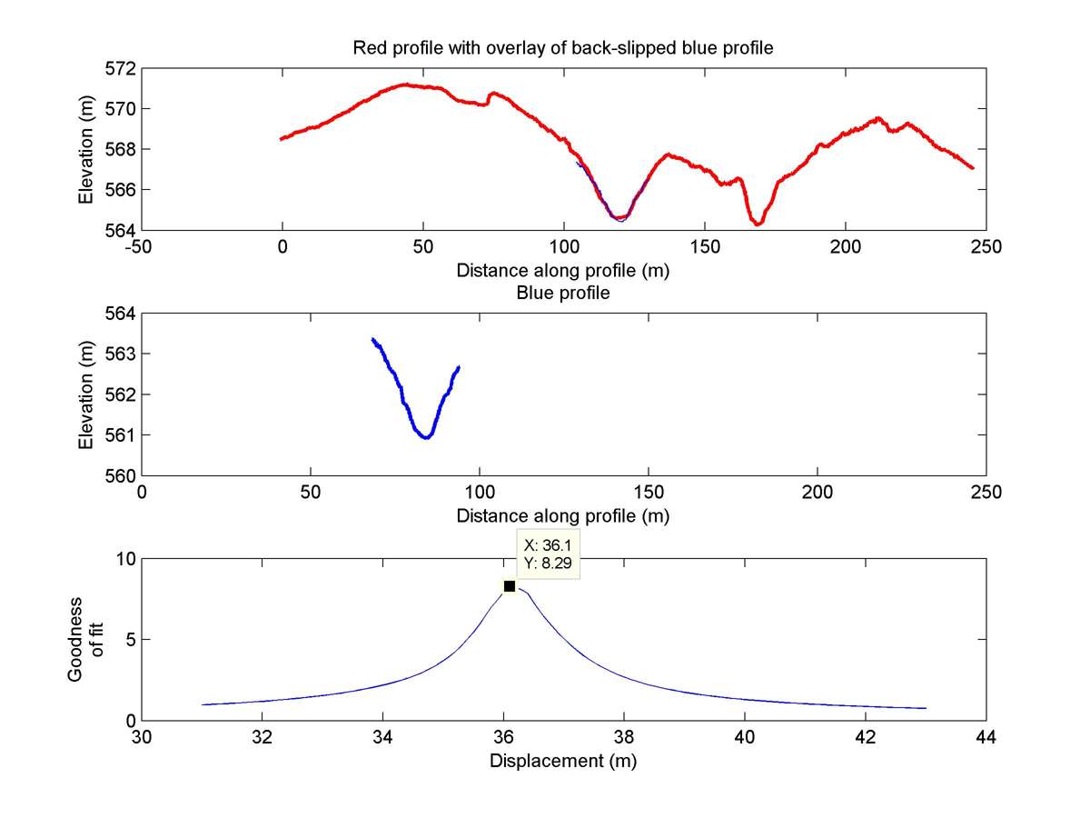
| 35.61936 | -120.17202 | 16.50 km | 36.1 | 34.0 - 38.0 | Moderate | Offset channel. |
| Hillshade with profiles | Topographic profiles and GOF |
|
|
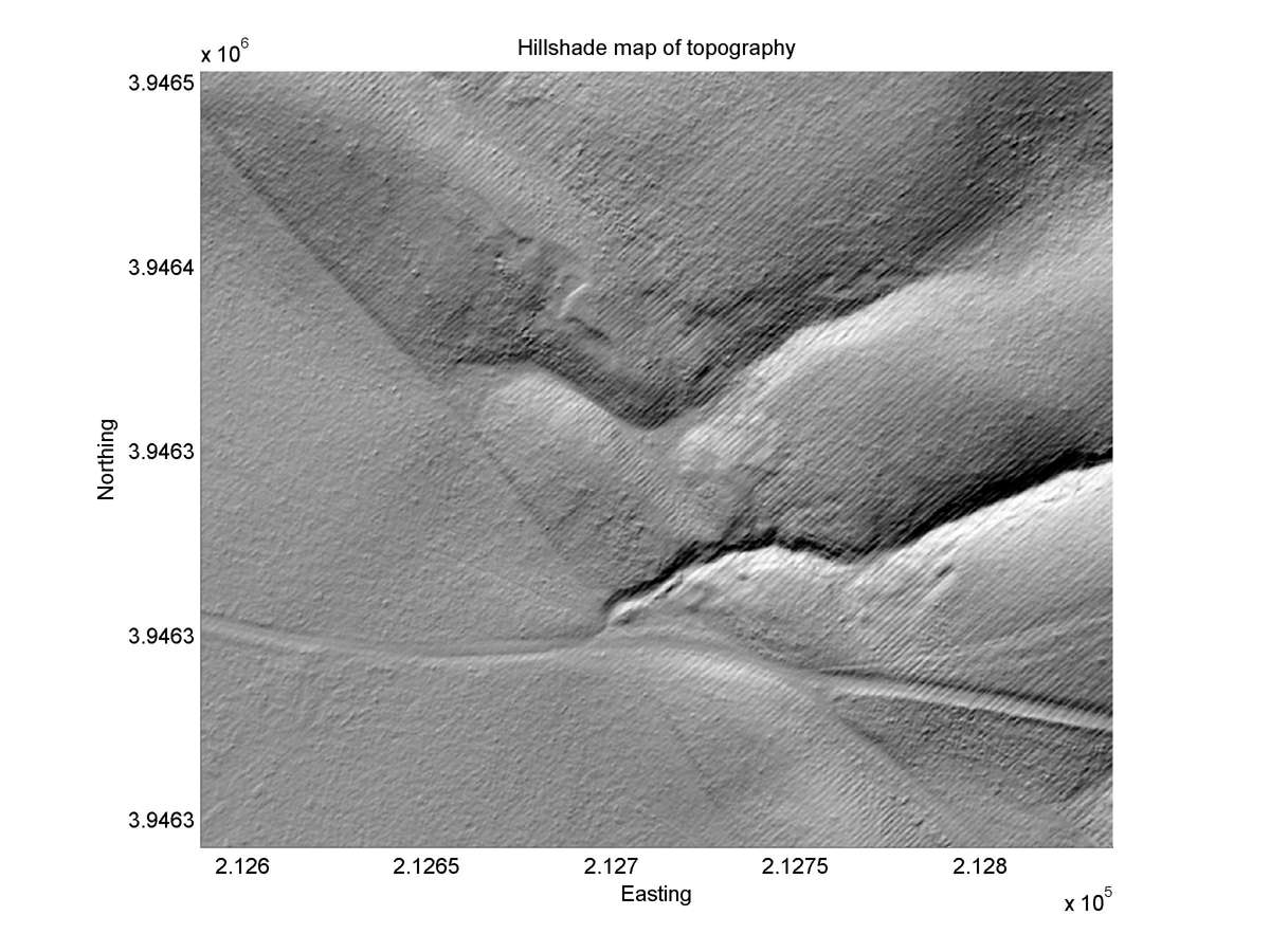
| Hillshade plot | Hillshade plot, Optimal back-slip |
|
|
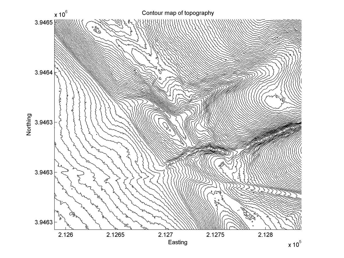
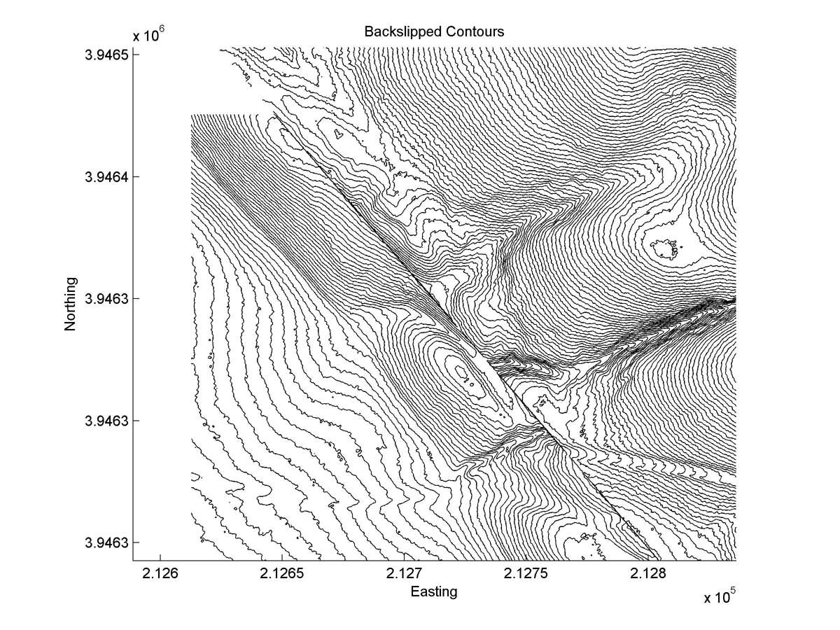
| Contour plot | Contour plot, Optimal back-slip |
|
|
| Dist. from Bitterwater road | Offset (m) | Error (m) | Quality Rating | Comments |
|---|---|---|---|---|
| 9.05km | 40 | 10 | medium | Large channel reliably matched across fault, but heavy erosion of tail and wide zone of faulting makes projection of offset inexact. |