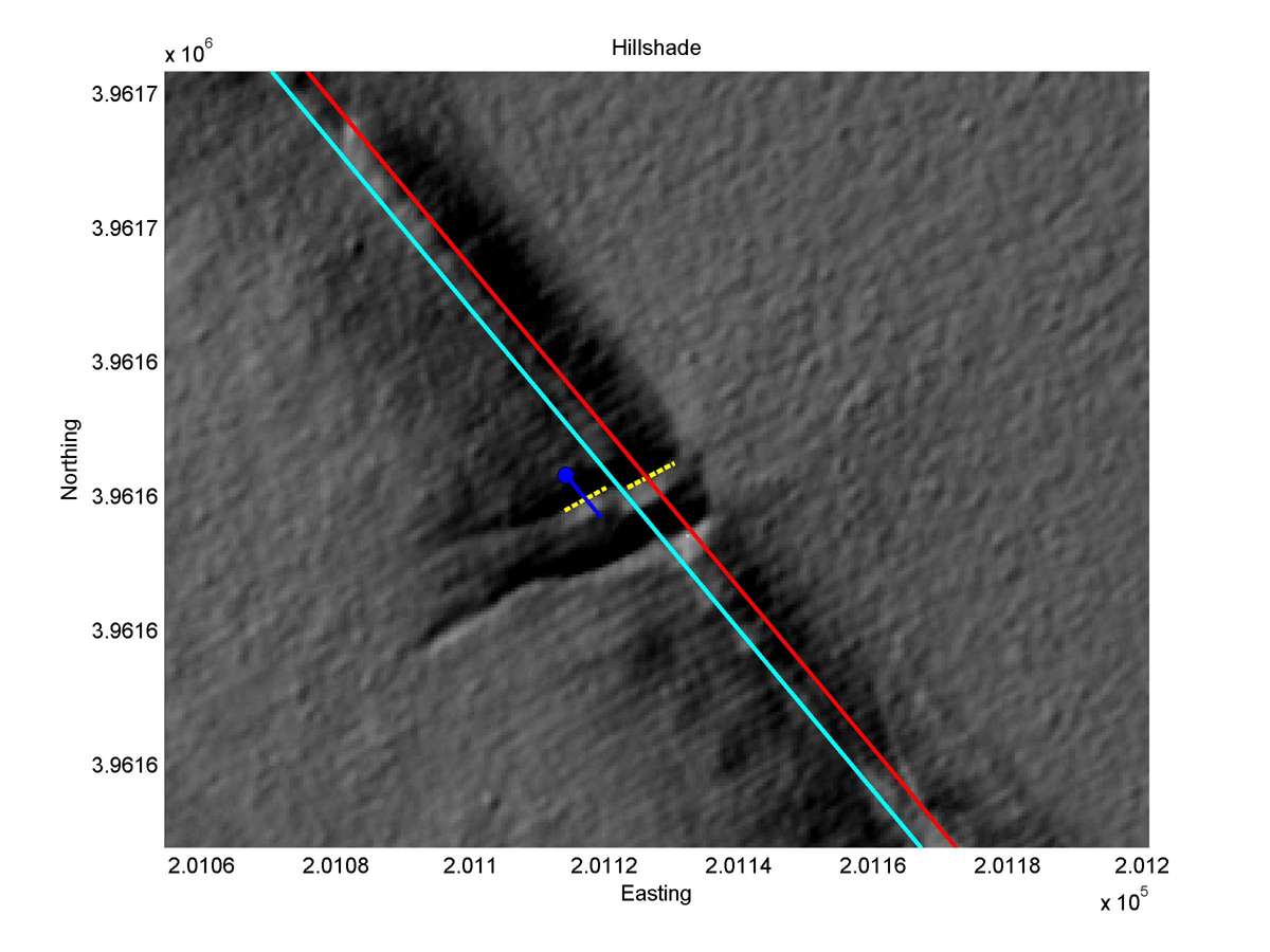
| Latitude | Longitude | Distance to reference | Best Offset (m) | Offset Range (m) | Quality Rating | Comment |
|---|---|---|---|---|---|---|
| 35.75325 | -120.30531 | -2.90 km | 1.4 | 1.1 - 1.7 | High-Moderate | Small offset channel. Fault trace very narrow. |
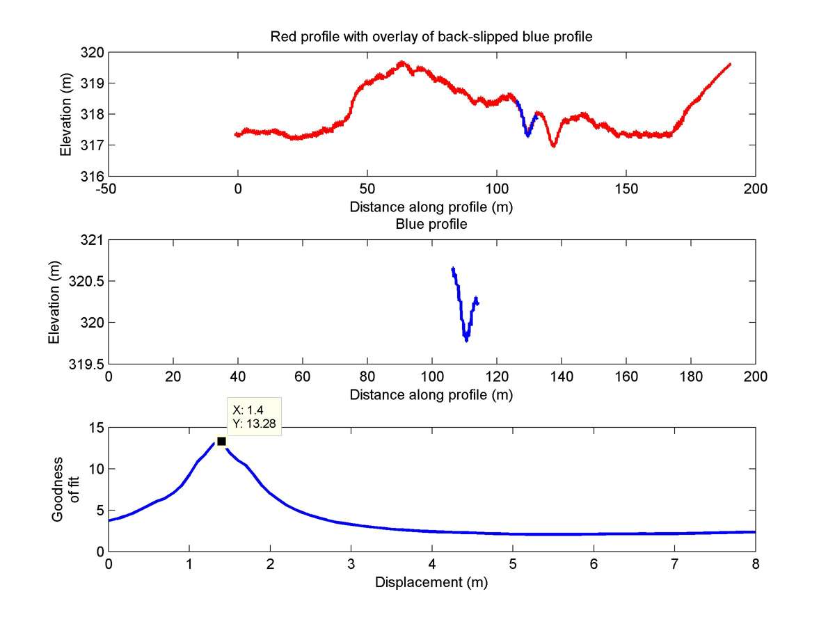
| Hillshade with profiles | Topographic profiles and GOF |
|
|
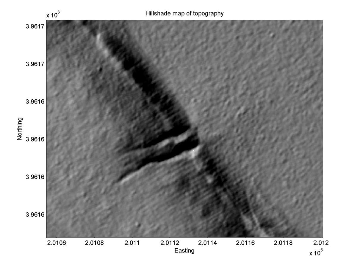
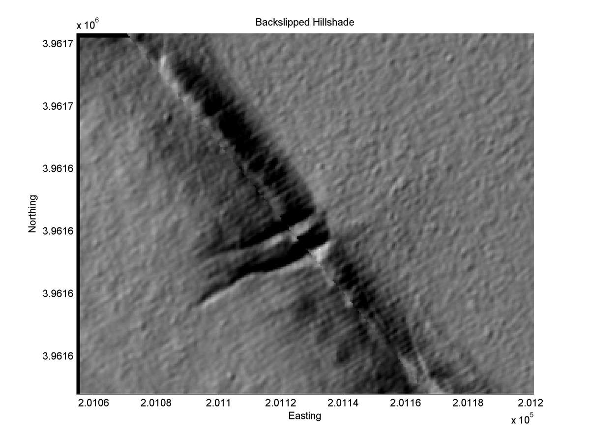
| Hillshade plot | Hillshade plot, Optimal back-slip |
|
|
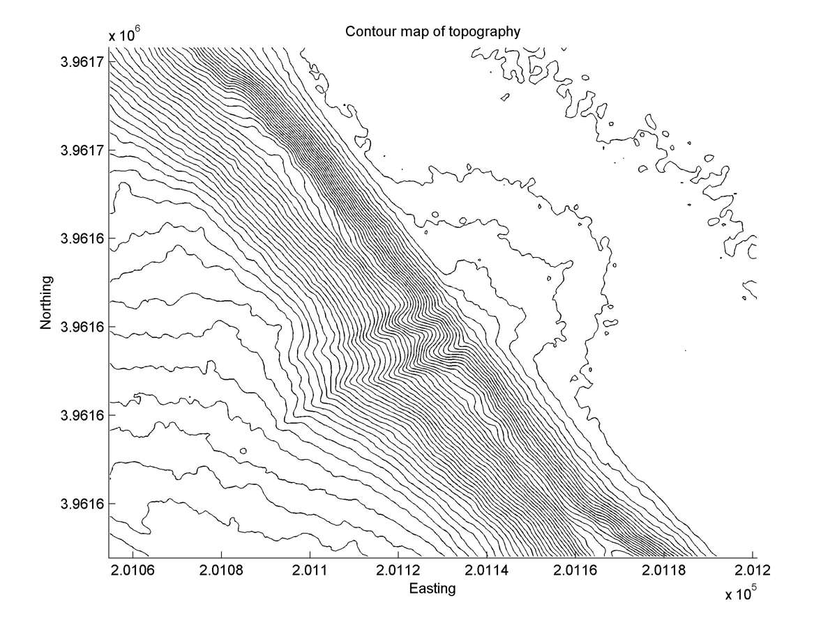
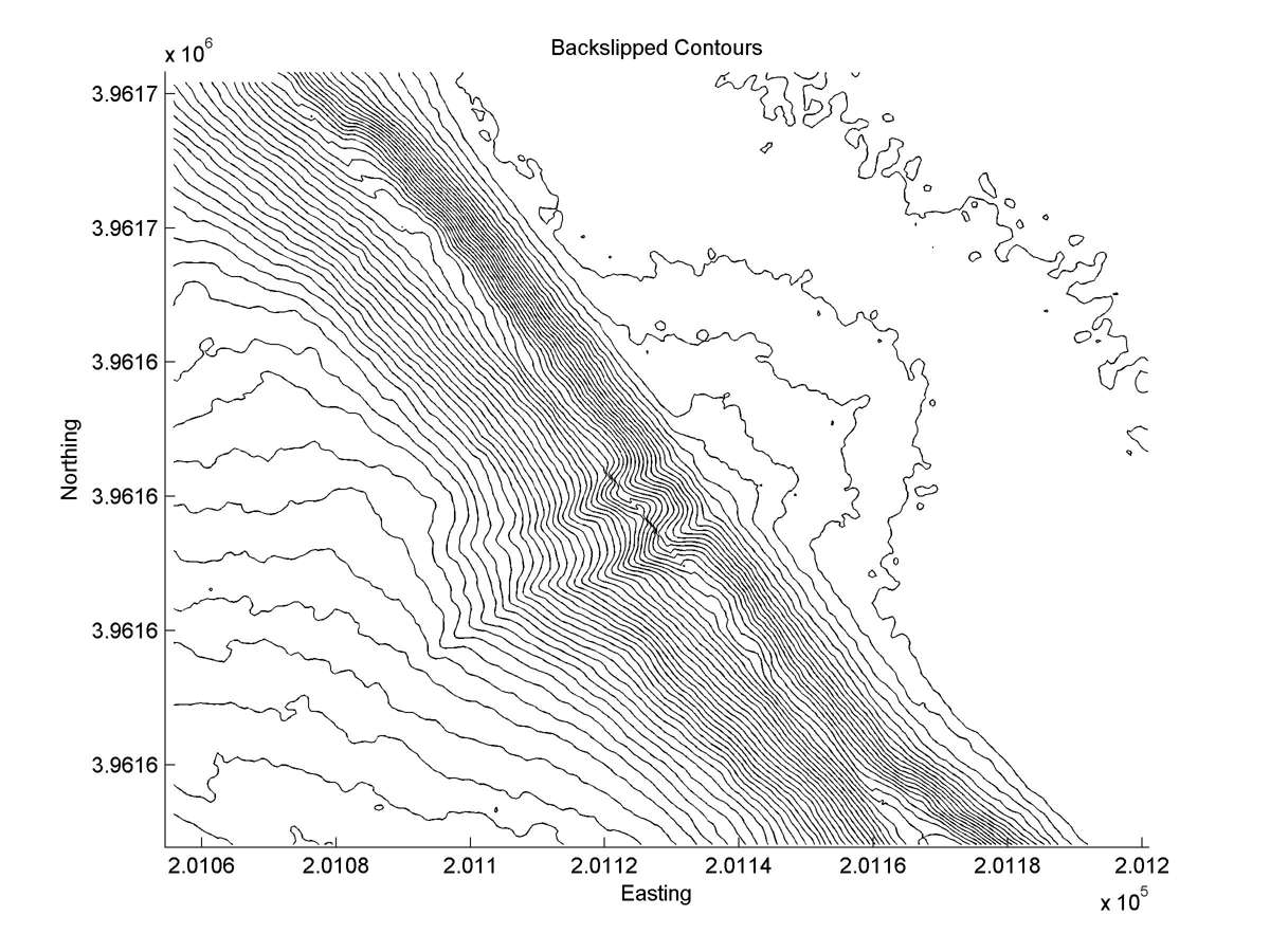
| Contour plot | Contour plot, Optimal back-slip |
|
|
| Offset (m) | Error (m) | Quality Rating | Comments |
|---|---|---|---|
| 1.68 | +/-0.15 | Excellent | NE-most of 2 offset gullies. Probably all post-1857. |
| Dist. from Bitterwater road | Offset (m) | Error (m) | Quality Rating | Comments |
|---|---|---|---|---|
| 28.17km | 1.30 | +/-0.3 | High | Narrow, straight, parallel head and tail of small gully. Post-earthquake aerial photo (1:1600) shows 1966 rupture between two offset segments with well-defined centers. |