| Latitude | Longitude | Distance to reference | Best Offset (m) | Offset Range (m) | Quality Rating | Comment |
|---|---|---|---|---|---|---|
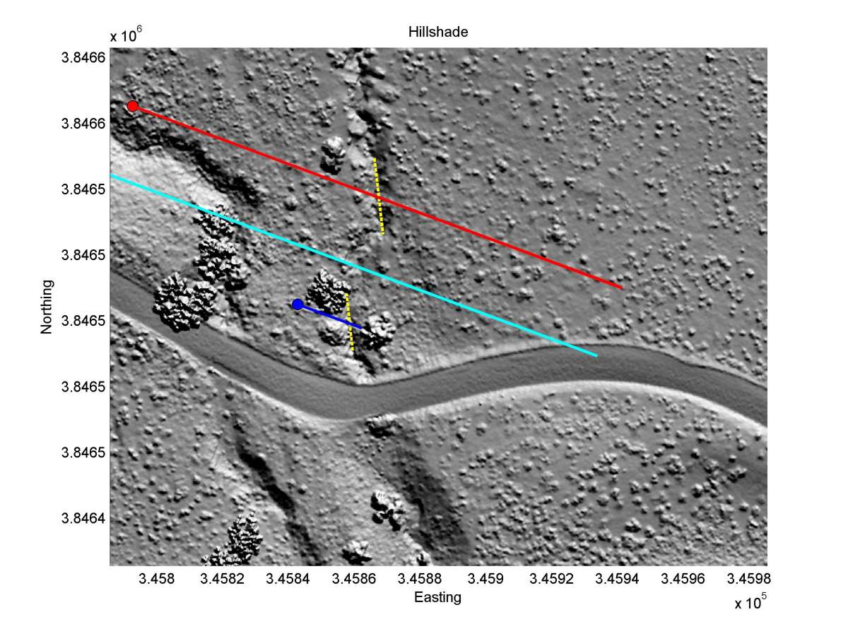
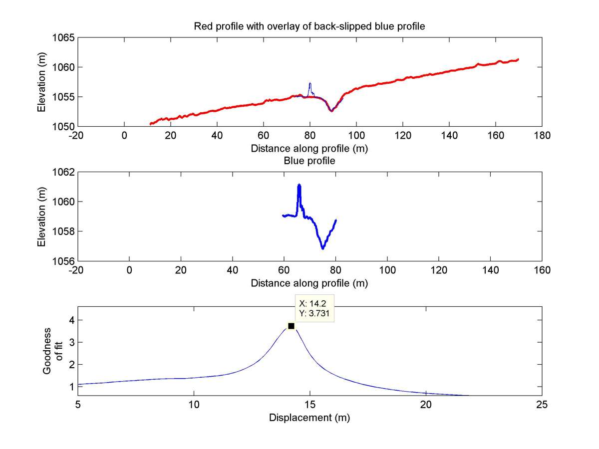
| 34.74914 | -118.68393 | 190.00 km | 14.2 | 13.0 - 16.5 | Moderate-Low | Offset channel. Wide fault zone lowers rating. |
| Hillshade with profiles | Topographic profiles and GOF |
|
|
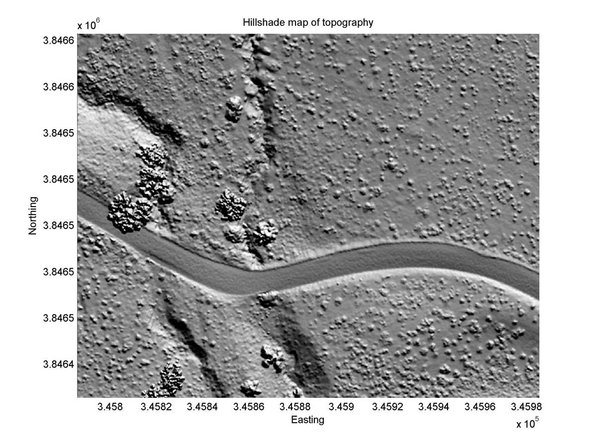
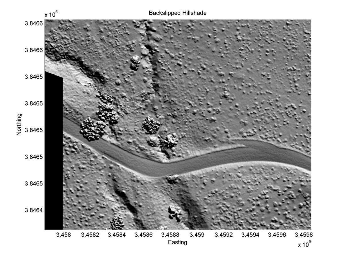
| Hillshade plot | Hillshade plot, Optimal back-slip |
|
|
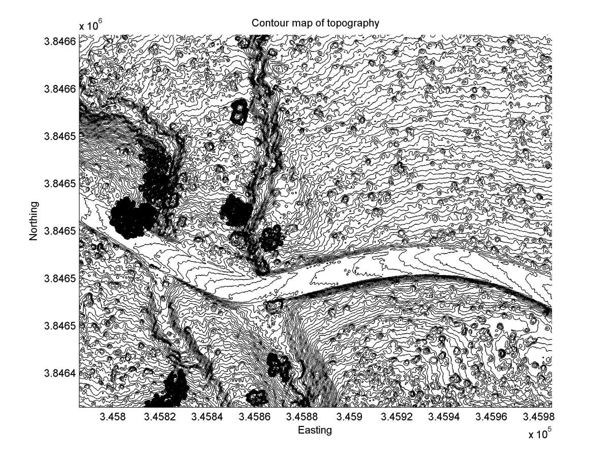
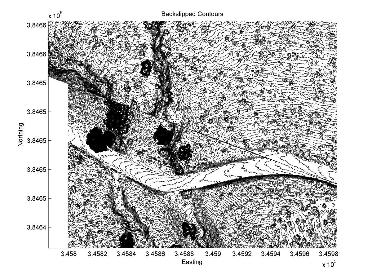
| Contour plot | Contour plot, Optimal back-slip |
|
|
| Offset (m) | Error (m) | Quality Rating | Comments |
|---|---|---|---|
| 14.3 | +/-1.5 | Fair/Poor | Gentle gully in alluvium may have been formed downstream from now-deeply-incised gully N of road. Another active trace to SW. |