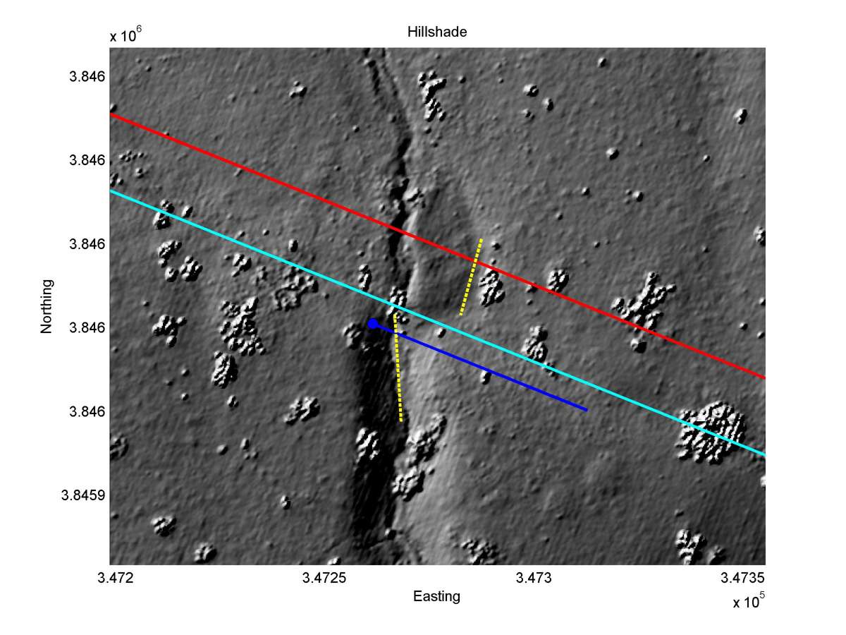
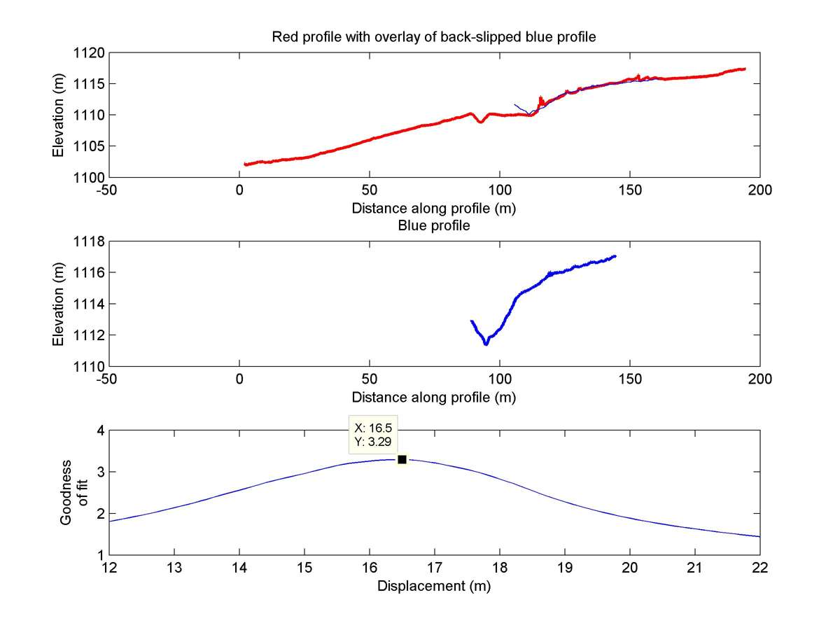
| Latitude | Longitude | Distance to reference | Best Offset (m) | Offset Range (m) | Quality Rating | Comment |
|---|---|---|---|---|---|---|
| 34.74455 | -118.66843 | 191.53 km | 16.5 | 15.5 - 17.5 | Low | None |
| Hillshade with profiles | Topographic profiles and GOF |
|
|
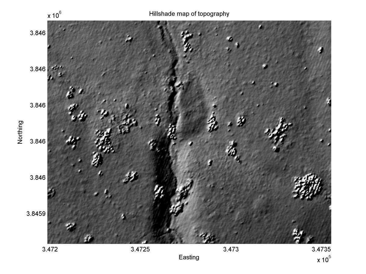
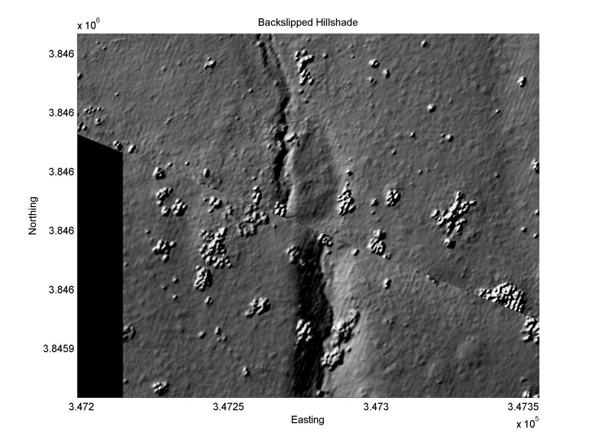
| Hillshade plot | Hillshade plot, Optimal back-slip |
|
|
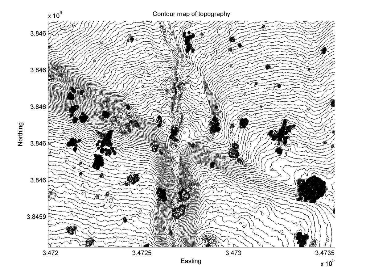
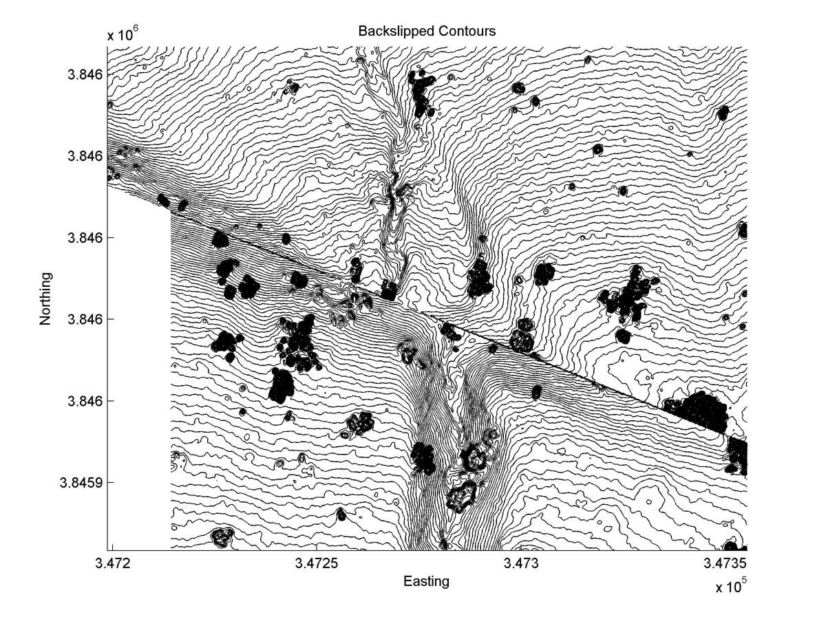
| Contour plot | Contour plot, Optimal back-slip |
|
|
| Offset (m) | Error (m) | Quality Rating | Comments |
|---|---|---|---|
| 17.0 | +/-2.25 | Good/Excellent | Beheaded channel originally a part of the Robinson Canyon drainage. |