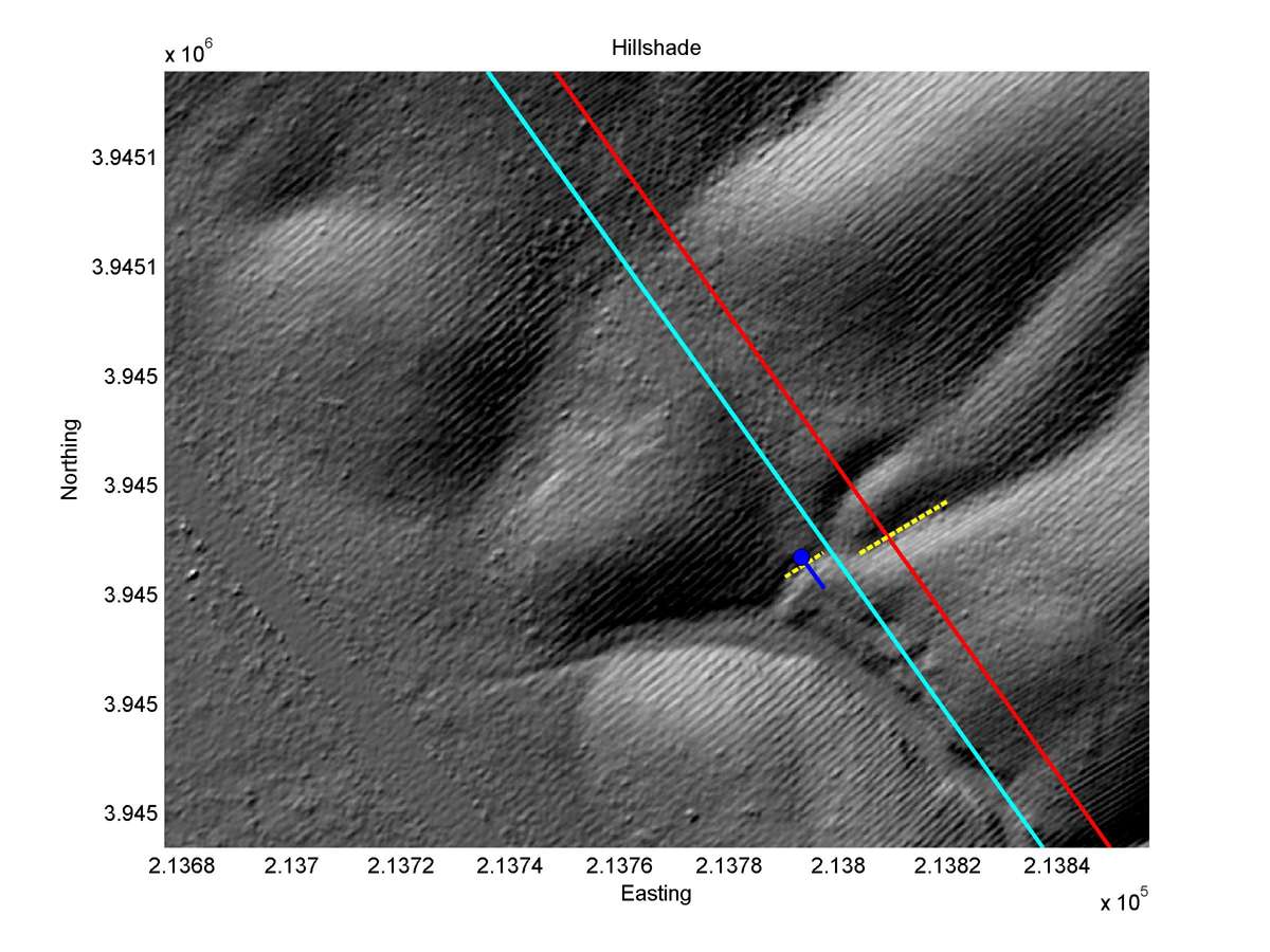
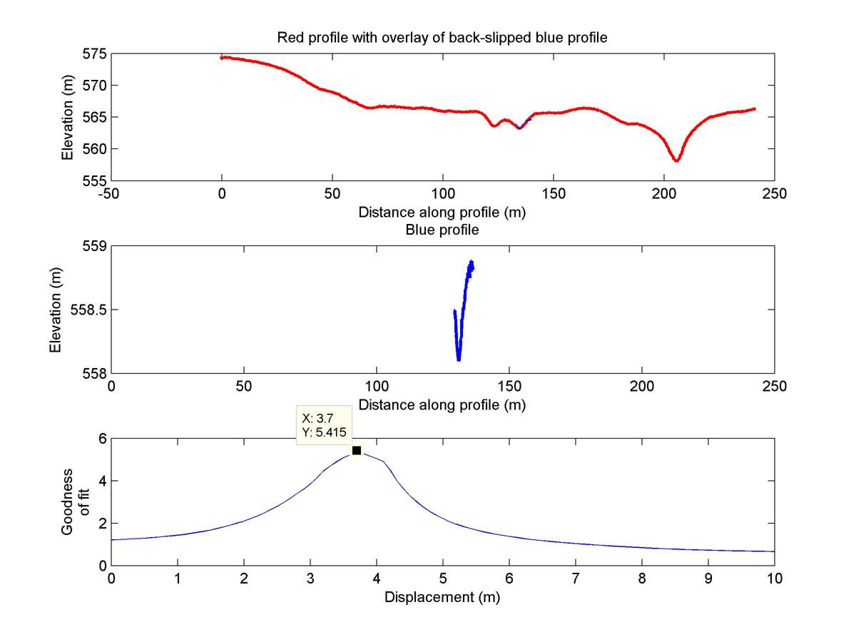
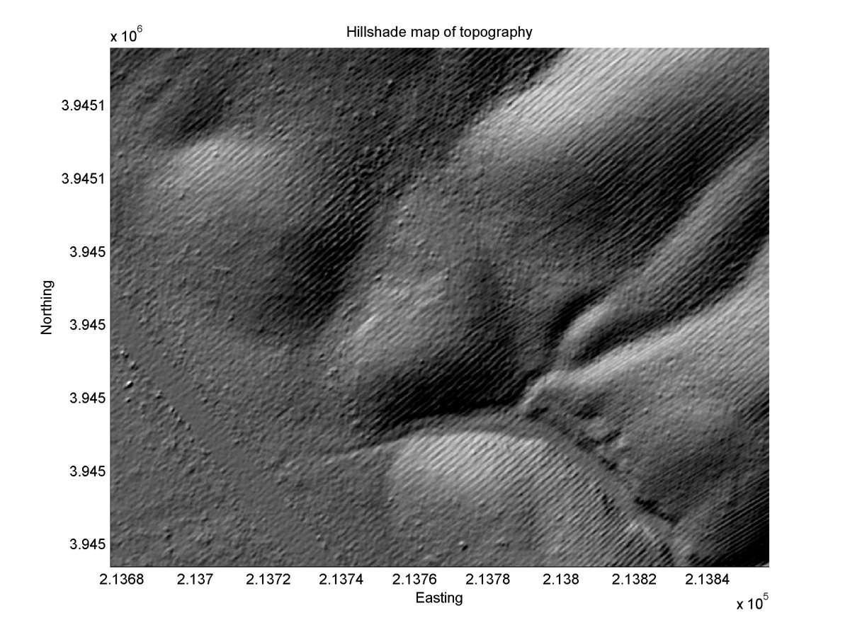
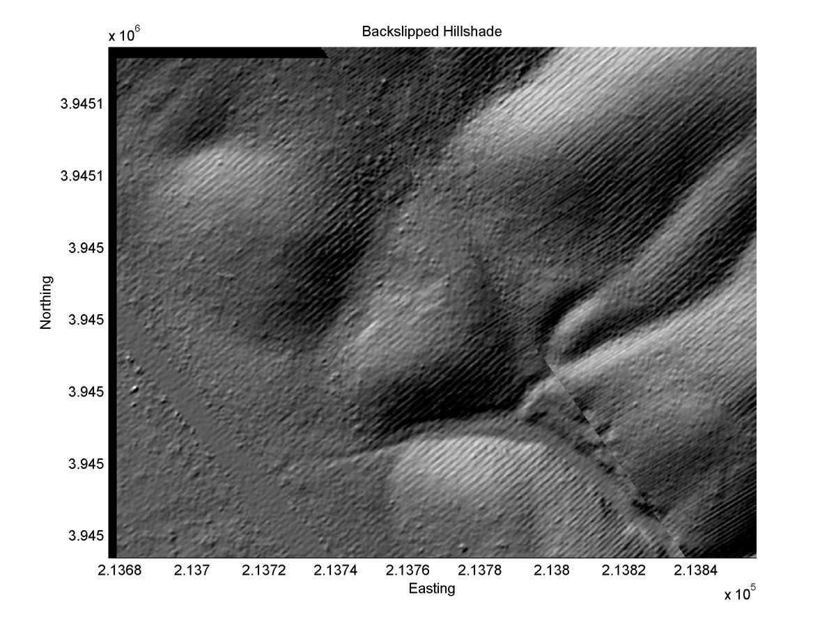
| Latitude | Longitude | Distance to reference | Best Offset (m) | Offset Range (m) | Quality Rating | Comment |
|---|---|---|---|---|---|---|
| 35.60745 | -120.15940 | 18.25 km | 3.7 | 3.0 - 4.2 | Moderate-Low | Offset channel. Specific channel morphology makes correlation difficult. Correlation with Lienkaemper observation not certain. |
| Hillshade with profiles | Topographic profiles and GOF |
|
|
| Hillshade plot | Hillshade plot, Optimal back-slip |
|
|
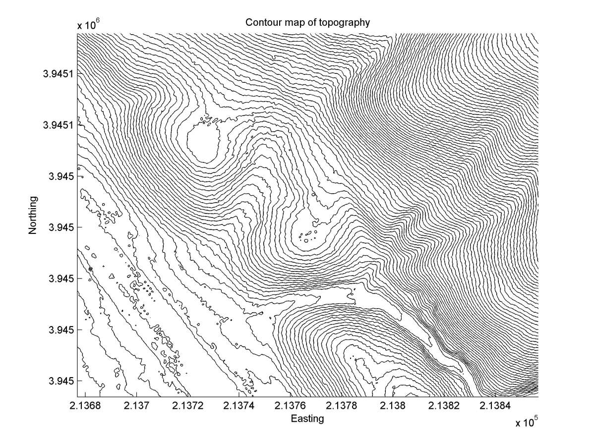
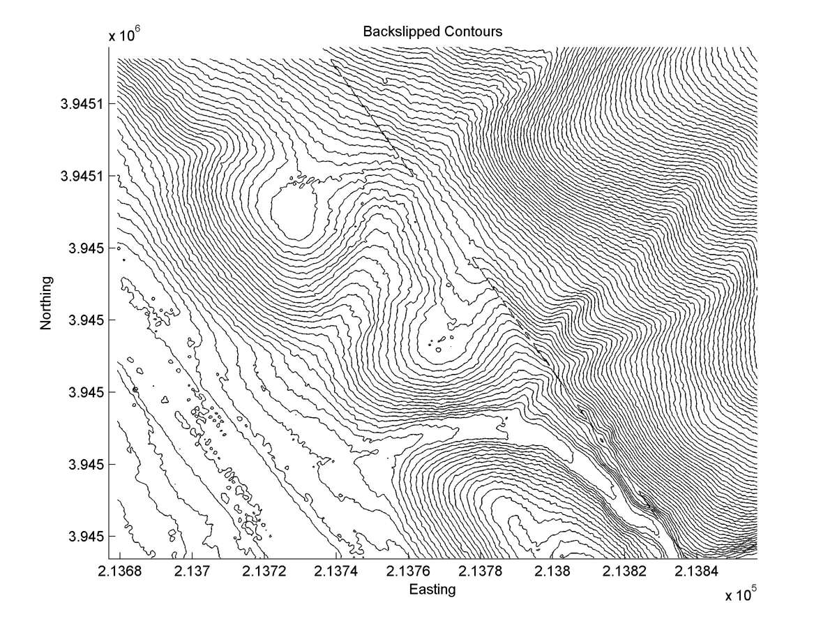
| Contour plot | Contour plot, Optimal back-slip |
|
|
| Offset (m) | Error (m) | Quality Rating | Comments |
|---|---|---|---|
| 4.1 | +/-0.9 | Excellent | Gully. See plane-table map of original paper. |
| Dist. from Bitterwater road | Offset (m) | Error (m) | Quality Rating | Comments |
|---|---|---|---|---|
| 7.31km | 6.2 | 0.7 | medium | Main trace (4.2 +/-0.6); second trace offsets measured on bases of both banks of large channel (2.0+/-0.3). Second trace trenched in 1988 yielding a modern radiocarbon date from peat in the fault fissure (i.e., last event was almost certainly 1857). |