| Latitude | Longitude | Distance to reference | Best Offset (m) | Offset Range (m) | Quality Rating | Comment |
|---|---|---|---|---|---|---|
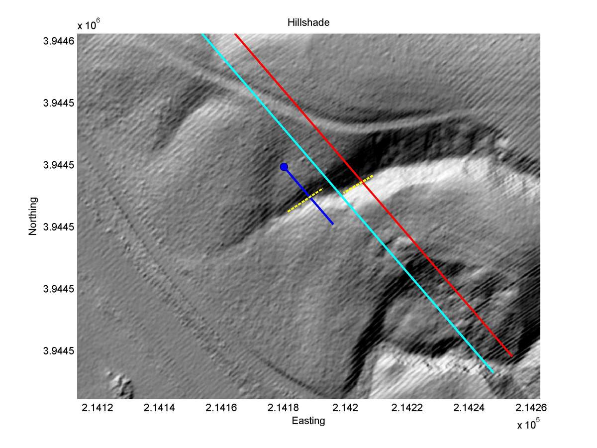
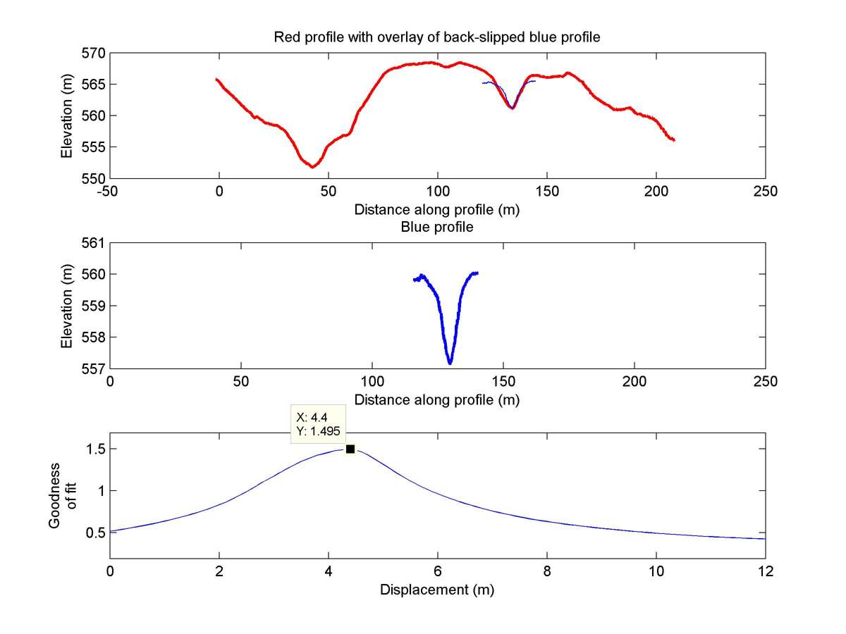
| 35.60311 | -120.15484 | 18.89 km | 4.4 | 3.8 - 5.0 | High-Moderate | Offset channel. Fault trace well expressed in this section, justifying reliability rating. |
| Hillshade with profiles | Topographic profiles and GOF |
|
|
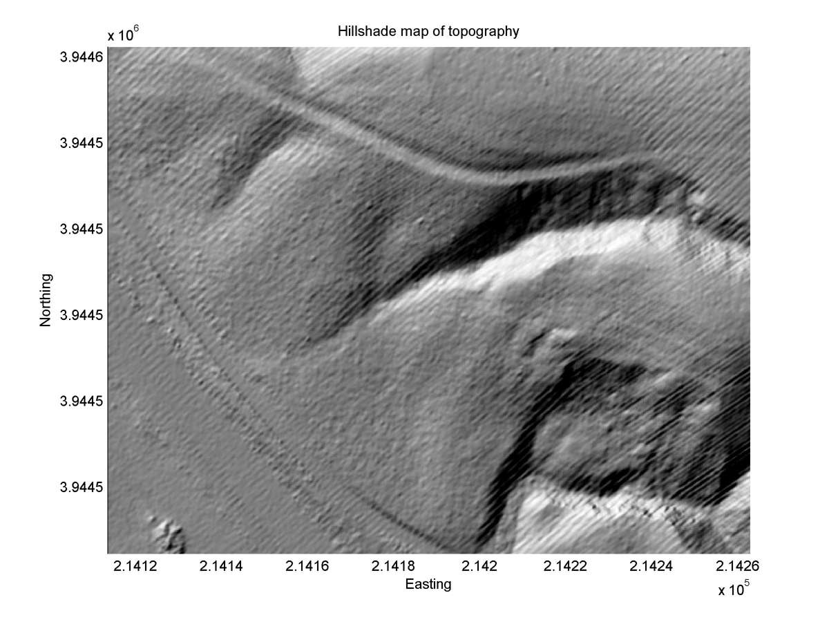
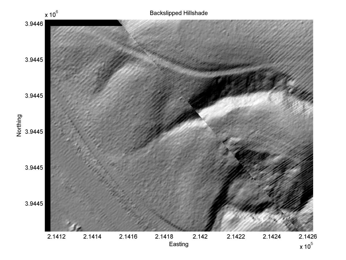
| Hillshade plot | Hillshade plot, Optimal back-slip |
|
|
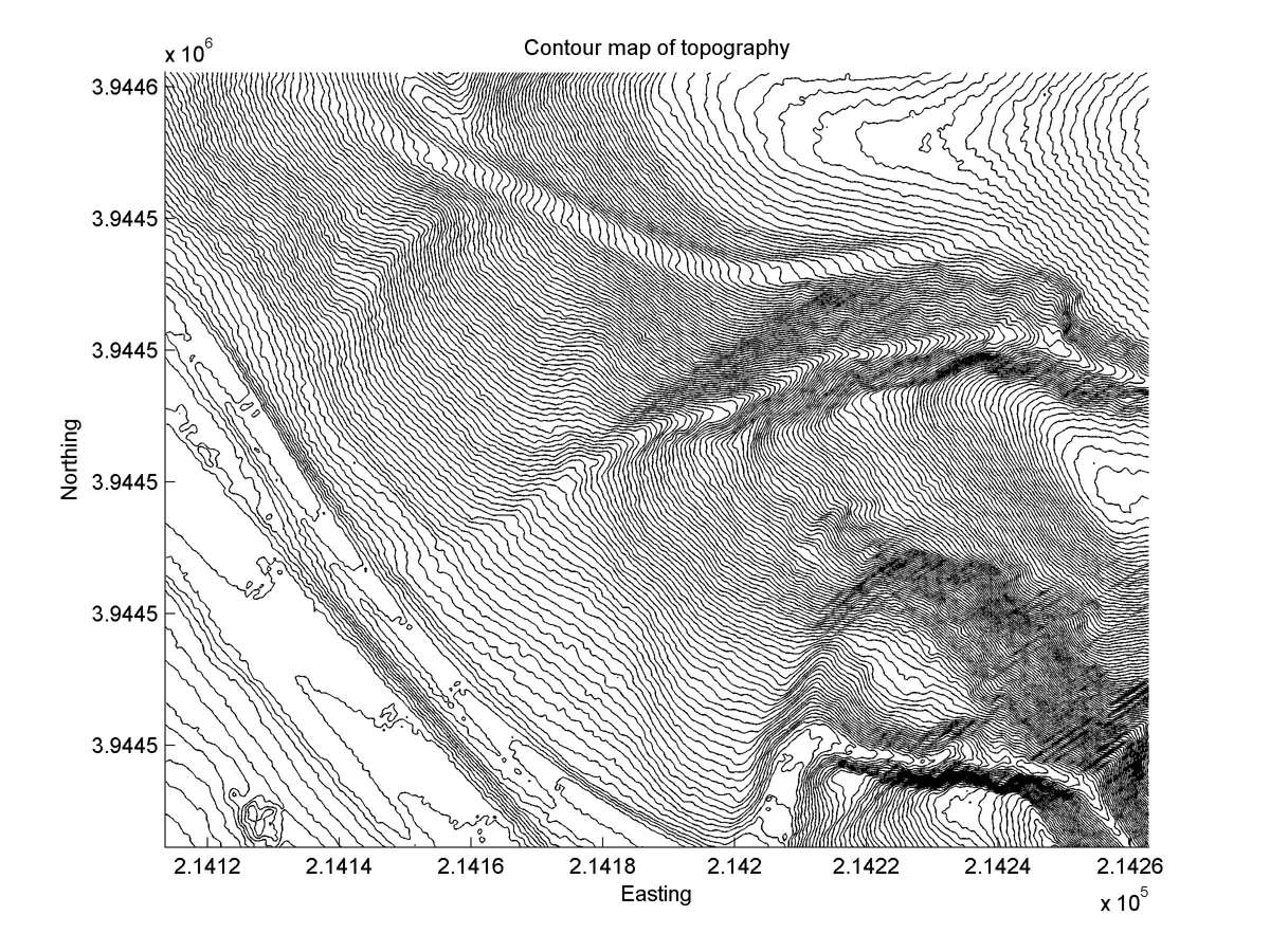
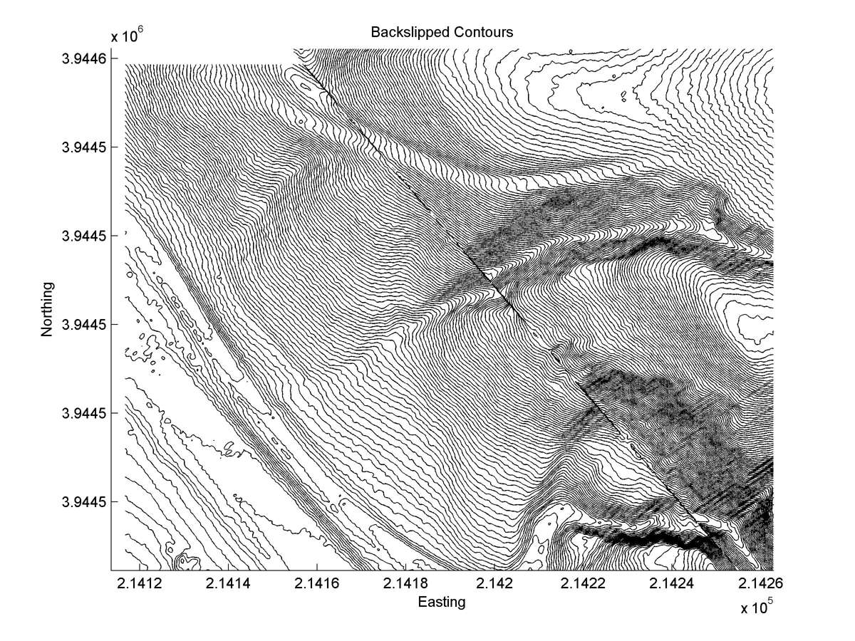
| Contour plot | Contour plot, Optimal back-slip |
|
|
| Offset (m) | Error (m) | Quality Rating | Comments |
|---|---|---|---|
| 3.2 | +0.3, -0.5 | Excellent | Gully. |
| Dist. from Bitterwater road | Offset (m) | Error (m) | Quality Rating | Comments |
|---|---|---|---|---|
| 6.69km | 4.5 | 1.5 | medium | Slumping southeast of head near fault trace makes interpretations ambiguous. |