| Latitude | Longitude | Distance to reference | Best Offset (m) | Offset Range (m) | Quality Rating | Comment |
|---|---|---|---|---|---|---|
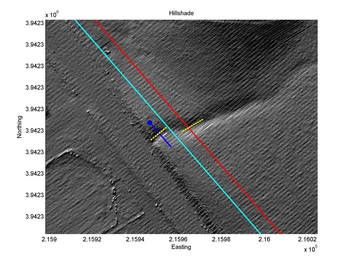
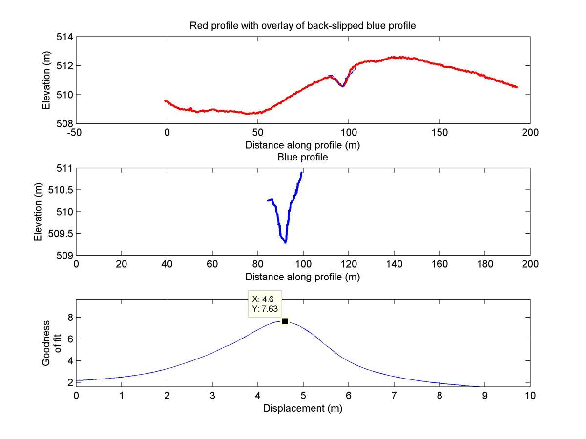
| 35.58370 | -120.13466 | 21.70 km | 4.6 | 4.0 - 5.1 | High-Moderate | Small offset gully. Correlation with Liekaempers measurement not certain. Apparently relatively wide fault zone lowers reliability of offset measurement |
| Hillshade with profiles | Topographic profiles and GOF |
|
|
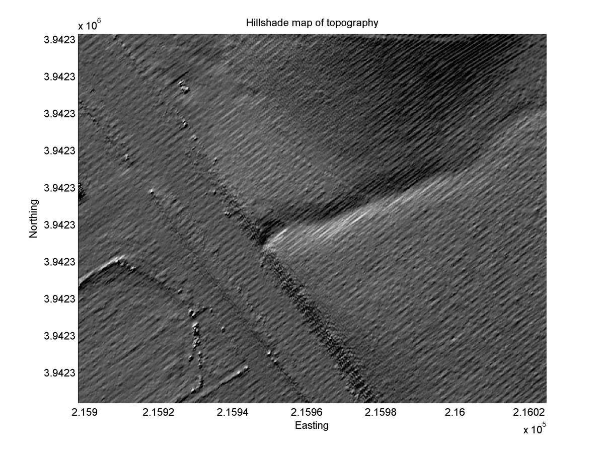
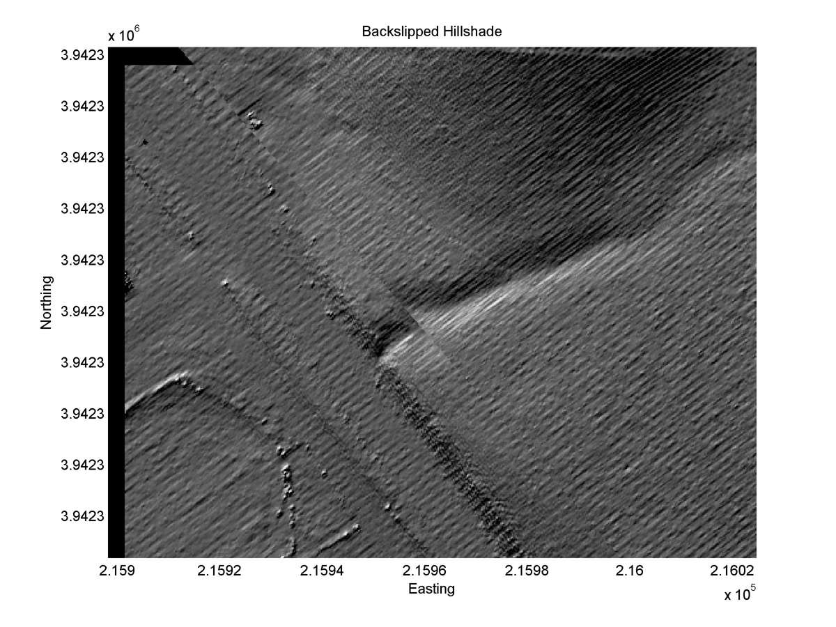
| Hillshade plot | Hillshade plot, Optimal back-slip |
|
|
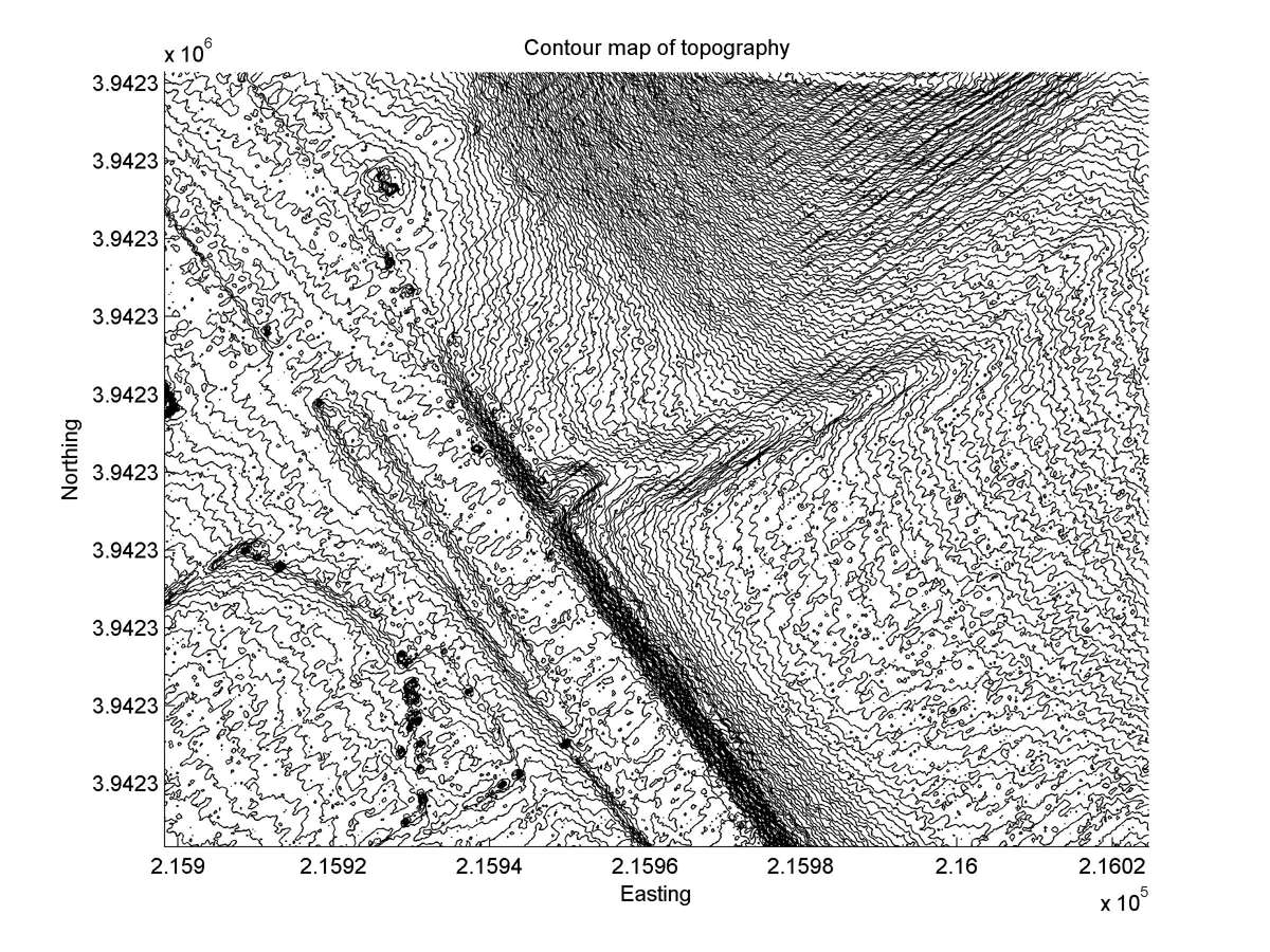
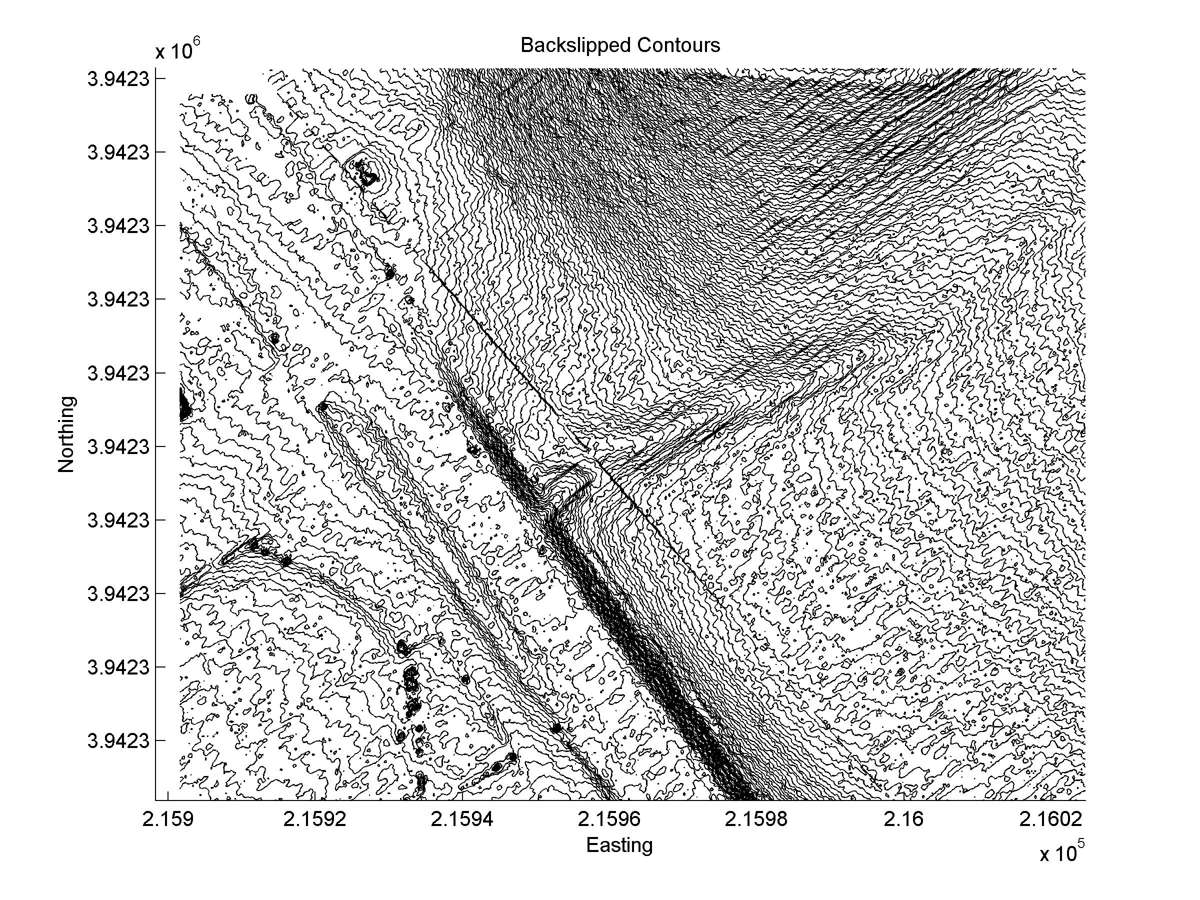
| Contour plot | Contour plot, Optimal back-slip |
|
|
| Offset (m) | Error (m) | Quality Rating | Comments |
|---|---|---|---|
| 3.3 | +/-0.6 | Excellent | Offset gully on alluvial fan depositing against ridge. Small, broad, about 1.2m deep. Bottom well-defined and straight, except at fault. |
| Dist. from Bitterwater road | Offset (m) | Error (m) | Quality Rating | Comments |
|---|---|---|---|---|
| 3.91km | 5.5 | 0.7 | high | Gully in late Holocene fan; offset measured on 1966 aerial photos. Post-1966 disking reduced apparent offset to 3.5m |