| Latitude | Longitude | Distance to reference | Best Offset (m) | Offset Range (m) | Quality Rating | Comment |
|---|---|---|---|---|---|---|
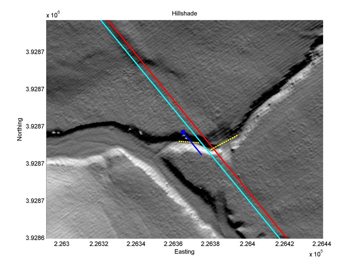
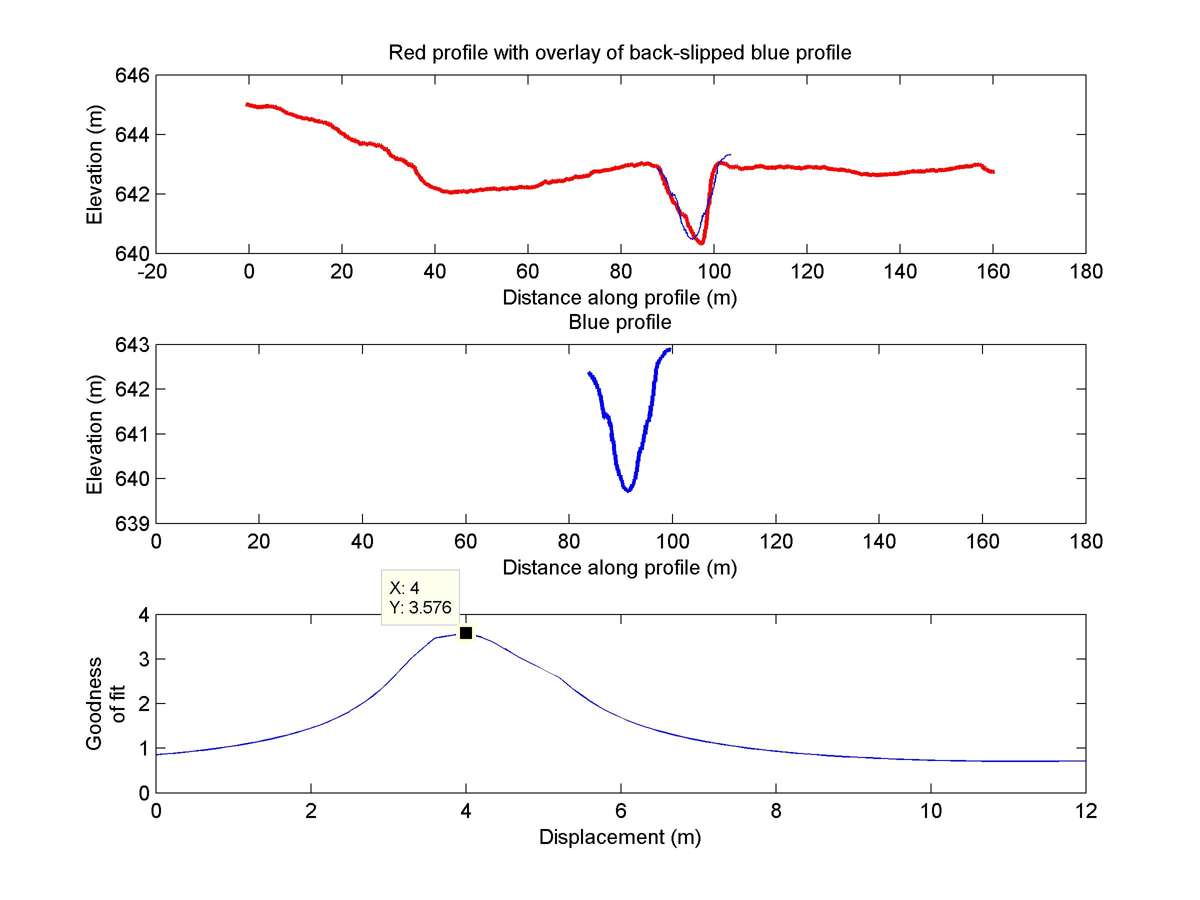
| 35.46408 | -120.01522 | 38.89 km | 4.0 | 3.4 - 4.6 | Moderate-Low | None |
| Hillshade with profiles | Topographic profiles and GOF |
|
|
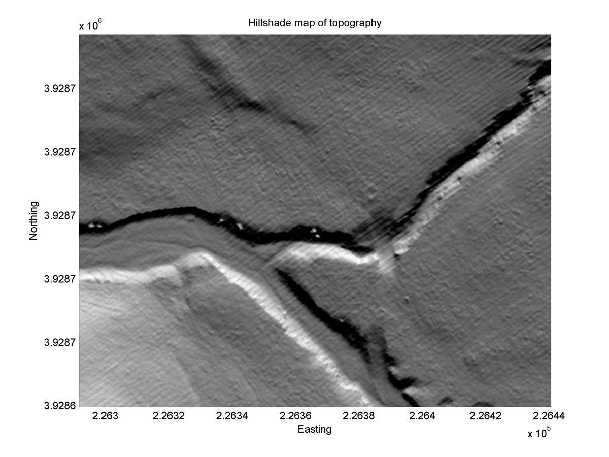
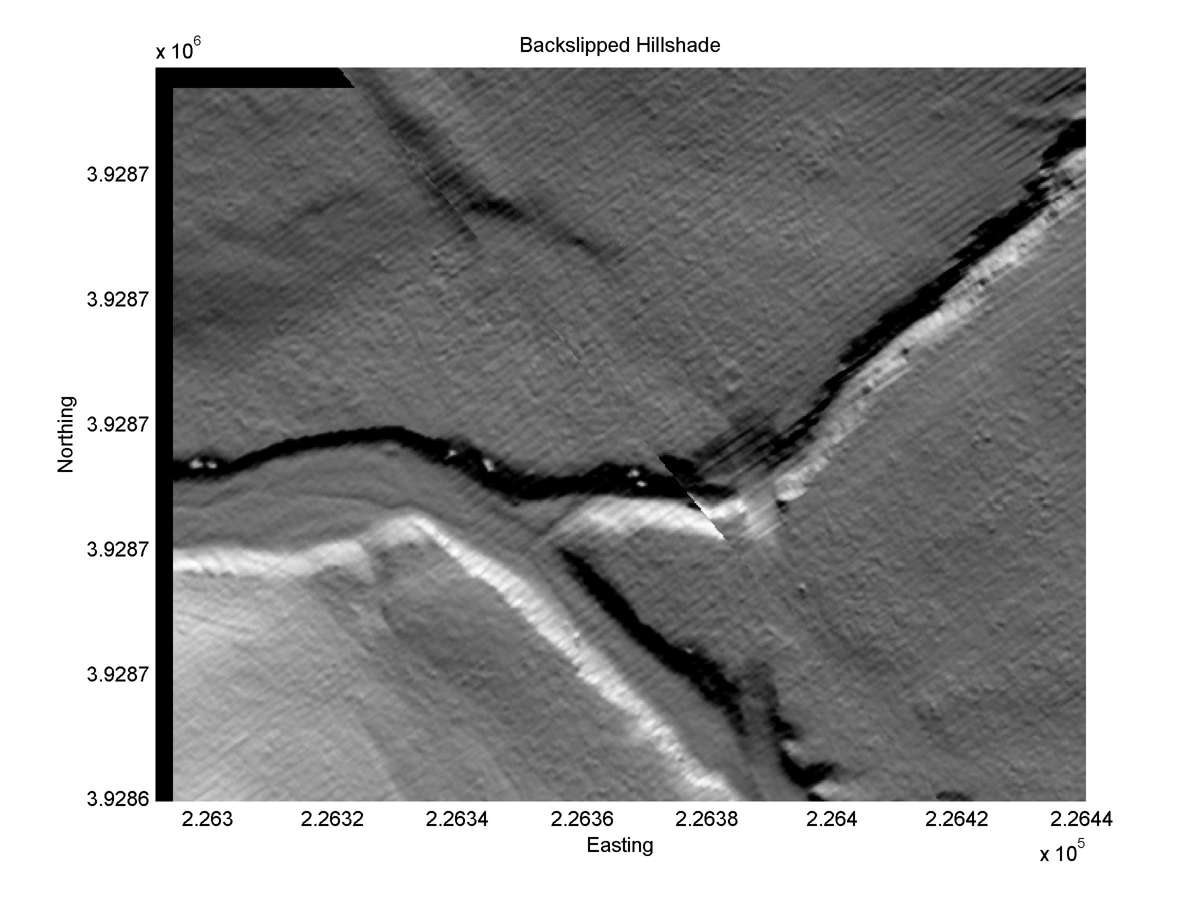
| Hillshade plot | Hillshade plot, Optimal back-slip |
|
|
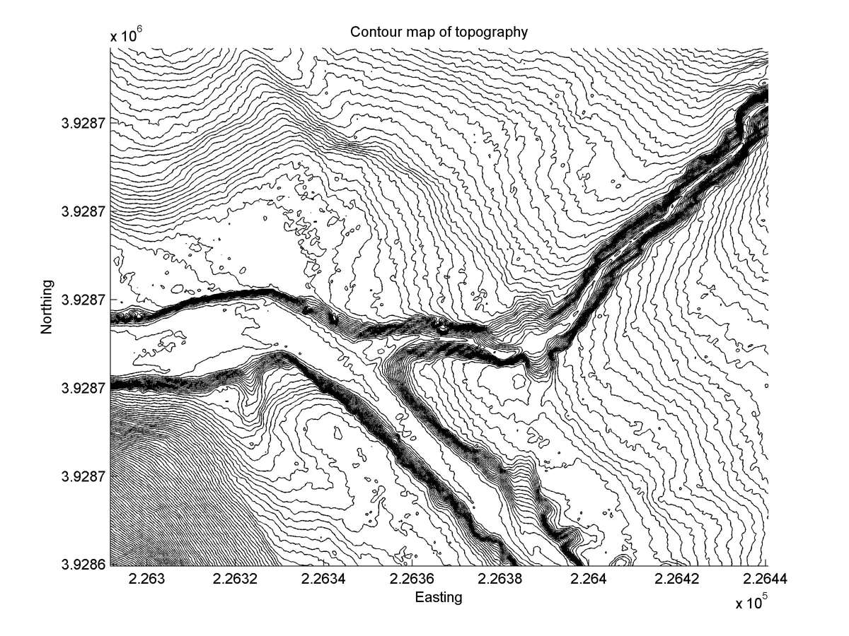
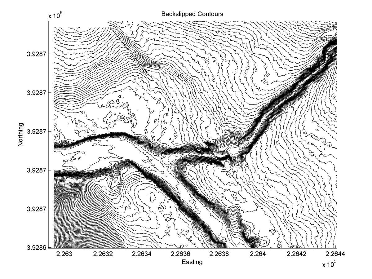
| Contour plot | Contour plot, Optimal back-slip |
|
|
| Offset (m) | Error (m) | Quality Rating | Comments |
|---|---|---|---|
| 5.5 | +/-2.1 | Poor/Fair | Deeply incised gully in alluvial deposits. Fault trace geometry and position uncertain. This may be a deflection. |