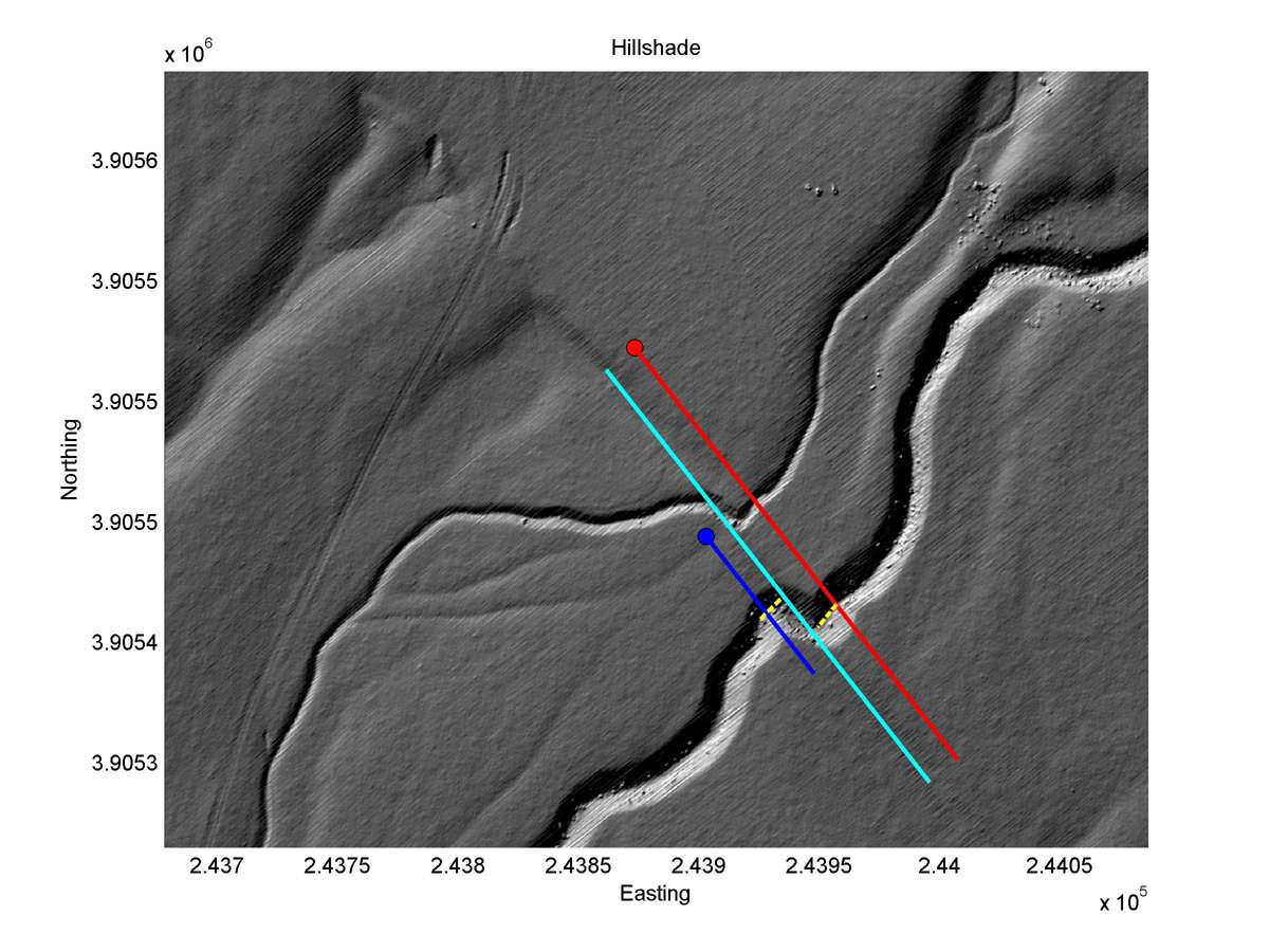
| Latitude | Longitude | Distance to reference | Best Offset (m) | Offset Range (m) | Quality Rating | Comment |
|---|---|---|---|---|---|---|
| 35.25912 | -119.81459 | 68.10 km | 18.5 | 17.0 - 20.0 | High-Moderate | None |
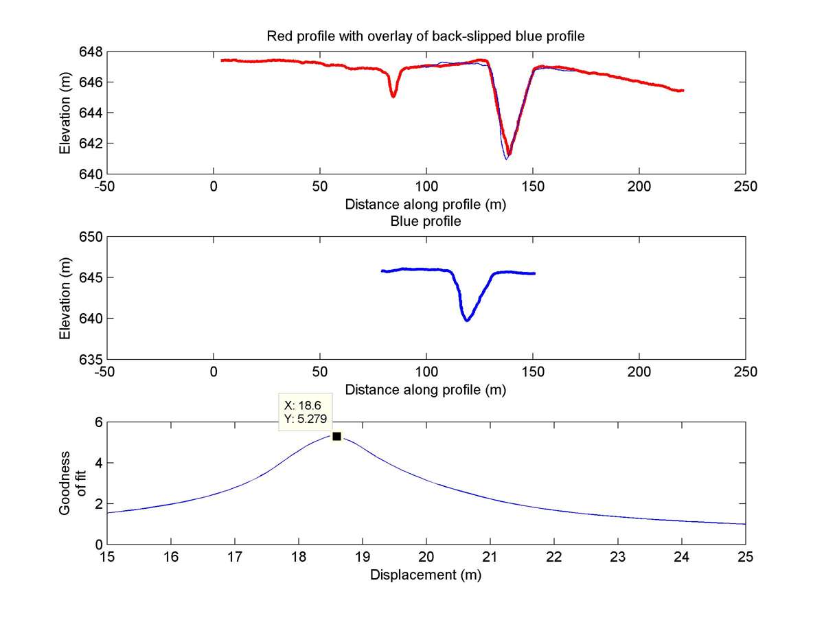
| Hillshade with profiles | Topographic profiles and GOF |
|
|
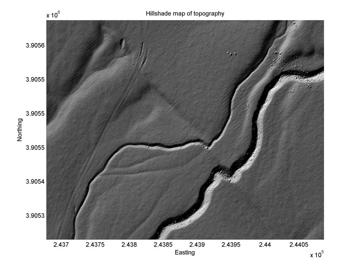
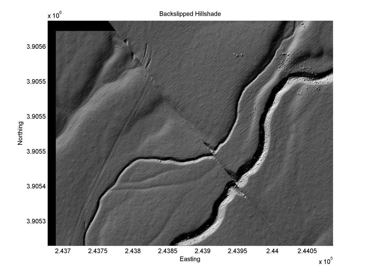
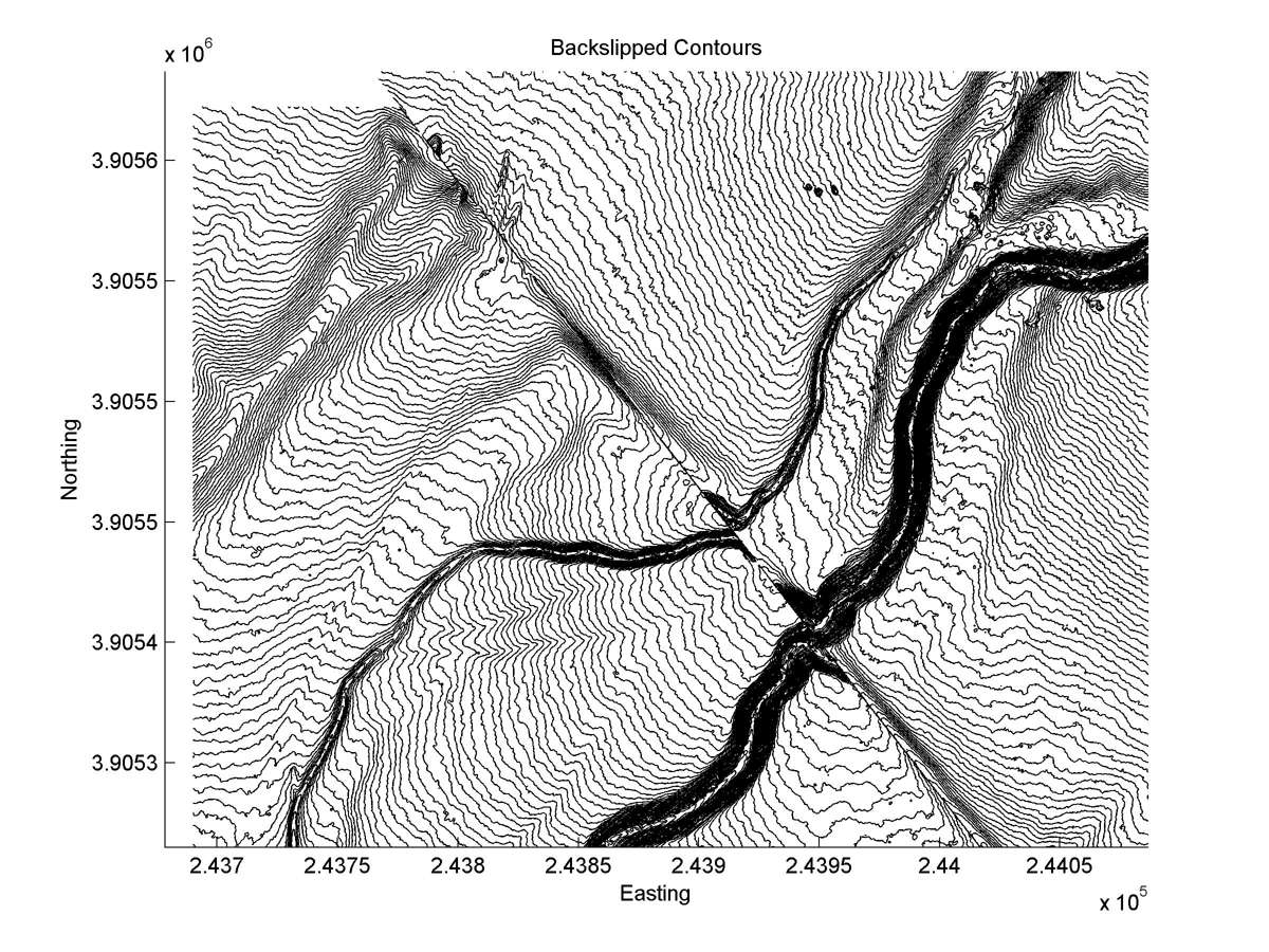
| Hillshade plot | Hillshade plot, Optimal back-slip |
|
|
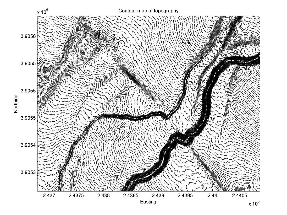
| Contour plot | Contour plot, Optimal back-slip |
|
|
| Offset (m) | Error (m) | Quality Rating | Comments |
|---|---|---|---|
| 19.6 | +/-1.8 | Excellent | Sharp offset of channel deeply incised in alluvium (Wallace, 1968, Figure 9). Offset calculated by averaging offset of top of bank on NW side of channel (17.8 +/-1.0) and channel bottom (21.4 +/-1.0). |