| Latitude | Longitude | Distance to reference | Best Offset (m) | Offset Range (m) | Quality Rating | Comment |
|---|---|---|---|---|---|---|
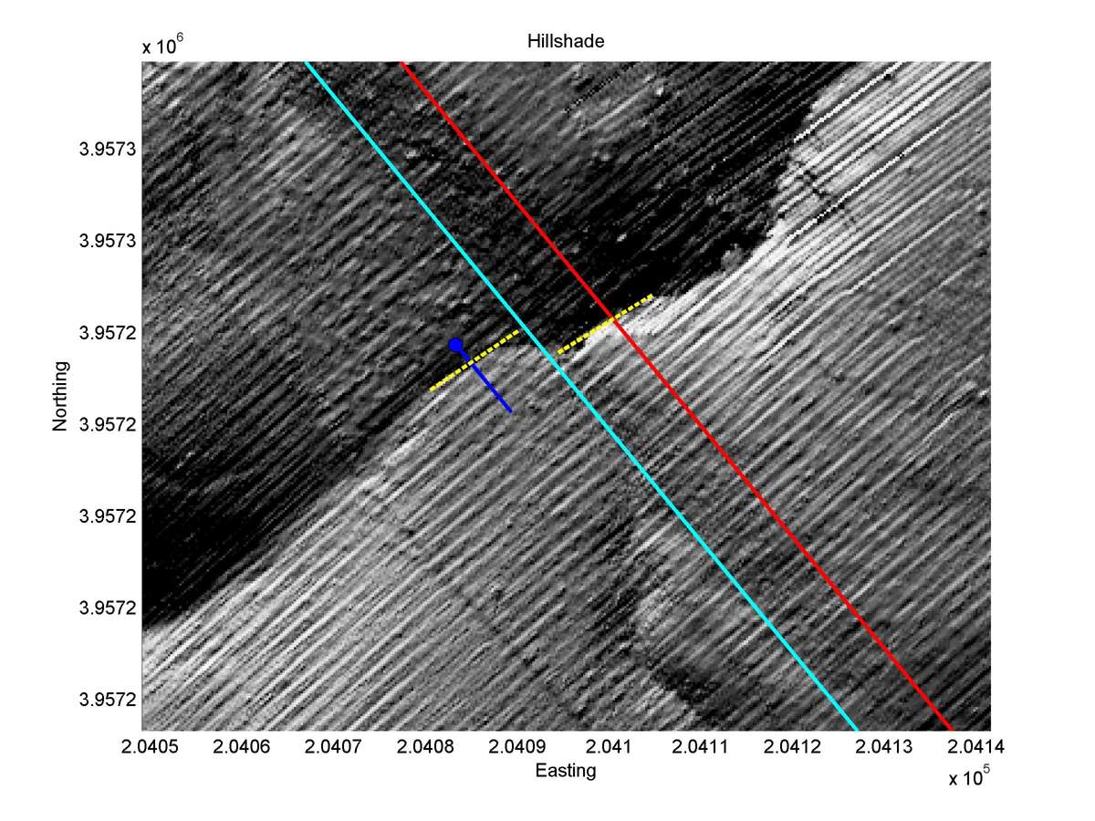
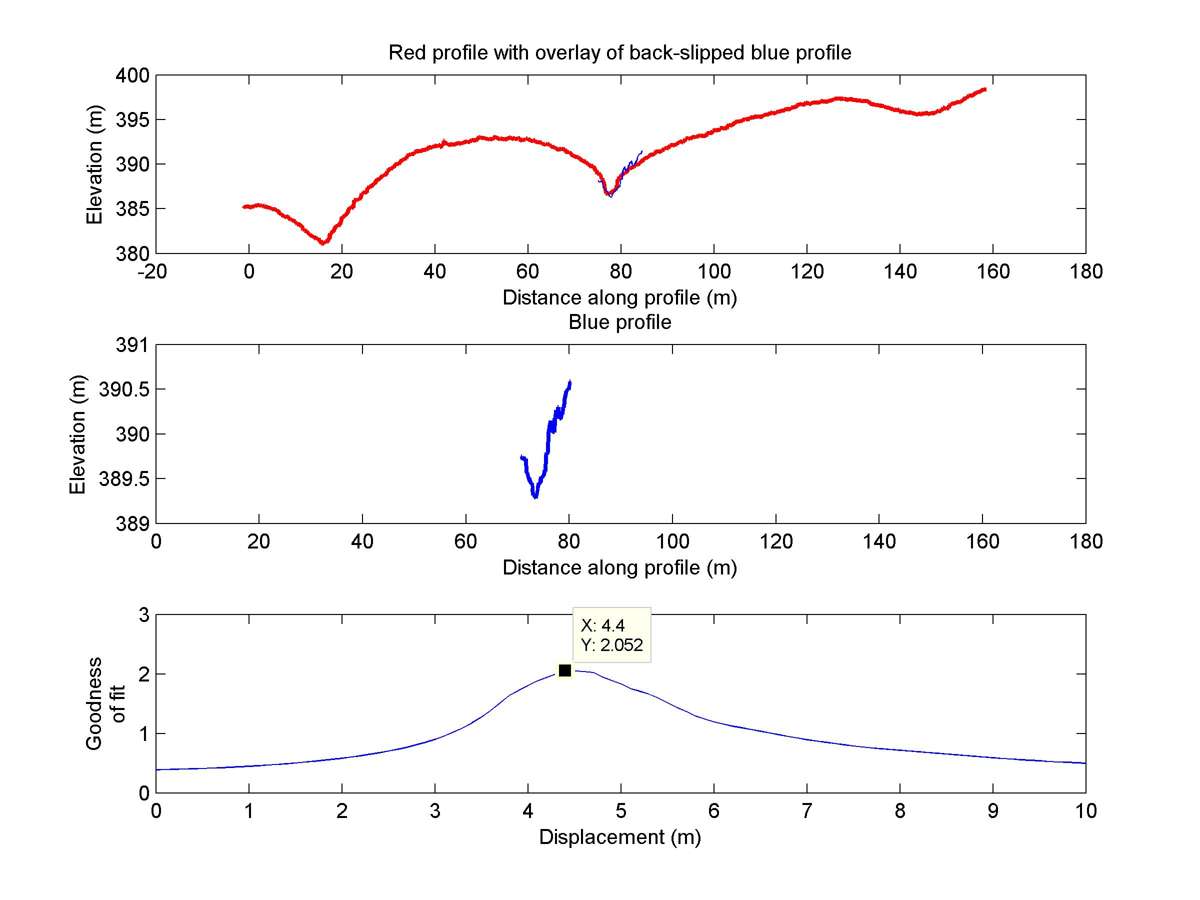
| 35.71470 | -120.27090 | 2.63 km | 4.4 | 3.8 - 5.0 | High-Moderate | Offset channel. |
| Hillshade with profiles | Topographic profiles and GOF |
|
|
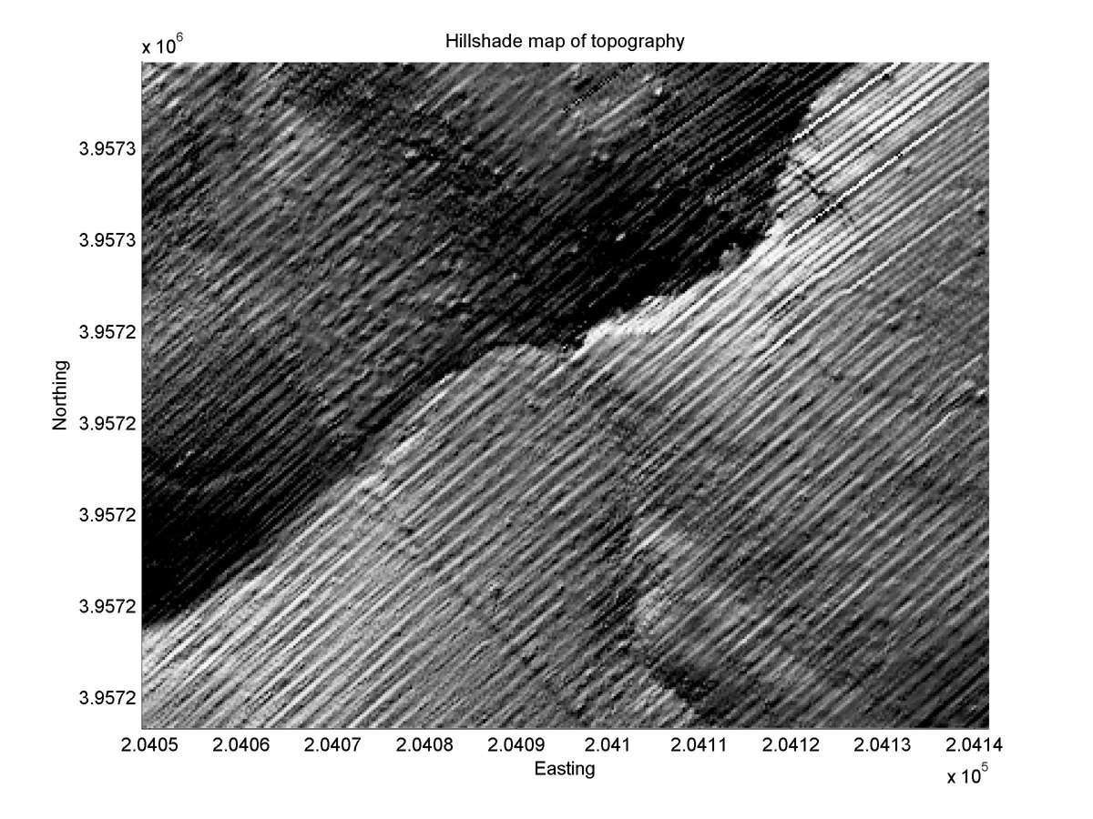
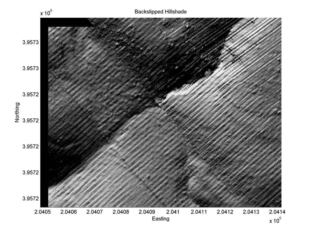
| Hillshade plot | Hillshade plot, Optimal back-slip |
|
|
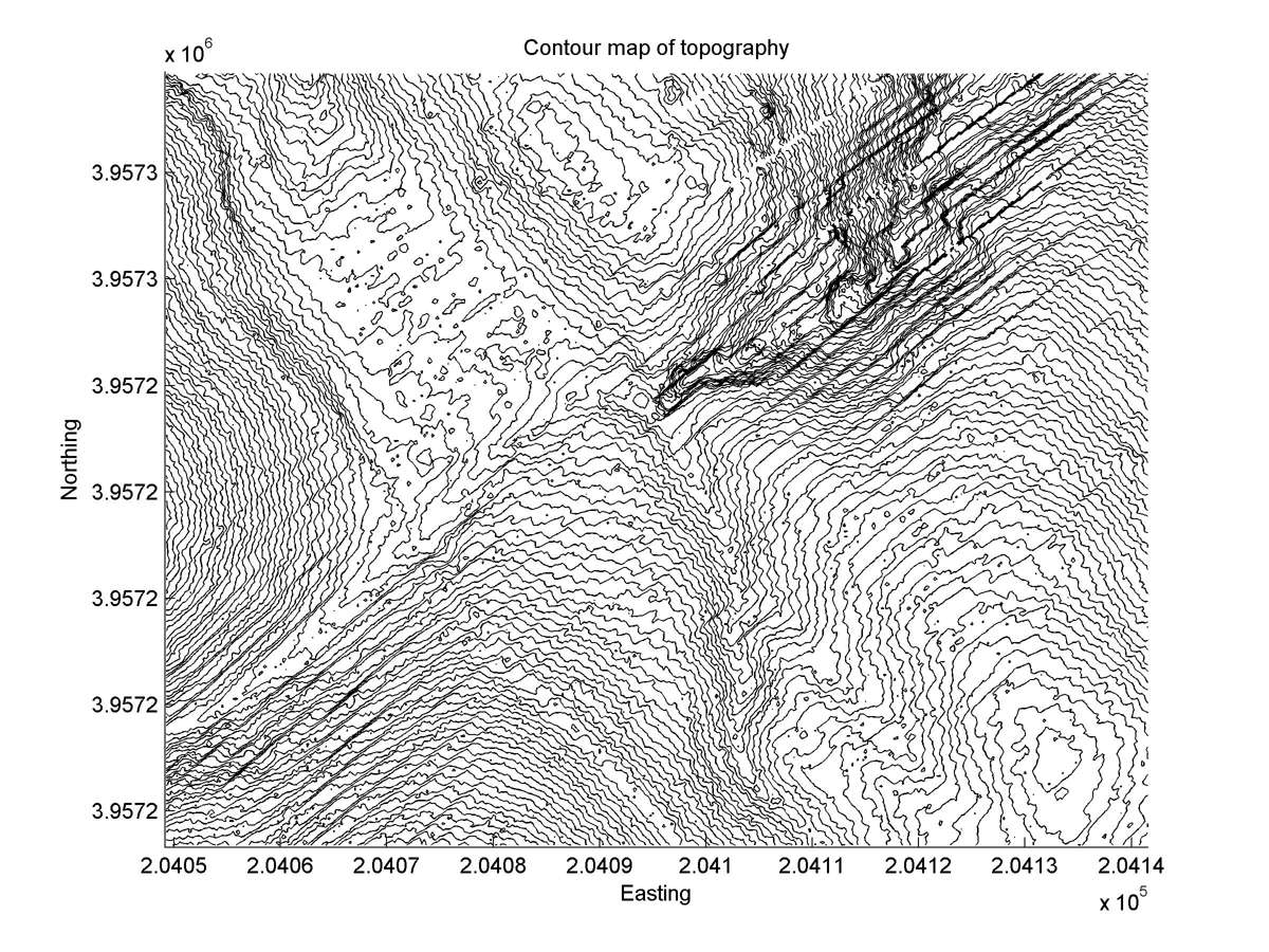
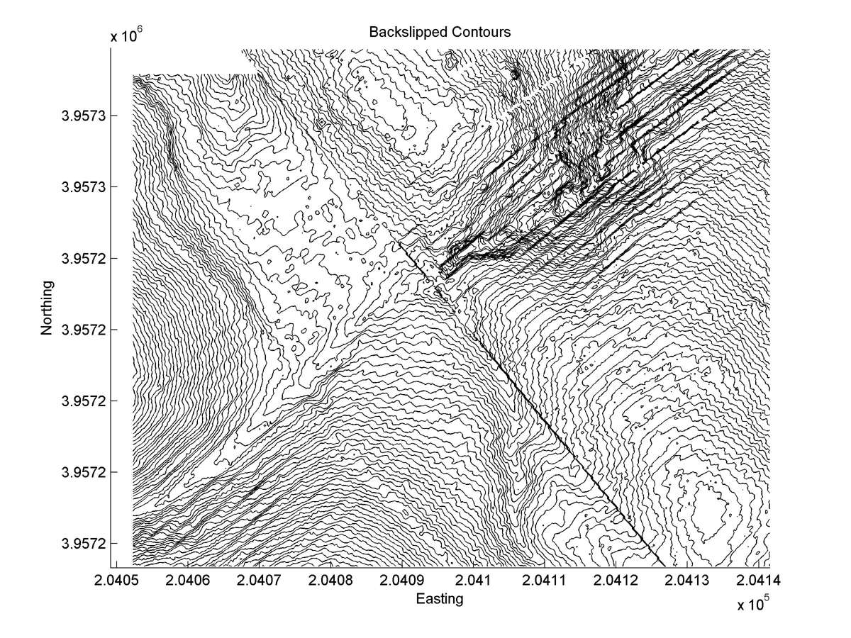
| Contour plot | Contour plot, Optimal back-slip |
|
|
| Offset (m) | Error (m) | Quality Rating | Comments |
|---|---|---|---|
| 4.2 | +/-0.2 | Poor | Gully has been cut through high ridge down-stream from fault. May never have been alignment of upstream and downstream segments. |
| Dist. from Bitterwater road | Offset (m) | Error (m) | Quality Rating | Comments |
|---|---|---|---|---|
| 22.92km | 6.6 | 3 | low | Various offset reconstructions are plausible: one likely history involves tail capture that invalidates slip interpretation. |