| Latitude | Longitude | Distance to reference | Best Offset (m) | Offset Range (m) | Quality Rating | Comment |
|---|---|---|---|---|---|---|
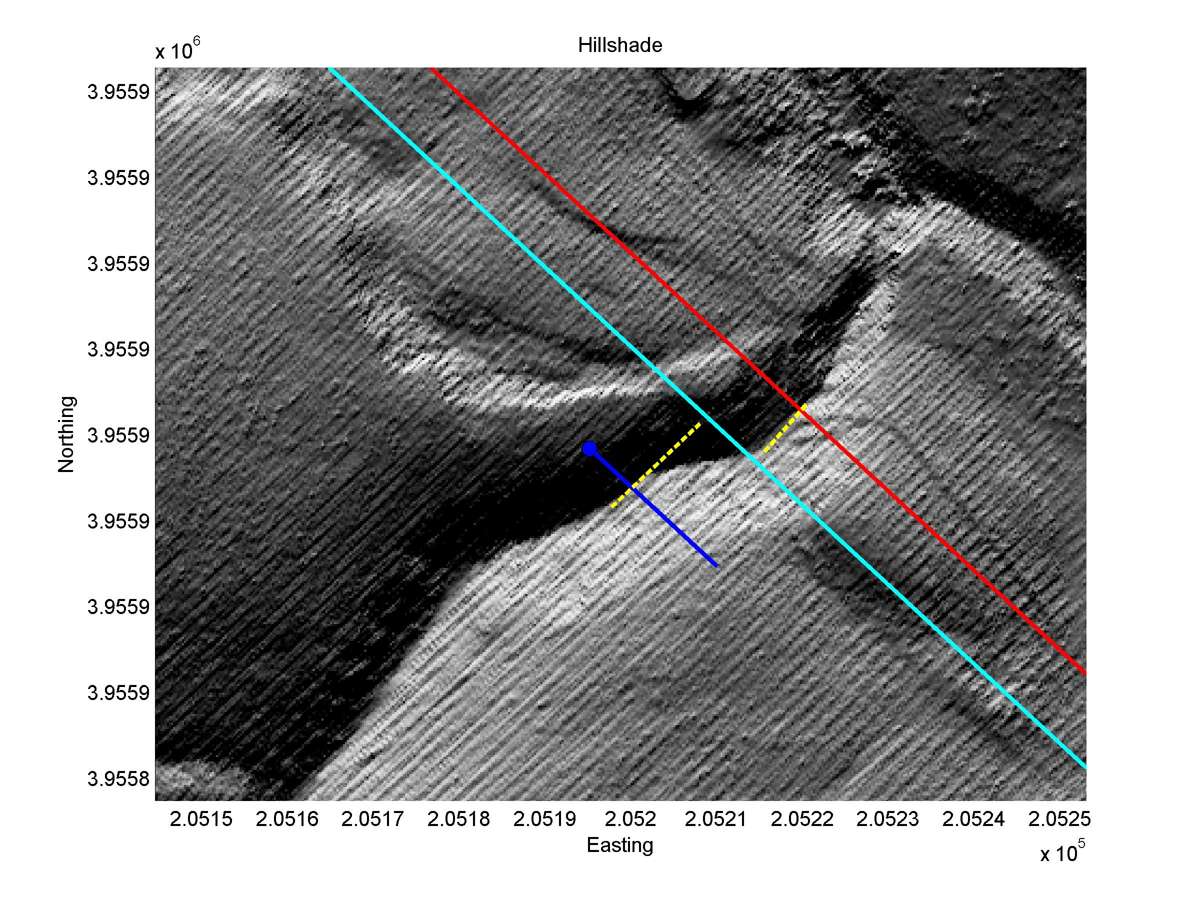
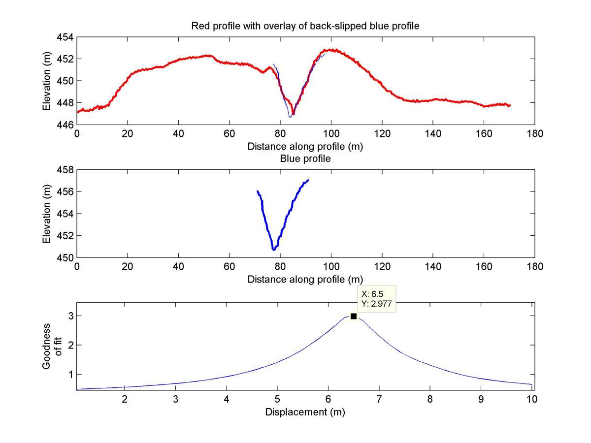
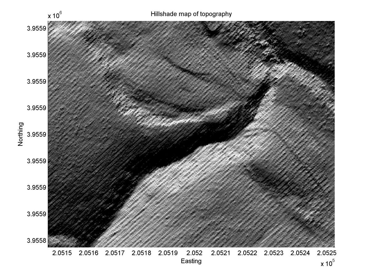
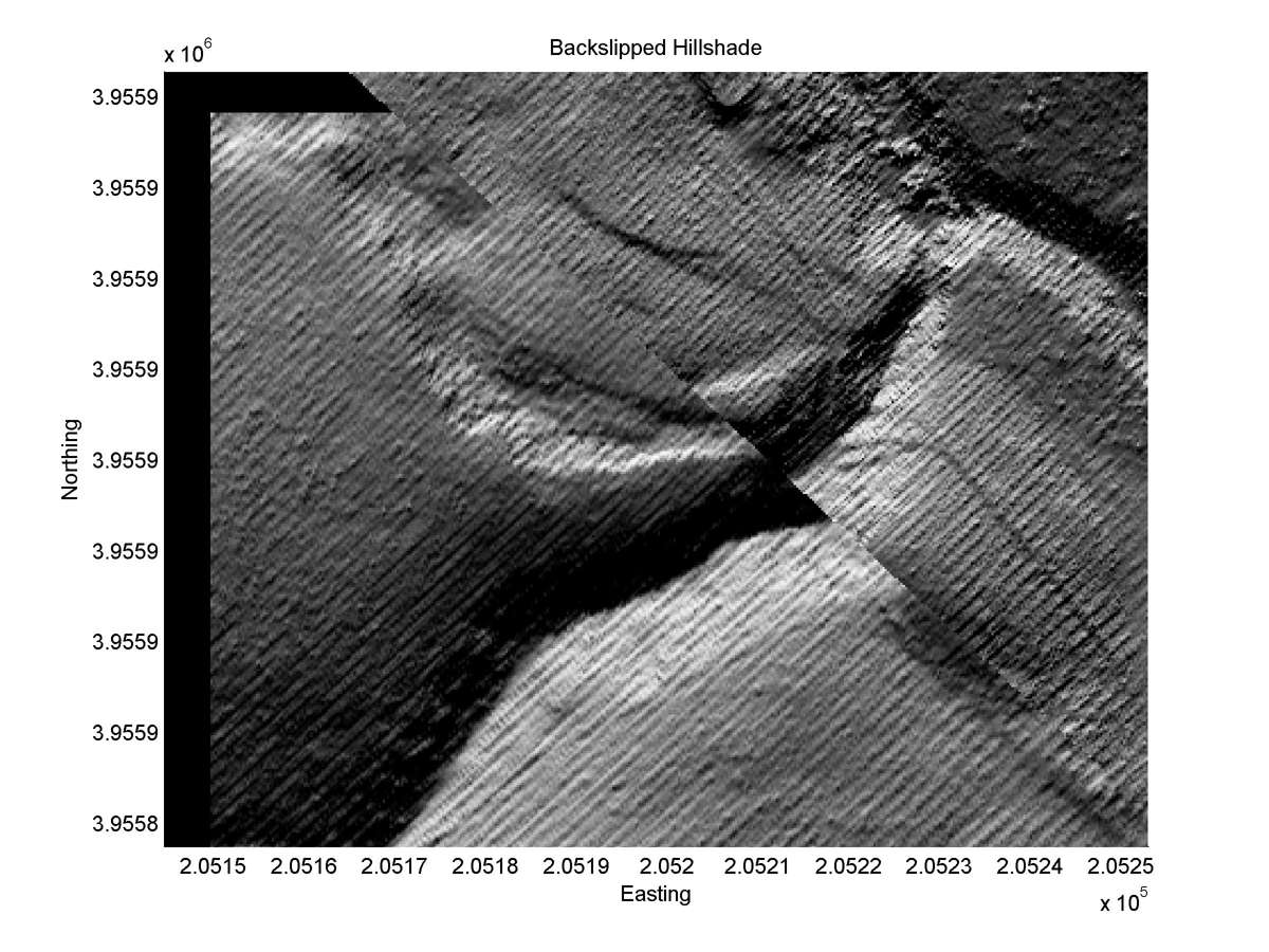
| 35.70289 | -120.25804 | 4.39 km | 6.5 | 5.5 - 7.5 | Low | Bend in fault as it crosses fault zone suggests channel offset. |
| Hillshade with profiles | Topographic profiles and GOF |
|
|
| Hillshade plot | Hillshade plot, Optimal back-slip |
|
|
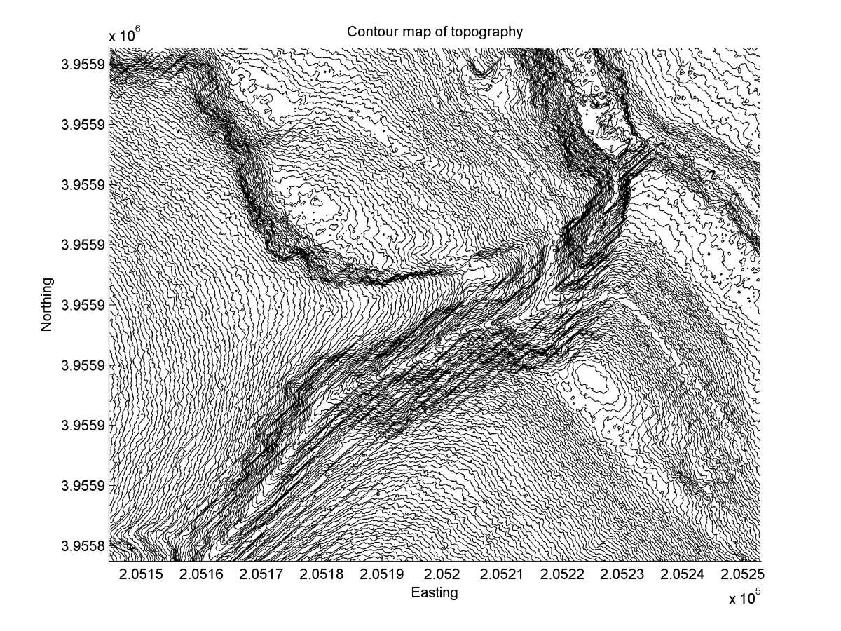
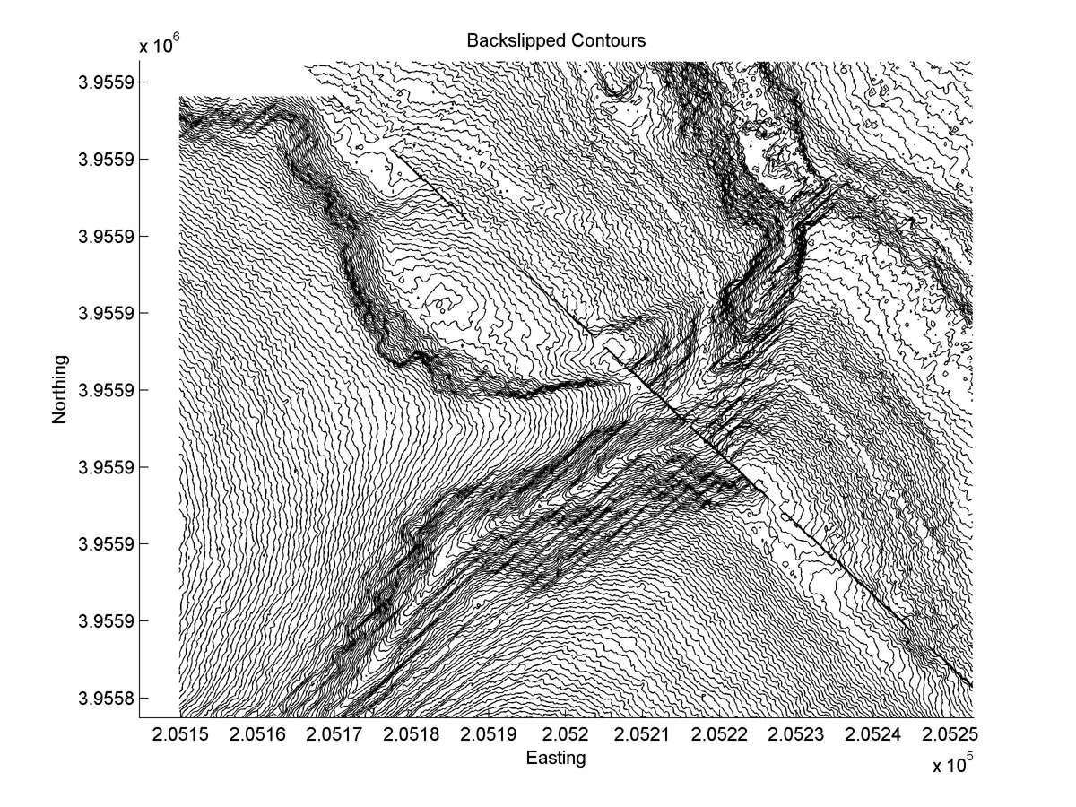
| Contour plot | Contour plot, Optimal back-slip |
|
|
| Offset (m) | Error (m) | Quality Rating | Comments |
|---|---|---|---|
| 9.1 | +/-0.6 | Fair/Poor | Possible warp upstream and downstream from fault. Gully. |
| Dist. from Bitterwater road | Offset (m) | Error (m) | Quality Rating | Comments |
|---|---|---|---|---|
| 21.18km | 6.6 | 3 | low | Offset distinctively tectonic, but head and tail curved. Extreme erosion near fault makes many reconstructions plausible. |