| Latitude | Longitude | Distance to reference | Best Offset (m) | Offset Range (m) | Quality Rating | Comment |
|---|---|---|---|---|---|---|
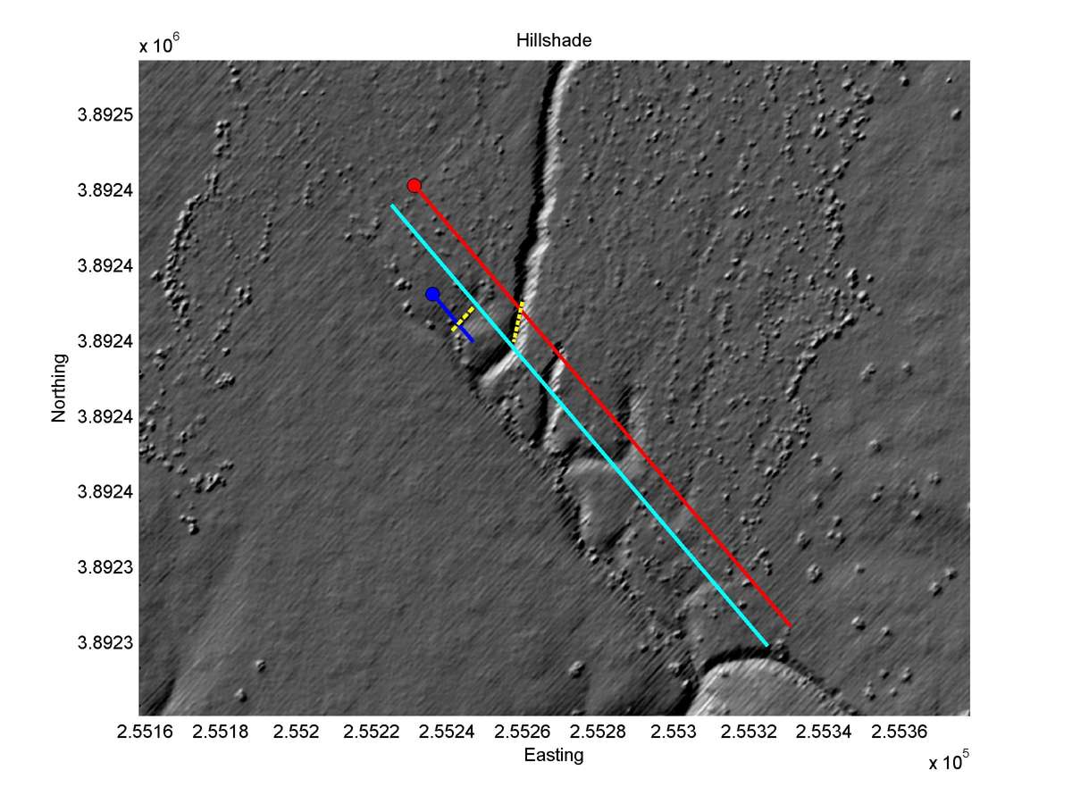
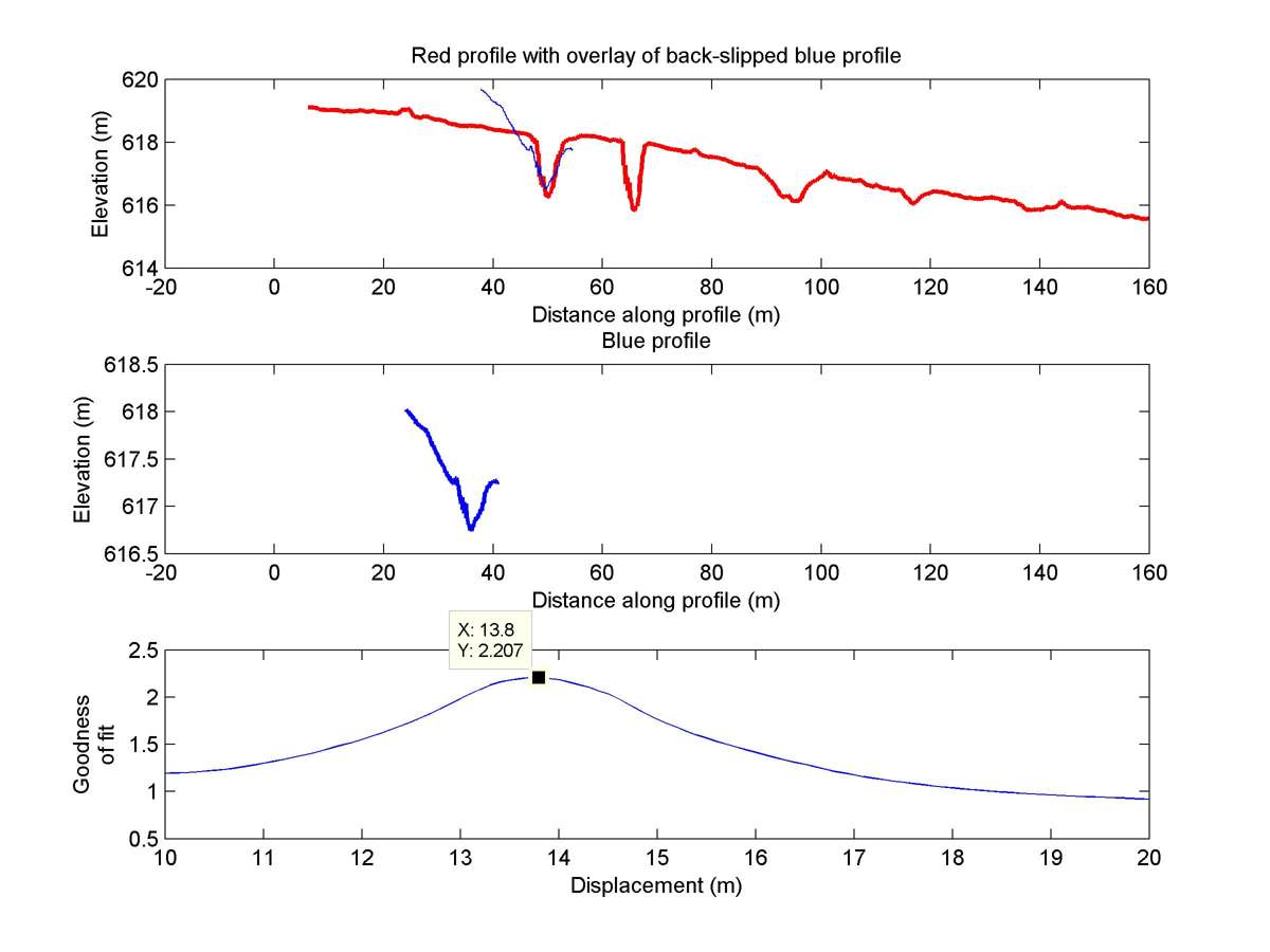
| 35.14479 | -119.68652 | 85.44 km | 13.8 | 13.0 - 15.0 | Moderate-Low | Beheaded channel. Correlation with Sieh uncertain. |
| Hillshade with profiles | Topographic profiles and GOF |
|
|
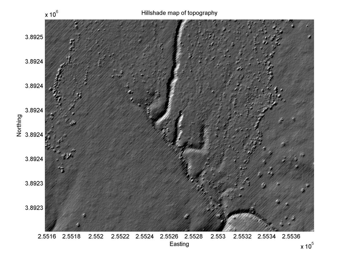
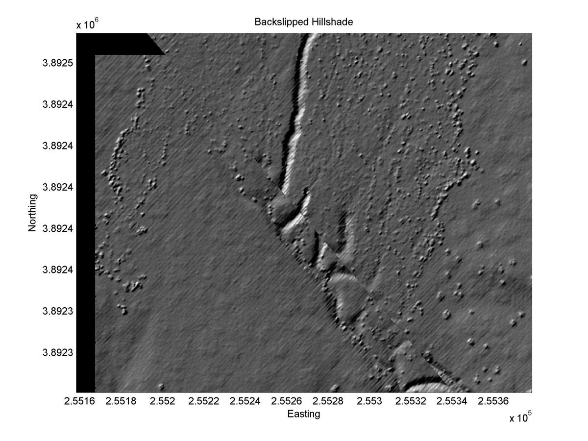
| Hillshade plot | Hillshade plot, Optimal back-slip |
|
|
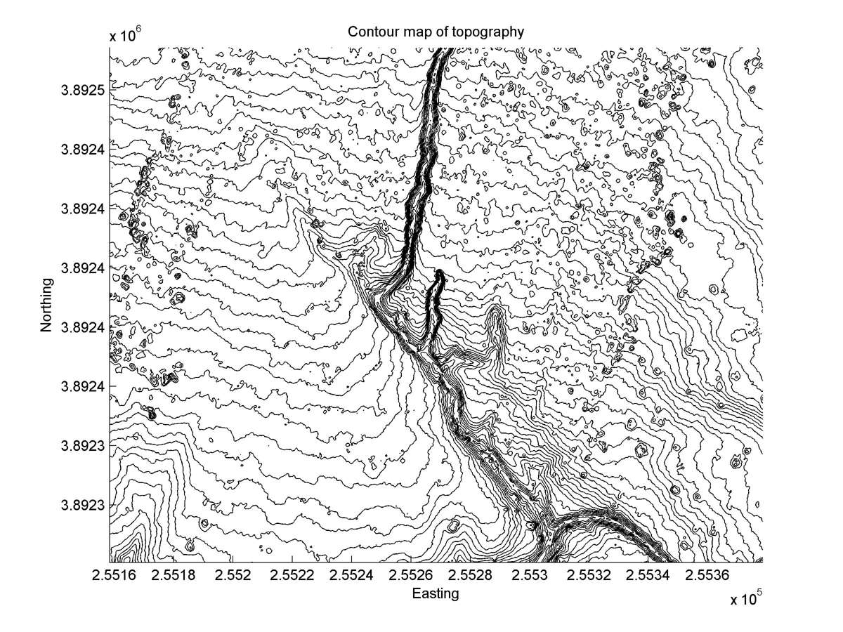
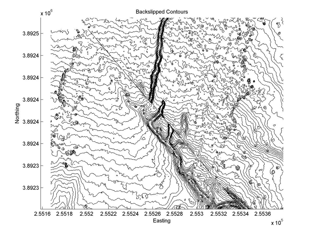
| Contour plot | Contour plot, Optimal back-slip |
|
|
| Offset (m) | Error (m) | Quality Rating | Comments |
|---|---|---|---|
| 13.9 | +/-0.8 | Poor/Fair | Much post-1857 headward erosion of beheaded gully ("spring-sapping"?). No fault trace clearly evident. Incision of source gully in post-1929 photos. |