| Latitude | Longitude | Distance to reference | Best Offset (m) | Offset Range (m) | Quality Rating | Comment |
|---|---|---|---|---|---|---|
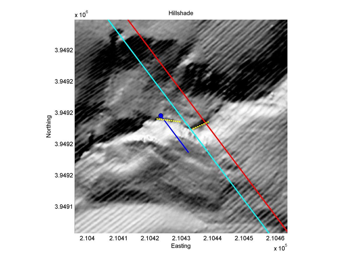
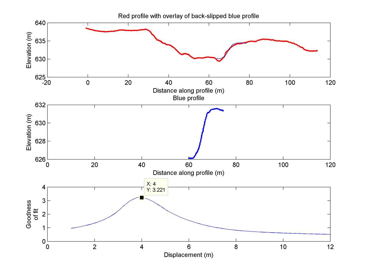
| 35.64400 | -120.19801 | 12.89 km | 4.0 | 3.5 - 4.5 | Low | Offset channel. Slumping to the NW makes measurement less reliable. |
| Hillshade with profiles | Topographic profiles and GOF |
|
|
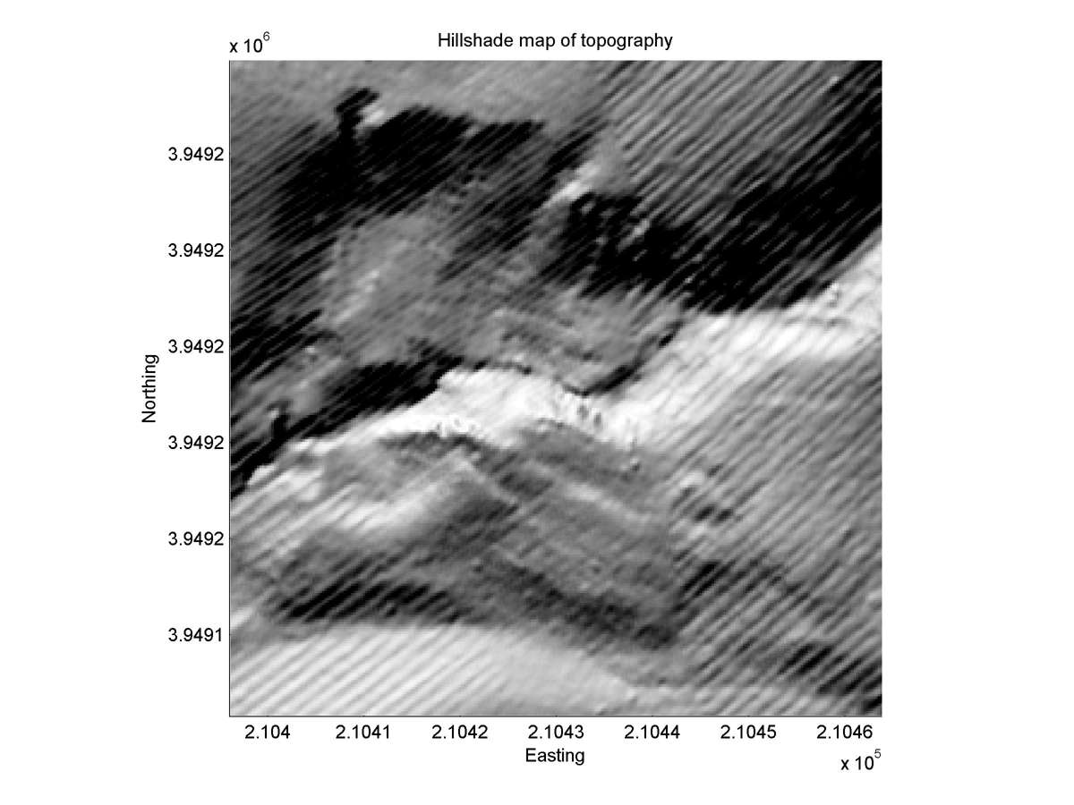
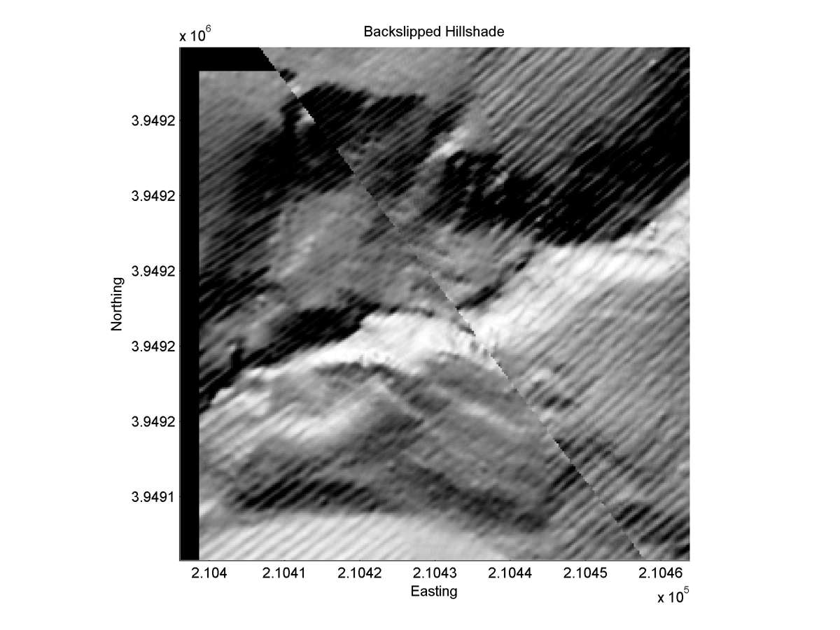
| Hillshade plot | Hillshade plot, Optimal back-slip |
|
|
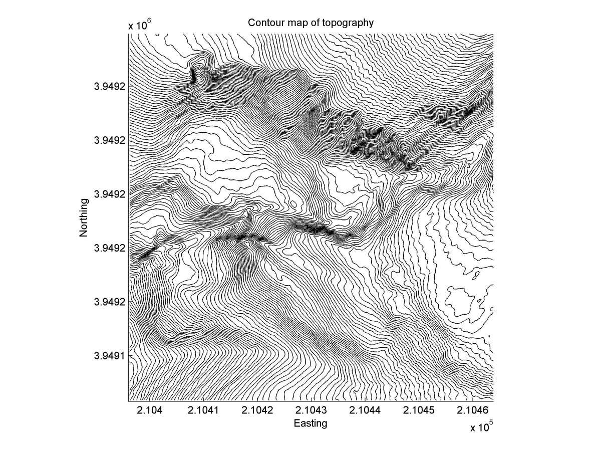
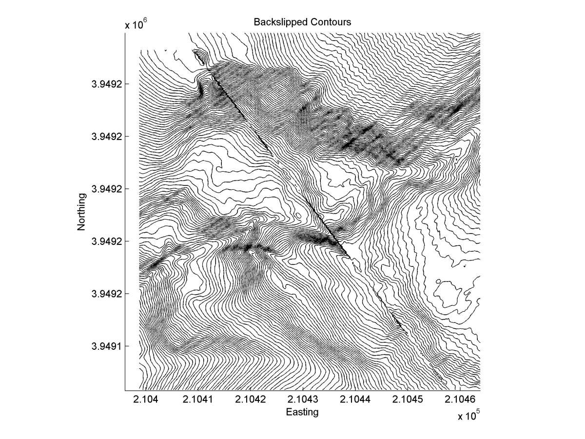
| Contour plot | Contour plot, Optimal back-slip |
|
|
| Offset (m) | Error (m) | Quality Rating | Comments |
|---|---|---|---|
| 3.8; 3.8 | +/-0.6; +/-1.0 | Poor | 3.8+/-0.6 m on stream channel, not valid if slide moved in or after 1857. 3.8+/-1.0 m on steep SE flank of creek. Latest offset of large channel and slide. |
| Dist. from Bitterwater road | Offset (m) | Error (m) | Quality Rating | Comments |
|---|---|---|---|---|
| 12.67km | 5.5 | 3.5 | low | Severe erosion and slumping near fault allow many possible reconstructions of slip from highly askew head and tail. |