| Latitude | Longitude | Distance to reference | Best Offset (m) | Offset Range (m) | Quality Rating | Comment |
|---|---|---|---|---|---|---|
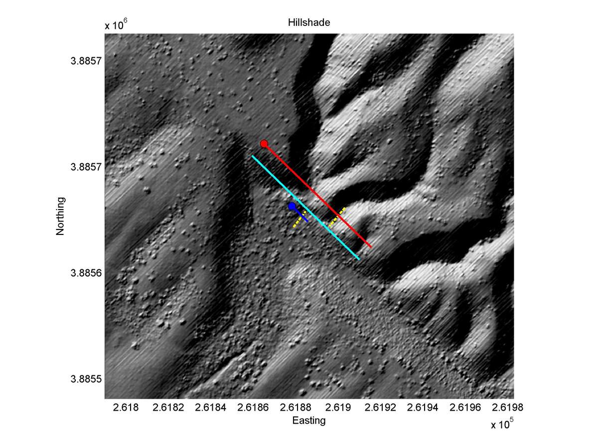
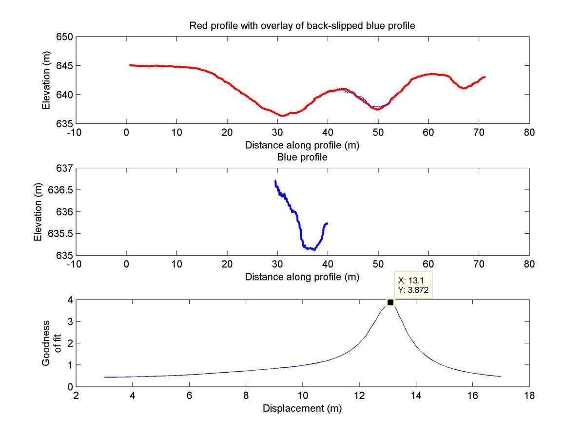
| 35.08532 | -119.61178 | 94.87 km | 13.1 | 12.0 - 14.5 | High | None |
| Hillshade with profiles | Topographic profiles and GOF |
|
|
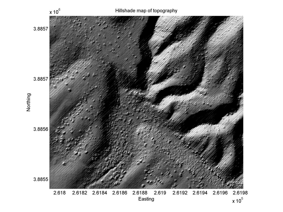
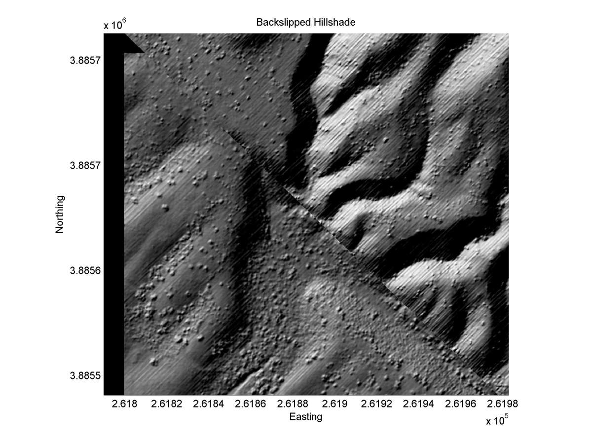
| Hillshade plot | Hillshade plot, Optimal back-slip |
|
|
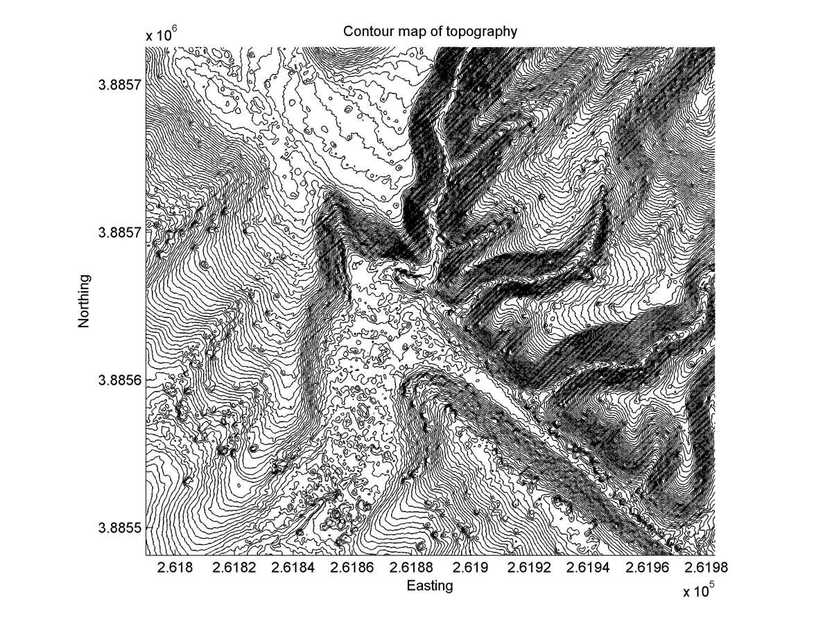
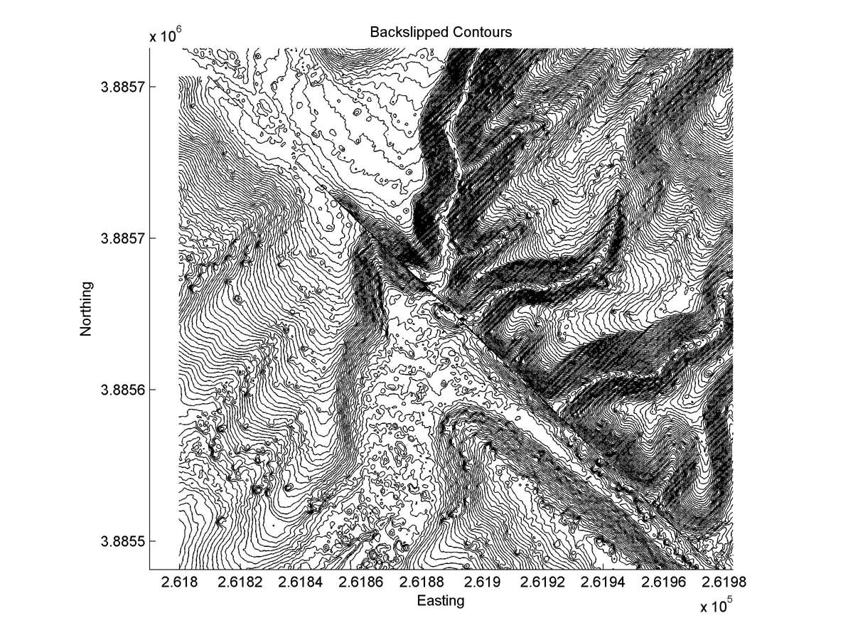
| Contour plot | Contour plot, Optimal back-slip |
|
|
| Offset (m) | Error (m) | Quality Rating | Comments |
|---|---|---|---|
| 12.9 | +/-2.5 | Good | 200m-long channel SE of #67. Downstream segment must have originated across fault from this channel. Small alluvial deposit at fault makes offset imprecise. |