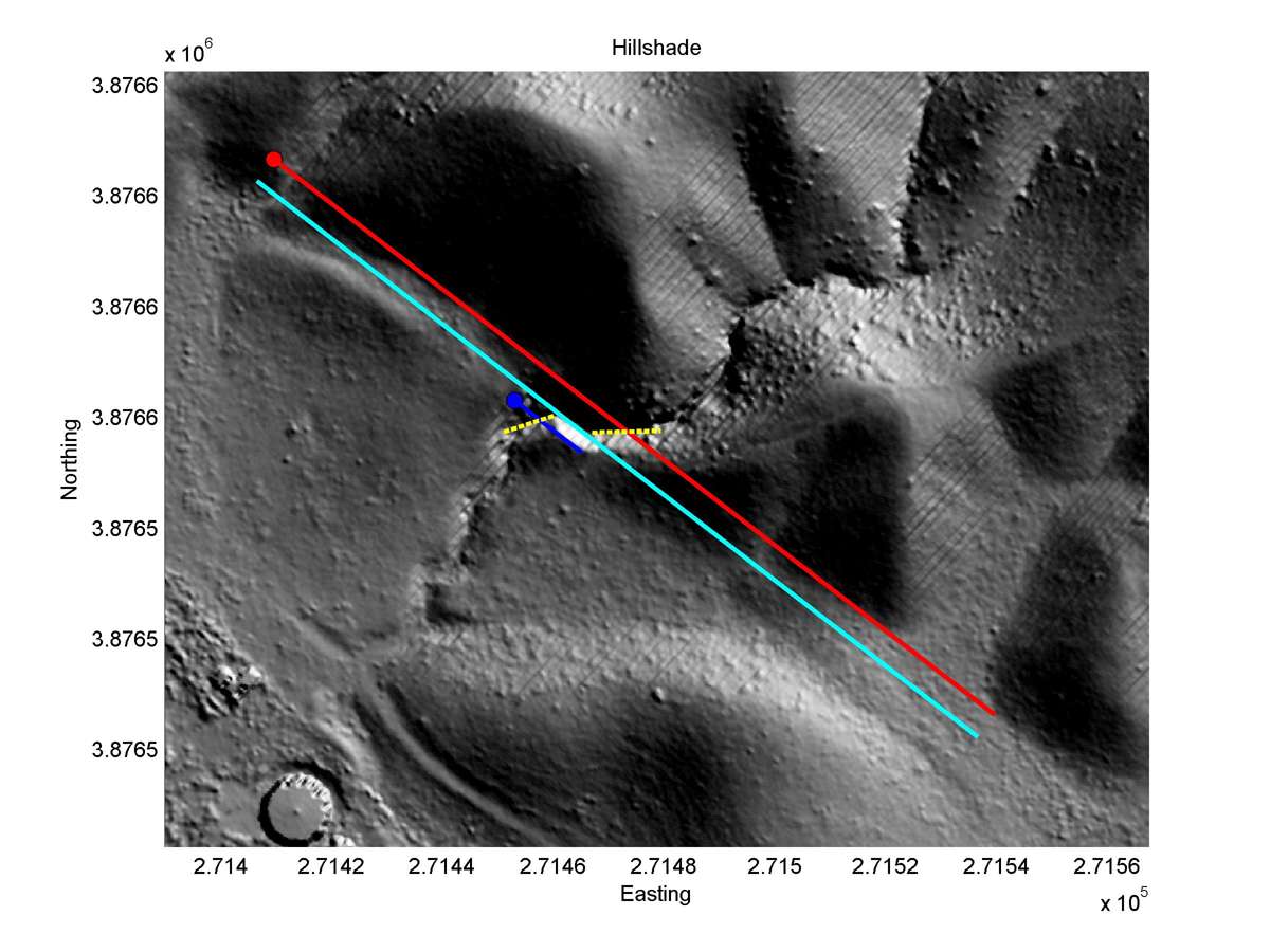
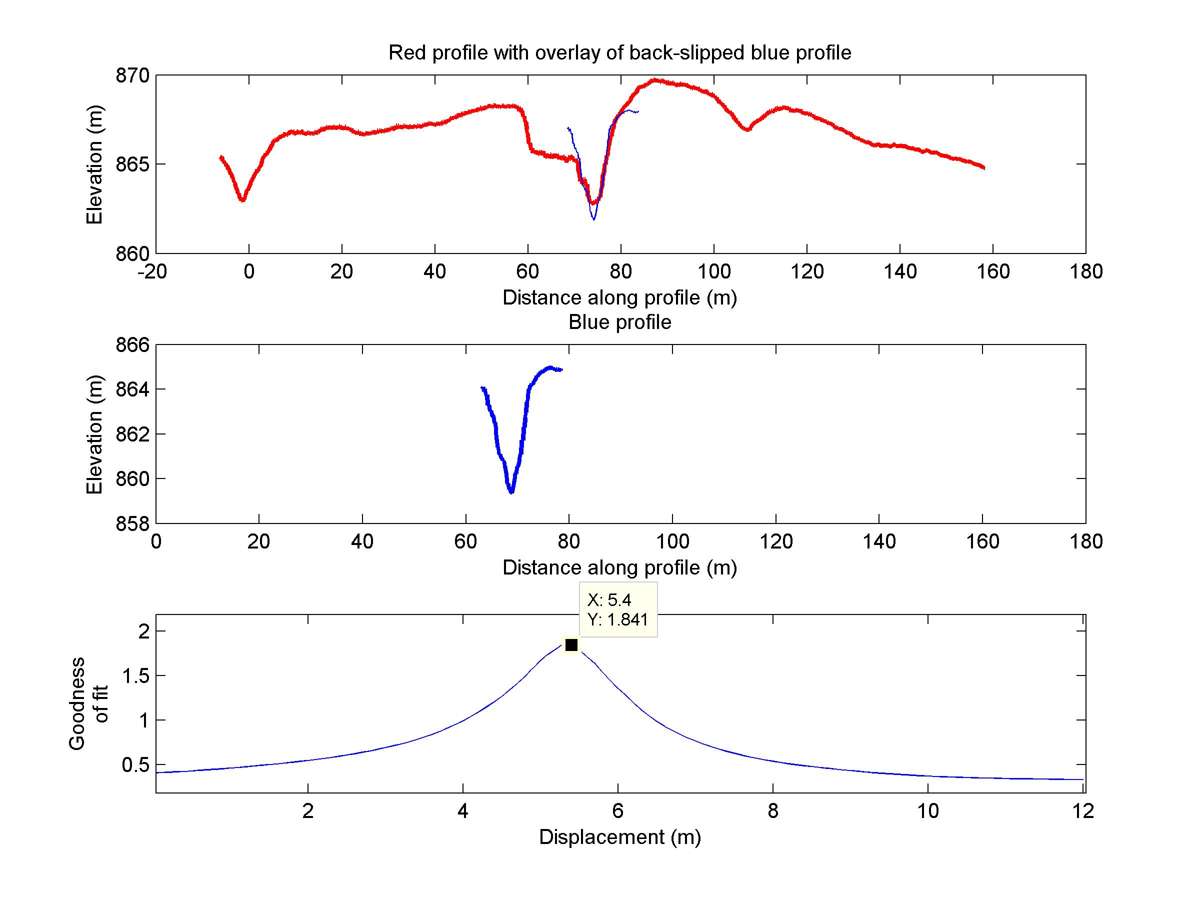
| Latitude | Longitude | Distance to reference | Best Offset (m) | Offset Range (m) | Quality Rating | Comment |
|---|---|---|---|---|---|---|
| 35.00586 | -119.50437 | 107.92 km | 5.4 | 4.8 - 6.0 | High-Moderate | None |
| Hillshade with profiles | Topographic profiles and GOF |
|
|
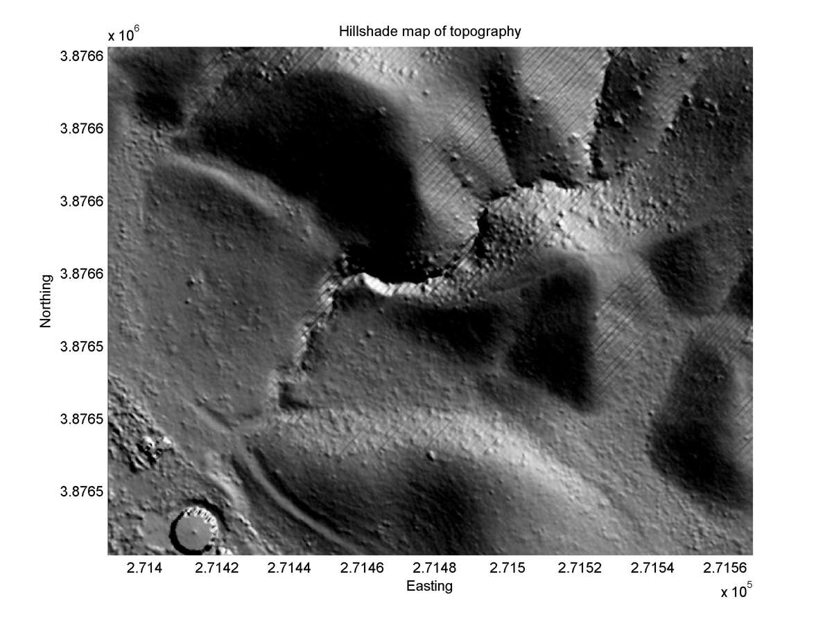
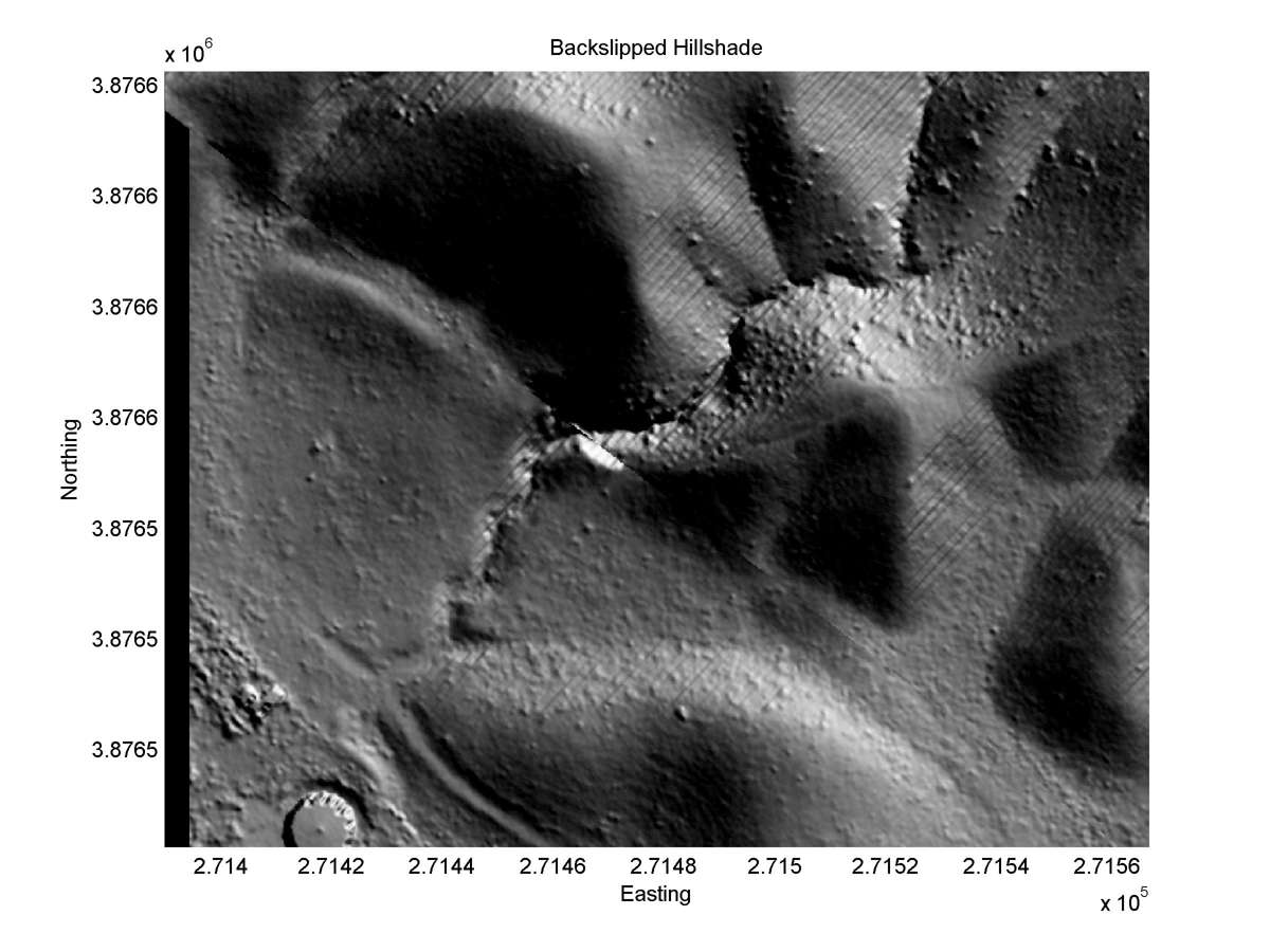
| Hillshade plot | Hillshade plot, Optimal back-slip |
|
|
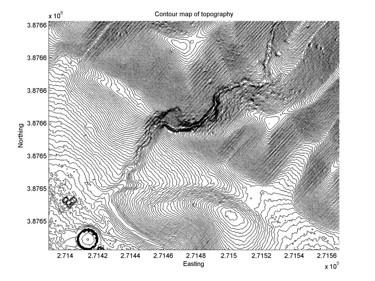
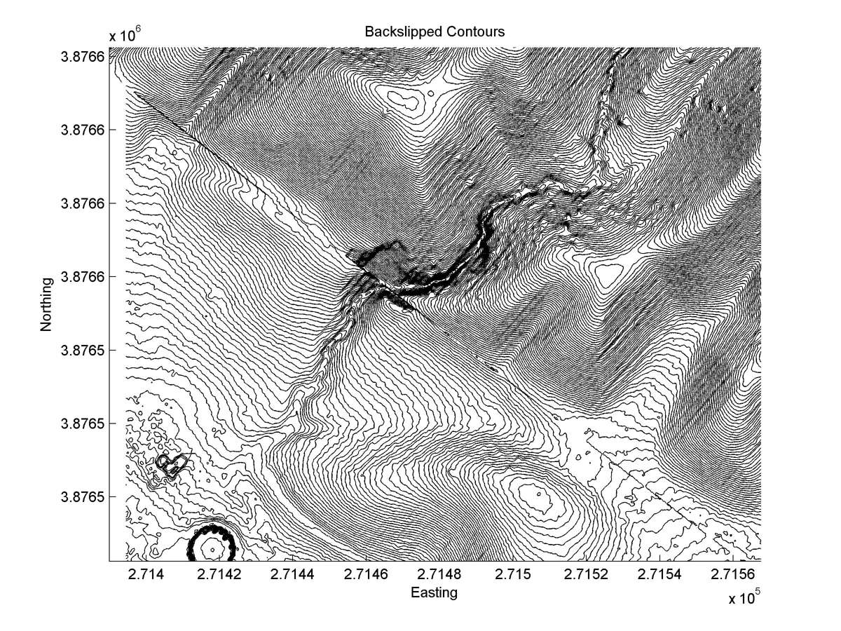
| Contour plot | Contour plot, Optimal back-slip |
|
|
| Offset (m) | Error (m) | Quality Rating | Comments |
|---|---|---|---|
| 9.0 | +/-0.5 | -- | 200m-long recently-deeply-incised channel (stream cut across fault after previous offset of >=100m). Freshest part of gully wall may indicate latest movement. |