| Latitude | Longitude | Distance to reference | Best Offset (m) | Offset Range (m) | Quality Rating | Comment |
|---|---|---|---|---|---|---|
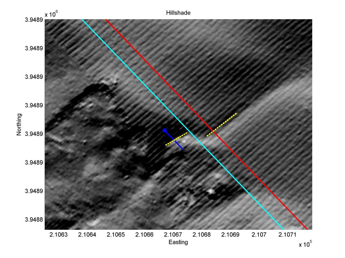
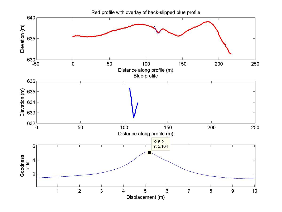
| 35.64131 | -120.19520 | 13.25 km | 5.2 | 4.7 - 5.7 | High-Moderate | Offset channel. Short downstream segment that is straight only for a small section lower rating |
| Hillshade with profiles | Topographic profiles and GOF |
|
|
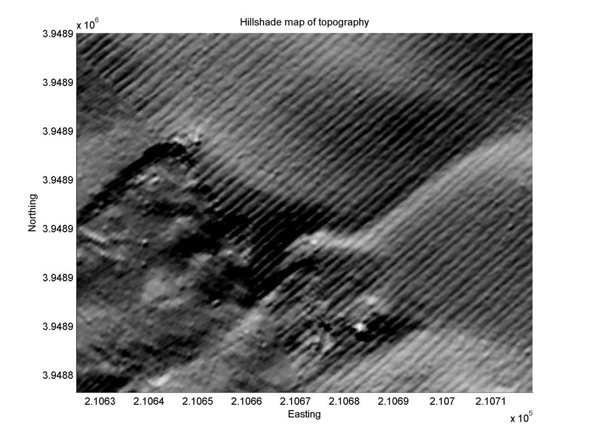
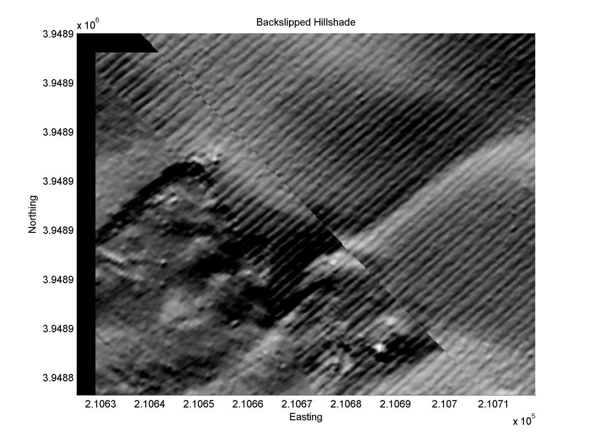
| Hillshade plot | Hillshade plot, Optimal back-slip |
|
|
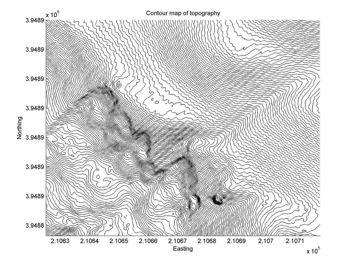
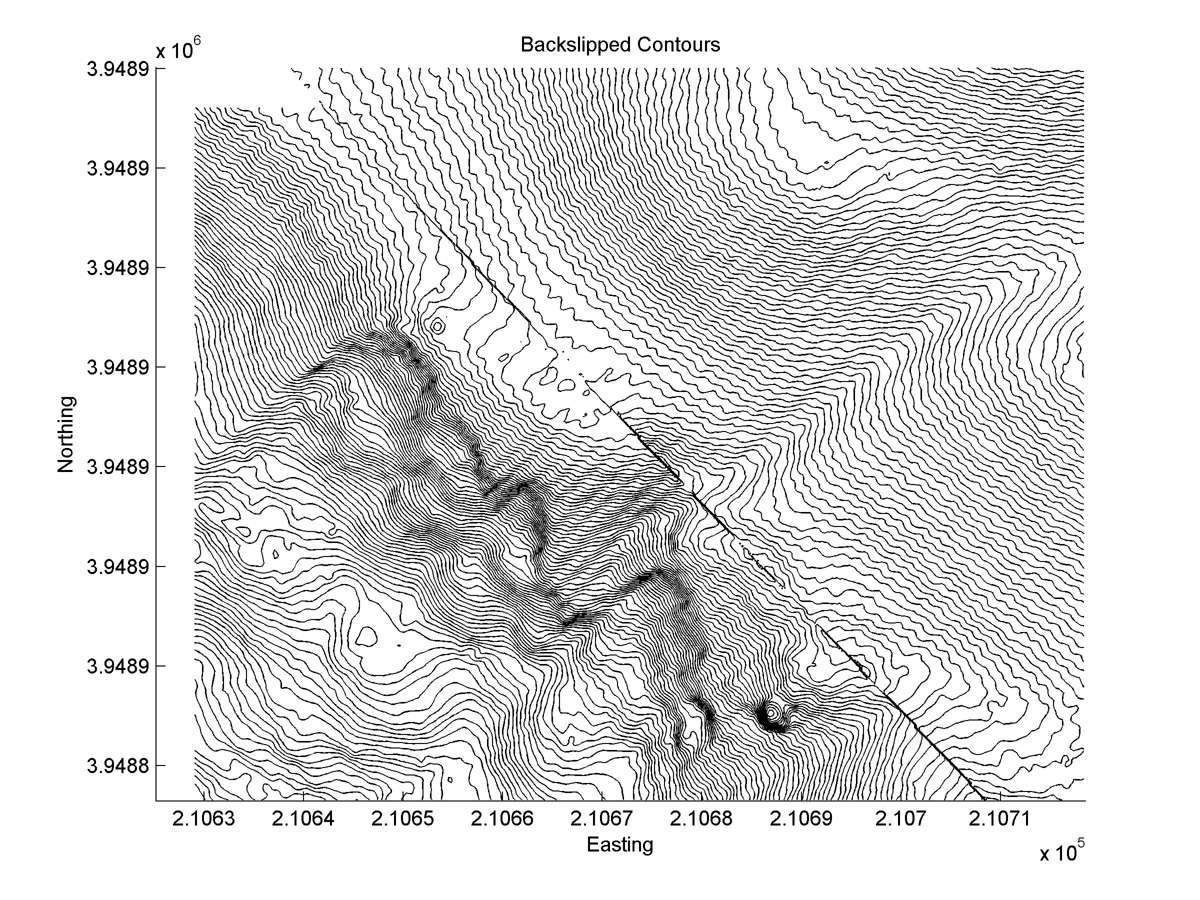
| Contour plot | Contour plot, Optimal back-slip |
|
|
| Offset (m) | Error (m) | Quality Rating | Comments |
|---|---|---|---|
| 6.7 | +/-2.1 | Fair/Good | Gully. Imprecision due to uncertainties at NW end. |
| Dist. from Bitterwater road | Offset (m) | Error (m) | Quality Rating | Comments |
|---|---|---|---|---|
| 12.28km | 5.4 | 0.5 | high | Unusually straight head, but tail sinuous. Rock outcrops at fault trace complicate interpretation. |