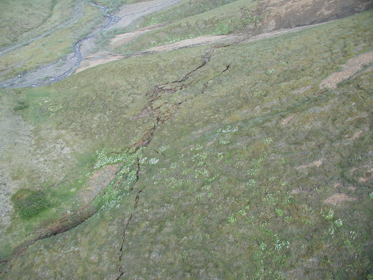
Aerial view looking northeast along the Totschunda fault trace. The offset channel of site HS-557 is visible at the top of the photo. At that site there was some extension and a right-lateral offset of 2.8-3.0m and a vertical displacement of 0.45 +/- 0.15m, up to the north. A paleo-offset here revealed previous fault slip for a combined total of 5.8 +/- 0.5m, right-lateral. Site HS-557, km 249.92. Photo by P. Haeussler.
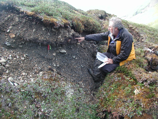
D. Schwartz pointing to a buried organic horizon exposed along the Totschunda fault trace. An offset channel within a few meters showed some extension and a right-lateral offset of 2.8-3.0m and a vertical displacement of 0.45 +/- 0.15m, up to the north. A paleo-offset here revealed previous fault slip for a combined total of 5.8 +/- 0.5m, right-lateral. Site HS-557, km 249.92. Photo by P. Haeussler.
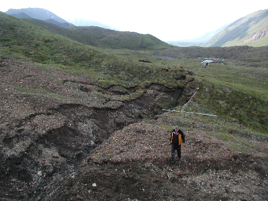
View to the west of an offset channel along the Totschunda rupture. There was some extension across the 2.5-m-wide rupture zone, with a right-lateral offset of 2.8-3.0m and a vertical displacement of 0.45 +/- 0.15m, up to the north. The white rod and tape show the approximate offset from previous fault slip for a total paleo-offset of 5.8 +/- 0.5m, right-lateral. Site HS-557, km 249.92. Photo by P. Haeussler.
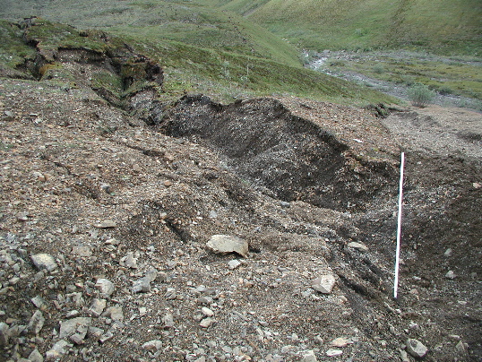
View of a stream channel offset along Totschunda fault. There was some extension across the 2.5-m-wide rupture zone, with a right-lateral offset of 2.8-3.0m and a vertical displacement of 0.45 +/- 0.15m, up to the north. The white rod shows the projection across the fault of an offset channel margin. The offset equivalent can be seen in the center of the photo trending toward the bottom left corner. This site also showed previous offset for a total paleo-offset of 5.8 +/- 0.5m, right-lateral. Site HS-557, km 249.92. Photo by P. Haeussler.
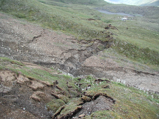
View to the west of an offset channel along the Totschunda rupture. There was some extension across the 2.5-m-wide rupture zone, with a right-lateral offset of 2.8-3.0m and a vertical displacement of 0.45 +/- 0.15m, up to the north. This site also showed previous offset for a total paleo-offset of 5.8 +/- 0.5m, right-lateral. Site HS-557, km 249.92. Photo by P. Haeussler.
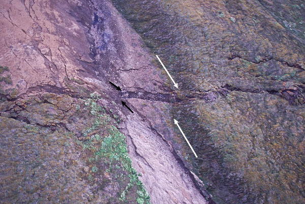
Aerial view south of multiple offset channel margins along the Totschunda fault. Black arrows point to the offset from the 2002 event and the white arrows point to a longer-term displacement from two or more events. Site HS-557, km 249.92. Photo by D. Schwartz.
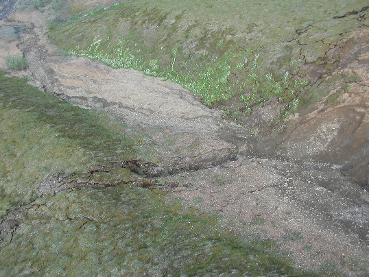
Aerial view to the northeast of an offset channel along the Totschunda rupture. There was some extension across the 2.5-m-wide rupture zone, with a right-lateral offset of 2.8-3.0m and a displacement of 0.45 +/- 0.15m, up to the north. This site also showed previous offset for a total right-lateral paleo-offset of 5.8 +/- 0.5m. Site HS-557, km 249.92. Photo by P. Haeussler.