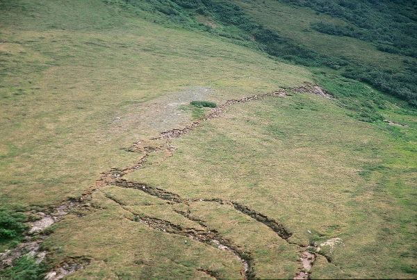
Aerial view of the Denali fault on the first topographic saddle west of the Delta River, looking northeast as seen in July, 2003. Here, the tundra root mat is offset 5.0 +/- 1.0m right-laterally and 1.33 +/- 0.5m up to the north. Cracks perpendicular to the fault trace in the lower left are related to slope failure during ground shaking. Site PH031, km 88.54. Photo by H. Stenner.
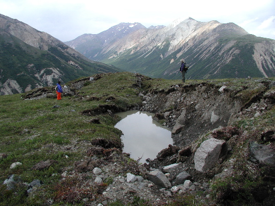
Sloughing of root mat and walls of a fissure along the Denali fault west of the Delta River. Photograph was taken in July, 2003. The fissure has filled with water and the permafrost has melted since the 2002 earthquake. Offset in this area is 5.0 +/- 1.0m, right-lateral, and 1.33 +/- 0.5m, up to the north. Site PH031, km 88.54. Photo by P. Haeussler.
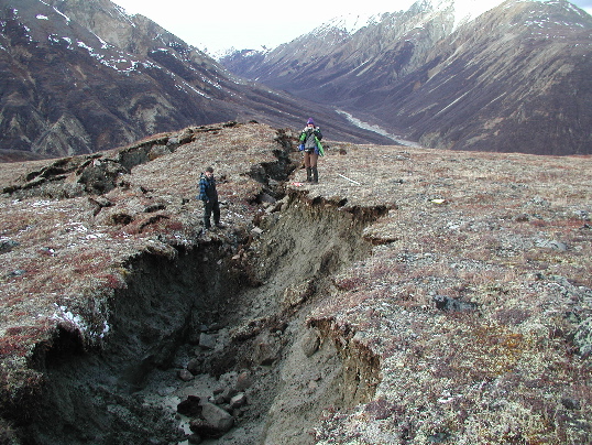
The Denali fault on the first prominent topographic saddle west of the Delta River. Photograph was taken in November, 2002, just after the earthquake. Here, offset is 5.0 +/- 1.0m, right-lateral, and 1.33 +/- 0.5m, up to the north. Note the push-up in the background. There is permafrost at the bottom of the cracks. Site PH031, km 88.54. Photo by P. Haeussler.
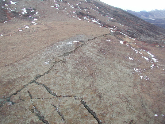
Aerial view of the Denali fault trace west of Delta River, as seen in November, 2002. Offset in this area is 5.0 +/- 1.0m, right-lateral, and 1.33 +/- 0.5m, up to the north. Note push-up in the central part of the photograph, where the main trace steps left. Cracks perpendicular to the fault trace in the lower left are related to slope failure during ground shaking. Site PH031, km 88.54. Photo by P. Haeussler.
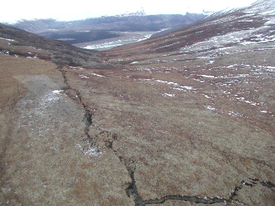
Aerial view eastward of the Denali fault trace. The Delta River can be seen in the valley bottom in the distance. Offset in this area is 5.0 +/- 1.0m, right-lateral, and 1.33 +/- 0.5m, up to the north. Cracks perpendicular to the fault trace in the lower right are related to slope failure due to ground shaking. Site PH031, km 88.54. Photo by P. Haeussler.