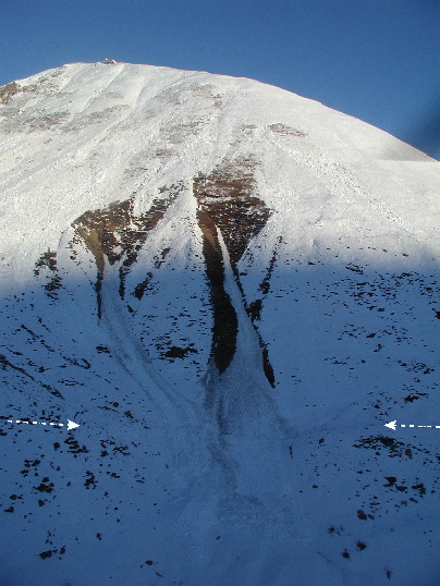
View north of snow avalanche chutes. The eastern (right-hand) chute is offset by the Denali fault (arrows) and failed down to bare rock, with a total vertical drop of approximately 1600 ft from the headscarp to the fault trace. The avalanche chute on the left covers the fault trace, and clearly post-dates surface offset. Site PH266, km 25.31. Photo by P. Haeussler.

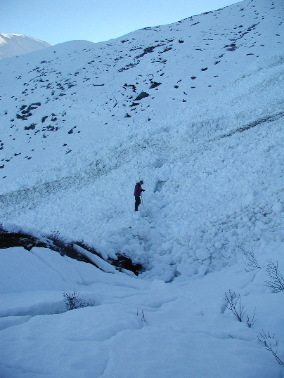
View west of an offset snow avalanche chute along the Denali fault trace just east of the Susitna Glacier. This is the only locality where a snow avalanche chute is offset by the fault trace. This avalanche chute appears to be the same vintage as other snow avalanche chutes that cover the fault trace. Some possibilities are that the avalanche was initiated by the October 23 M6.7 earthquake or that it was caused by a M4+ foreshock on the morning of November 3, 2002. Offset at this location is 2.05 +/- 0.5m, right-lateral, and 0.77 +/- 0.4m, up to the south. P. Haeussler provides scale (2m tall). Site PH266, km 25.31. Photo by P. Haeussler.

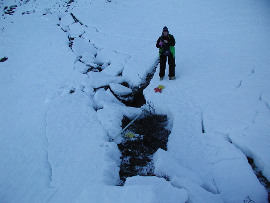
View west of an offset snow avalanche chute along the Denali fault trace just east of the Susitna Glacier. This is the only locality where a snow avalanche chute is offset by the fault trace. Offset at this location (stadia rod) is 2.05 +/- 0.5m, right-lateral, and 0.77 +/- 0.4m, up to the south. The rupture appears as a zone of disturbed snow about 1.5-2 m wide with a small amount of extension. Site PH266, km 25.31. Photo by P. Haeussler.