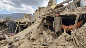
2 March 2023–Within minutes, a statistical model based on a global database of public reports of ground shaking can be used to identify an earthquake as a high- or low-impact event, according to a new study published in The Seismic Record. High-impact earthquakes, as defined by the study, are those … Continue Reading »
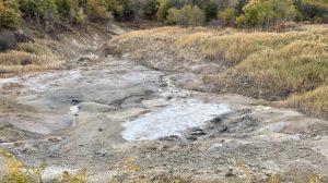
28 February 2023–At one of the world’s largest emission fields of non-volcanic carbon dioxide in southern Italy, researchers have detected a complex variety of seismic tremor signals, captured by a seismic array deployed in the region in the summer of 2021. In their study published in the Bulletin of the … Continue Reading »
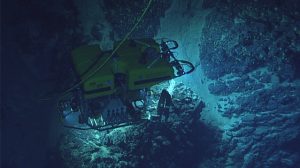
3 January 2023–Seafloor video collected by a remotely operated vehicle off the coast of Puerto Rico indicates that an underwater landslide was not the cause of a devastating tsunami that hit the island’s west coast after a 1918 earthquake. The proposed scar of the landslide is too old to be … Continue Reading »
25 November 2022–A study of hydroacoustic, acoustic and seismic waves from underwater explosions off the French coast could help guide the disposal of unexploded World War II ordnance (UXO) in those waters, according to a new study published in the Bulletin of the Seismological Society of America. The French Navy … Continue Reading »
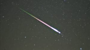
17 November 2022–Data collected by a large-N seismic array and distributed acoustic sensing (DAS) in Iceland offer one of the most detailed acoustic fingerprints of a meteoroid entering and disintegrating in the atmosphere. The dense record, described in Seismological Research Letters, allowed the researchers to distinguish acoustic phases that are … Continue Reading »
11 November 2022–Caltech Hall, a 55-year-old nine-story reinforced concrete building on the Caltech campus, has been getting structurally stiffer over the past 20 years, according to a new report published in The Seismic Record. Previous work by seismologists and engineers had documented the building softening—that is, decreasing in stiffness—from its … Continue Reading »