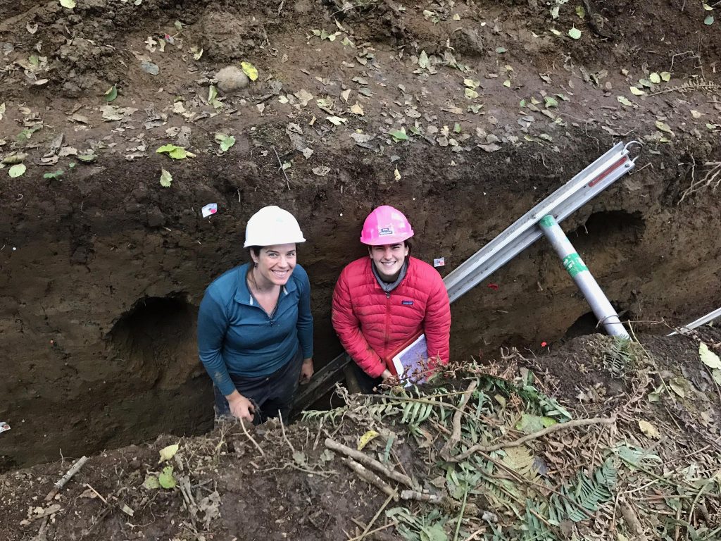
20 October 2020–A paleoseismic trench dug across the Gales Creek fault, located about 35 kilometers (roughly 22 miles) west of Portland, Oregon, documents evidence for three surface-rupturing earthquakes that took place about 8,800, 4,200 and 1,000 years ago.
The findings, published in the Bulletin of the Seismological Society of America, suggest that earthquakes occur about every 4,000 years on the fault. If the full 73-kilometer (45 miles) fault were to rupture, the result could be a magnitude 7.1 to 7.4 earthquake that would pose significant seismic hazard to the Portland metro area, according to Alison Horst and her colleagues.
By comparison, the 1993 Scotts Mills earthquake about 50 kilometers (31 miles) south of Portland was a magnitude 5.7 earthquake, and caused damages totaling about $30 million, the researchers noted.
The region is part of the seismically active Cascadia subduction zone, where the Juan de Fuca tectonic plate bends beneath the North American plate. The Gales Creek fault lays within the Cascadia forearc, the land wedged between the oceanic trench where the Juan de Fuca begins its bend and the line of Cascadia volcanoes in Washington State and Oregon that are fueled by the subducting plate.
“In general, little paleoseismic work has been done on forearc faults in Oregon, but many faults in the region are of interest based on their proximity to population centers,” said Horst, a paleoseismologist formerly at Portland State University and now at the Washington State Department of Resources.
Mapping and analyzing faults in the Pacific Northwest can be difficult, since fault surface traces are often covered by urban development and thick forests, or are difficult to reach in mountainous areas. To learn more about possible recent seismic activity along these forearc faults, Horst and her colleagues dug a trench across the Gales Creek fault, which had been mapped previously and is being investigated by the U.S. Bureau of Reclamation and the U.S. Geological Survey along part of the fault that projected through Scoggins Dam in Oregon’s Washington County.

The Reclamation project had turned up evidence of surface deformation along the fault in sediments from the most recent geological time period, called the Holocene. After digging a trench across the fault—first by hand and later by backhoe—the researchers looked for evidence of past earthquakes in the rock layers, assigning an estimated date for each earthquake using radiocarbon analysis of charcoal contained in the layers.
The trenching turned up strong evidence for at least three Holocene-age surface-rupturing earthquakes along the fault, with some weaker signs of one potential earthquake occurring after 1,000 years ago, and one earthquake occurring before 8,800 years ago.
The researchers also estimated the magnitude of an earthquake that would rupture the entire mapped length of the Gales Creek fault, assuming that the full length ruptured at once and that the rupture event did not extend across multiple faults.
“The linkage between rupture on the Gales Creek fault and neighboring faults is still unknown, as there are no other paleoseismic studies with earthquake ages for neighboring faults and as a result no indication of paleo-earthquakes with overlapping age estimates on neighboring faults,” Horst explained. “Future work on faults in the region could allow us to improve our understanding of the connectivity of rupture on these low slip, long recurrence forearc faults.”
The findings suggest that other faults within the Oregon portion of the Cascadia forearc should be studied for signs of Holocene earthquakes, the researchers concluded.
