20 April 2017-DENVER — As tensions rise again over the development of North Korea’s nuclear weapon and missile program, seismologists at the 2017 SSA Annual Meeting offered a unique glimpse at what the world knows about the country’s past nuclear tests.

Most of this information comes directly from work by seismologists, who are using a variety of tools to pinpoint the location, depth and size of these nuclear explosions. Data from seismic stations deployed as part of the Comprehensive Test Ban Treaty Organization, and from national and scientific stations around the world, “are our first indication of a nuclear test, most of the time,” said William Walter of Lawrence Livermore National Laboratory, who was one of the SSA chairs for the explosion monitoring session.
“Seismic data provide the basis for determining the relative locations of the multiple seismic events associated with nuclear testing,” agreed Frank Pabian of Los Alamos National Laboratory.
Seismologists have been refining their techniques for detecting these nuclear tests. For instance, new correlation techniques developed in the last decade analyze seismic wave data from different tests recorded on common stations. This process can provide remarkable relative timing precision, and have helped scientists narrow the area in which explosions occur on the scale of tens of meters, said Walter.
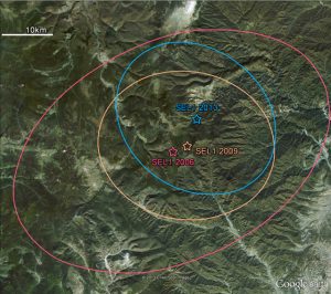
North Korea has conducted five nuclear explosions tests at the Punggye-ri Nuclear Test Site near Mt. Mantap, in 2006, 2009, 2013 and twice in 2016.
One of the clues confirming a January 2016 test explosion came from a technique called interferometric synthetic aperture radar, or InSAR, which uses satellite-based radar images to detect minute changes in landscape elevation. In his SSA presentation, Stephen Meyers of LLNL said InSAR data revealed an area in the test site that experienced a 1 to 3 centimeter surface displacement after the explosion.
Guided by these InSAR data, Pabian and colleagues took a closer look at satellite photos of the area and found evidence of new ground spall — landslides and tracks possibly made by boulders falling downhill through the snow-just 40 minutes after the explosion.
Seismologists also combine several types of data to estimate the depth of the North Korean tests, applying seismic waves, InSAR, and even acoustic, infrasound data. Infrasound are sound waves that occur at frequencies lower than the limit of human hearing, but can remain strong as they travel over long distances.
Nuclear explosions, volcanic eruptions and sometimes even earthquake ruptures produce infrasound, “with the ground acting as a giant speaker.” said Jelle Assink of the Royal Netherlands Meteorological Institute, in his SSA presentation.
The pressure waves transmitted from the ground to the atmosphere in this way are used to estimate explosion depth. Assink said infrasound stations in Russia and China collected data that researchers used to estimate the depth of the 2013 and one of the 2016 North Korean tests. They determined that the 2016 explosion was 1.5 times deeper than the 2013 explosion.
The North Korean tests seem to be getting more deeply buried as time goes on, the researchers noted. However, seismologists must also contend with different possible shapes of the tunnels containing the explosions when they estimate depth. In his presentation, Lian-Feng Zhao of the Chinese Academy of Sciences displayed possible several tunnel types, ranging from long horizontal tunnels to those with a curved, “fishhook” end.
Zhao and other presenters, including Neil Selby of AWE Blacknest, discussed ways to identify the seismic signature of a nuclear explosion as separate from those produced by natural earthquakes. Historically, seismologists have compared the magnitude of surface waves — seismic waves that travel near the ground surface — with that of body waves — which move through the Earth’s interior — to distinguish explosions from natural earthquakes.
However, this calculation is less successful when applied to the North Korean tests. Instead, the relatively newer comparison between P-waves and S-waves has proved more useful for nuclear monitoring in the country. P-waves compress rock in the same direction as the wave’s movement, while S-waves move rock perpendicular to the direction of the wave. The P/S-wave ratio is distinctively different for earthquakes and explosions.
